SUMMARY:
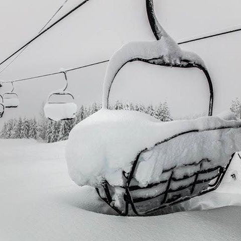
Significant snowfall is occurring in the Oregon and WA Cascades! Several feet of POW will fall in the Cascades Monday night into Tuesday. The Tetons and areas of Idaho will also score high amounts in the next 24-48 hours. A midweek break in most areas, with additional snow late week. The Sierra gets warm and deep midweek above 7,000 feet with colder systems late week. The Rockies grab a good storm for Wednesday-Thursday
FORECAST:
Sun Valley peaked the snow totals this week with over 3 feet in 24-36 hours ending Sunday. Breathing was not easy in waist-deep blower that pretty much allowed a \point it\" stance at any slope angle. We used our Snowshark to unbury the cars on Sunday morning.
The southern and central Cascades of WA and most of Oregon are favored with this next storm system. Heavy snow started again (10 inches last night at Crystal) Monday afternoon and will continue through Tuesday morning. Expect 12-20 inches at many resorts for Tuesday morning. Stevens may see the lower end of the forecast where Timberline Meadows or areas in southern WA grab the higher totals.
Additional moderate to heavy snow will fall in Idaho favoring the western mountains near Brundage, Central, and southern Panhandle, and even extending into Schweitzer in the north. Steady light snow will still be falling in Sun Valley Monday night and continue through Tuesday (4-9). Brundage may see higher amounts (10-15 inches through late Tuesday).
The Tetons who have seen consistent 5-11 inch powder days nearly every morning in the past several years score again tonight! Light to moderate snow increases late tonight and will dump 6-11 inches over JHMR and Targhee for Tuesday morning. Higher amounts (11-16) are possible in the northern end of Teton National Park. If this system edges further south the ski areas could land these higher numbers. 4-7 inches are likely for the town of Jackson or Driggs by Tuesday morning.
If your chasing pow, head to the Cascades, Idaho, Tetons or perhaps parts of Montana where the Montana Snowbowl might also score in the short term.
EXTENDED
Significant high elevation snow will be falling in the Sierramidweek. Strong winds and warmer temps would not make for any good long term chases. Colder air by late Thursday or Friday may bring some better quality snowfall late week.
In the Rockies, snow might taper somewhat Tuesday in the Tetonsbefore picking back up for Wednesday and Thursday. The Tetons will see moderate snowfall Wednesday and higher intensities into Thursday. The Wasatch is slightly delayed with the highest amounts late Wednesday into Thursday. It's likely that Wednesday and Thursday offer powder days for much of the northern and central Rockies. Snow levels will be rising with warmer temps, so the blower you have seen early this week may migrate to medium or heavier densities. Avy danger will be rising.
In Colorado, models show significant moisture late Wednesday into Thursday. The San Juans are favored (Silverton, Crested Butte, Purgatory, Telluride, Wolf Creek) with Aspen a wildcard (Some decent amounts likely push north towards Pitkin County). Another wildcard is Steamboat who can funnel SW moisture north into the Flat Tops (Thursday or Friday). The northern areas near I-70 and east will see lighter amounts (Specifics to follow on a later post). The southern mountains may be looking at 15-25 inches or more! Even New Mexico is on my radar for the end of this week!
Enjoy the powder everyone! SUPPORT US WITH THE CONCIERGE PROGRAM!


