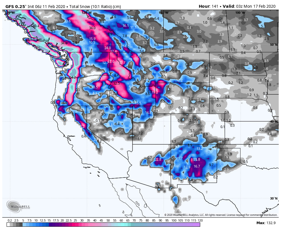
The low-pressure system that pushed up from the south Monday night skimmed Summit County as forecasted (1-3 inches being reported at many ski areas). New Mexico is scoring currently. Late this week and through the weekend brings a very active period for the Pacific Northwest that eventually gets into the Rockies by late in the holiday weekend.
Snow ramped up over the Front Range of Colorado last night with the highest amounts along the eastern side of the Divide. New Mexico came up as forecasted (4-9) with 8 inches being reported at Taos Tuesday morning. The southern mountains had 5-6 inches (Wolf and Telluride). Snow is currently dropping south of Taos and overhead near Santa Fe (No report yet this morning). Ruidoso NM near the Texas border grabbed 4 inches on Monday and will report higher amounts Tuesday.
The week ahead provides a break for much of the West except for the PNW. Colder temps move into Washington State Thursday/Friday with snow moving in from north to south. Mount Baker may grab moderate amounts during Thursday with Stevens getting into the game by late AM or early PM Thursday. West winds and cooler temps may form some convergence zones (Enhanced snowfall with cold air- west winds- orographics) over Stevens Pass and perhaps the I-90 Corridor for a moderate to a deep day on Friday. I would chase along I-90 or north for Friday morning. Crystal and resorts further south will see lower amounts (Moderate). Expect 7-12 inches for resorts from Mount Baker to Alpental (North and the central Cascades) with 3-6 inches south.
Extended:
The extended brings a very moist system into the Pacific Northwest and coastal BC for the weekend. Significant snow will be falling in these areas with the highest amounts from Saturday late AM to Sunday night. It's likely that 2-3 feet will fall in many areas by Monday morning. Temps are not overly cold, nor warm, so expect denser snow at the bases and good qualities from mid-mountain and the summits.
Interior BC will also score this weekend with the highest amounts further north towards Revelstoke. Snow will slide south to the Idaho border (Resorts just north of Idaho) through the period including the Panhandle of Idaho (8-14 inches) for the weekend.
That system moves into the Rockies for Sunday/Monday so look for some moderate to deep snow to ride late Sunday and early Monday from Idaho, Wyoming, Utah, and Colorado. More details on a future post.
See you on first chair this morning.
Powderchaser Steve


