SUMMARY
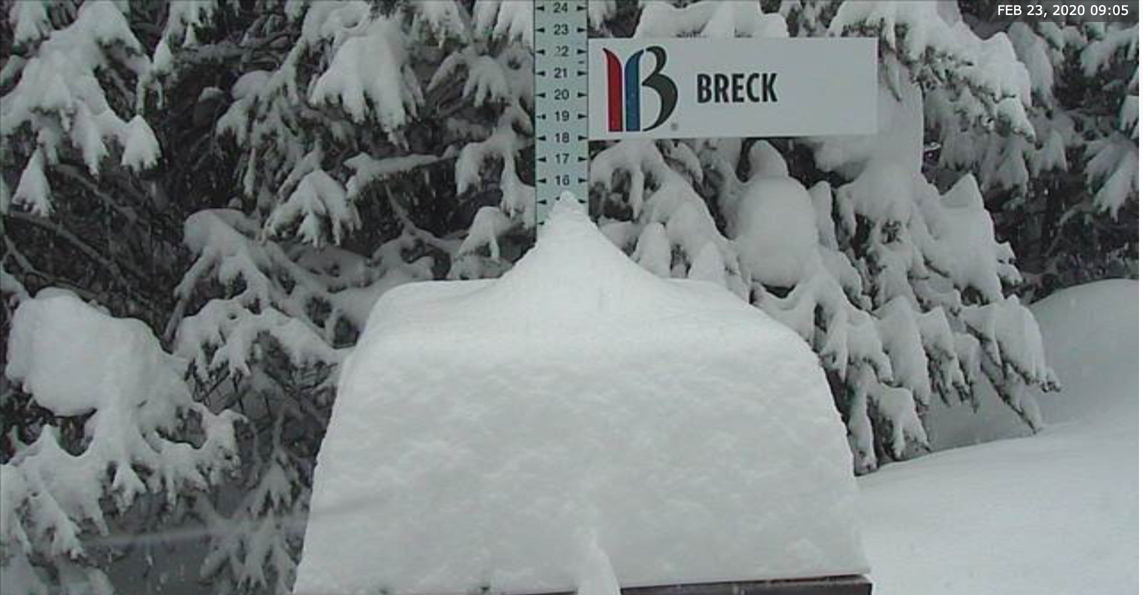
Remember I mentioned low confidence in the SW storm for the 4 corners and the love-hate relationship with the models. The models were all disagreeing with each other yesterday. This morning at 5:30 AM Breck had 1 inch. By opening lifts they had 12-14 inches. Most areas in Colorado reported 4-6 inches with a storm total of 10 at Wolf Creek. The next 2 days will bring additional snowfall to the Cascades (Sunday night) with a moderate storm for the Tetons. The Colorado Northern and Central Mountains will score moderate snow with an outside chance of sneaky deeper amounts Monday PM to Tuesday AM.
FORECAST
For the most part my highest confidence was in Wolf Creek with less at Telluride, and perhaps a wildcard for north of Durango. Wolf Creek had 10 inches by 2PM on Sunday. Taos delivered the 4-8 as forecasted, while the Cascades of Washington are all in the 5-10 inch range , a bit less than expected. Eagle Point and Brian Head in Southern Utah reported 10-11 inches as forecasted Sunday morning (Who chased from Salt Lake?). Arizona Snowbowl reported 15 inches Sunday morning which met our original forecast of 4-8 Saturday and 4-8 Saturday night (They over performed Saturday night). The San Juan Range including Arizona scored deep snow while Breckenridge reaped deep rewards that extended north into Southern Summit County. That was a complete surprise!
The Cascades should approach storm totals of 9-15 inches (12-18 was original forecast) by Monday morning favoring the Central and Northern Regions (Alpental, Stevens, Baker). Crystal will see another 3-5 inches Sunday night. The mountains further north in the 4-9 inch range (Additional for Monday morning).
Why did Breckenridge score such high numbers Sunday morning? I reviewed the models and in looking at the GFS, NAM 12,, NAM 3, and even the Canadian I don't see much evidence of this happening. Remember a few posts ago, I mentioned the EURO had central and Northern Colorado as deep for Sunday (\you believe the Euro moderate snow is possible further north into central and even the northern Colorado mountains along I-70 for Sunday 4-7\"). Well thats certainly not the 12-15 they had by Noon but nevertheless we can say 1 model picked up some deeper snow for the I-70 corridor. Most areas reported 3-7 inches by noon (Webcams) along the I-70 corridor. Breck was a big surprise! I heard it was epic!
Below: 5:30 AM Breck Cam (Ho Hum, MEH, back to bed). Its Sunday- Sleep in!

Below: Lift opening for Breckenridge (WTF, Really, Hey is the camera screwed up, No way). Wake up!

The next few days will bring light to moderate snow for the Tetons especially on Monday morning (3-6 inches). That system with colder air, NW winds will increase snowfall for Colorado (Steamboat, Vail, Breck, Aspen,) for the North/Central mountains while the Tetons, and some ares of Montana see rewards Sunday PM to Monday. Colorado will see the increase of intensity late Monday into Tuesday. I would not be surprised to see another 4-9 inches between Sunday night and Tuesday morning (Ride Tuesday for the deepest 12 hour event). Unstable NW flow, colder temps often over perform the models.
Chase? Cascades (Additional 5-10 central and north for Monday morning, ), Tetons (3-6 Monday), Colorado (Late Monday into Tuesday). Central Montana (Snowbowl), Central Panhandle of Idaho- Monday morning.
Below: Total additional snowfall through Wednesday morning,.

EXTENDED
High pressure takes hold in the West midweek through the early part of the weekend. The Ensembles are hinting of a pattern change to bring some low pressure systems into the West, perhaps the Sierra as early as Saturday night. Those systems will sweep East possibly favoring the southern Rockies. We might see another decent 4 corners storm by late in the weekend or early next week? It's too far out to forecast with confidence.
Below: Low pressure might finally reach the Sierra by Saturday night or Sunday.

Below: Low pressure might track south into the 4 corners early the following week (Map- March 2nd).

Please comment if you scored Powder today. I was at Stevens Pass that saw 5-10 inches up high with 50 MPH gusts (Deep pockets of powder followed by stripped snow). Overall it was a fun day storm skiing with minimal lift lines. Tomorrow will perhaps be even better. See you on 1st chair, but I will not disclose my next move.
Please join our Powder Concierge to chase the deepest snow and support the Powderchasers Forecasts.
Powderchaser Steve


