SUMMARY POW
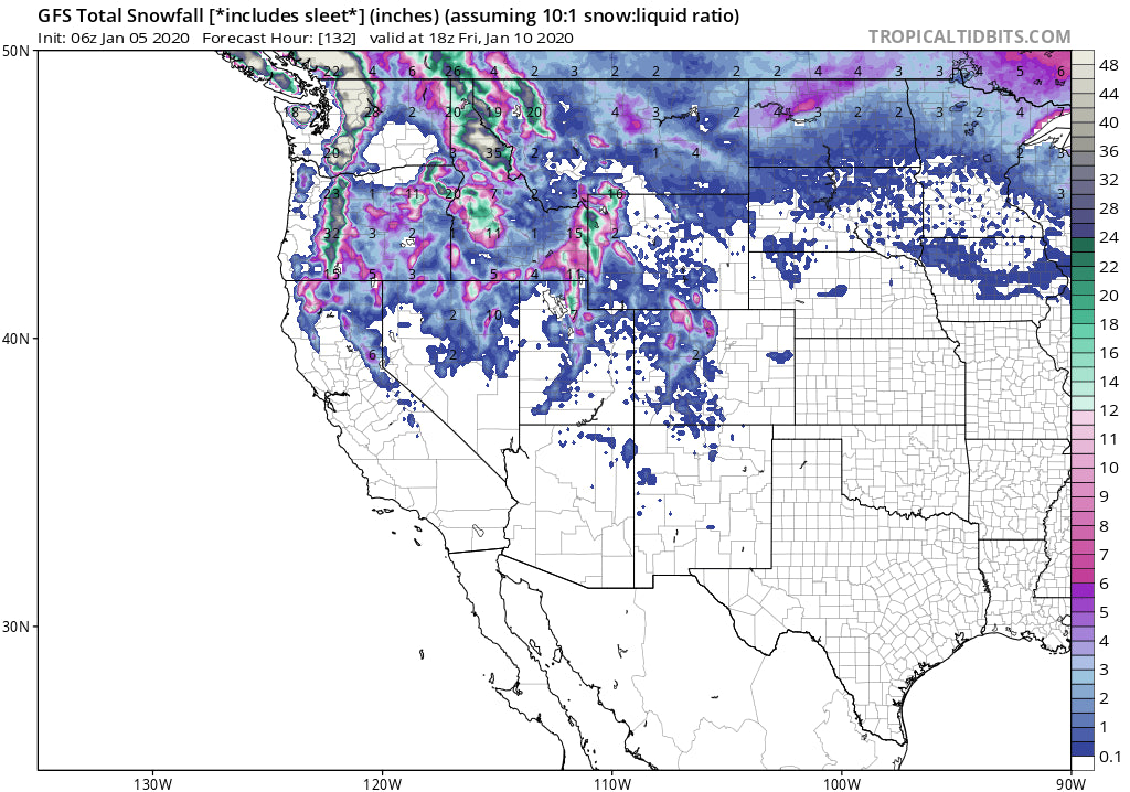
The next week looks very active for the Northwest with 3-6 feet likely through Sunday. Interior central and southern BC also look moderately deep early this week including the northern Panhandle of Idaho. The Tetons are in a steady flow of sleeper pow days with the Wasatch gaining attention late this week. A grand finale deep storm will crush the Cascades or OR/WA once again next weekend but winds may keep upper lifts closed (It's pretty far out to predict).
FORECAST POW
Light to moderate snow in the Northwest will turn heavy Sunday night and provide an epic powder day for Monday morning for the Cascades (12-18 inches). Temps will be cold initially turning warmer by 11 AM on Monday. Quality may decrease in the afternoon as additional snow falls through Tuesday (Warming snow levels to 4-5000 feet). Slightly lower amounts will fall in the Oregon Cascades. Some rain might fall on some of the lower base locations before turning back to all snow Tuesday night and Wednesday. The Eastern Cascades might see lower snow levels and should do well especially on Monday. The Northern Panhandle of Idaho might be the call for Tuesday as 3500-4,000 foot snow levels bring snowfall to even the base of Schweitzer. Several feet of snow will fall at Whistler in the short term forecast. This is all good news!
Below: Warming trend later Monday AM or early PM in the Cascades with snow levels rising to above 4,000 feet

Below: Sharp cooling trend for the NW Tuesday PM to Wednesday.

The flow of moisture from BC and the NW has favored the Tetons over the past 24 hours with steady periods of 3-7 inches likely each 24 hour period, perhaps increasing somewhat for Wednesday and certainly in the extended forecast. Upper elevations of Jackson had 5 inches in the past 24 hours with 2 inches reported at Targhee. An additional 2-4 inches are likely late AM Sunday to when the lifts close and even more is expected into Monday (Another 2-5). Total snowfall in the next 24 hours may approach 9 inches at the summits of the Tetons for a super fun Monday.
EXTENDED POW
In looking for chaseable pow, I would focus on a sneak up powder day for Jackson Hole Monday (3-8 with some of that falling late Sunday), Deep snow for the Cascades Monday (Cold initially before warming). Panhandle of Idaho might deliver for Tuesday.
Another system takes aim at the PNW Tuesday night into Wednesday with colder temps and good quality. That appears to be a moderate event currently in the 7-15 inch range. Yet another strong system enters the NW on Thursday and seems to favor the Oregon Cascades skirting south of Washington (Southern WA Cascades may also score moderate pow).
Moisture continues in waves for the Tetons (Sleepy powder days 3-6, 3-6, few breaks in-between). The Thursday-Friday timeframe is likely to see an uptick of moisture dropping further south into the Wasatch and a continuation in the Tetons. The Wasatch may benefit in the upcoming weekend. Colorado will see leftovers favoring northern sections of the State Friday-Saturday. It's hard to predict any single double digit event in 12-24 hours.
Next weekend looks very deep for the Cascades with strong winds. Winds may be gusting over 60 MPH at many mid-mountain locations initially before decreasing slightly late Saturday or early Sunday. Snow totals for the Northwest including the summit of Whistler will likely 3-6 feet in the next 7 days. The best quality may come on Monday this week with the deepest next weekend albeit windy that might impact lift operations.
If you want to be in the deepest places for every storm, join our concierge program.
Powderchaser Steve


