SUMMARY
2 Feet of Sierra Cement just fell over Tahoe and areas south to Mammoth. Light to moderate snow is falling over the Tetons. The week ahead brings some moderate snow to southern Colorado by Thursday and another deep fairly warm storm to the Sierra by the weekend. In the Rockies, it's possible the best chase ends up in the Tetons by Saturday afternoon or Sunday?
POW FORECAST
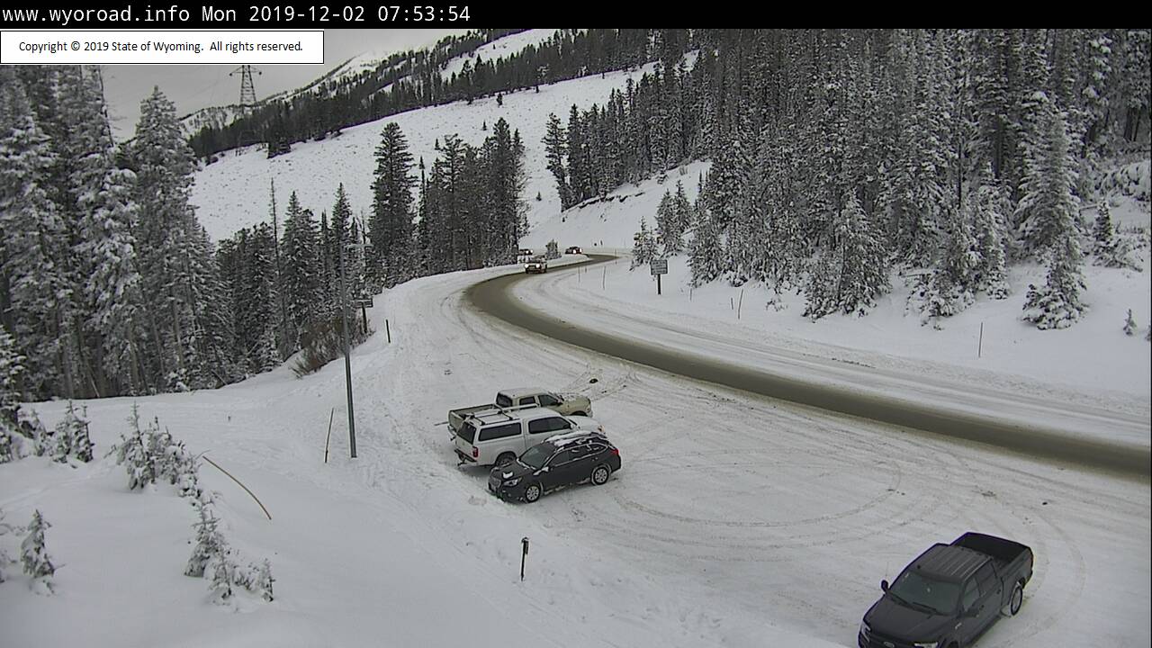
Light snow is falling on Teton Pass this morning. 2 inches on the Snow telemetry for JHMR and Targhee. Snow will continue lightly through the day perhaps ending at the 4-8 inch range. This was in my forecast last week. Colorado grabs light leftovers late Monday into Tuesday favoring the northern mountains (1-3 inches).
Below: Teton Pass Monday morning

The big news is in the Sierra where mixed rain/snow fell at most bases in the past 24 hours with snow continuing into midday Monday. Another 4-8 inches is likely on Monday favoring the northern areas near the Lake. Here are a few reports from this morning. Sierra Cement! This is exactly what they needed. Most resorts have picked up 50 plus inches in the past week. Another 2-3 feet will fall this weekend!
Squaw: 28 inches in 24 hours (18 overnight)
Mammoth: 23 inches in 24 hours
Kirkwood: 16 inches
Sugarbowl 17 inches (Summit)
Looking for chasing powder this week?
If you're in the Sierra aim to ride higher terrain if you can find a resort that opens the summit. Otherwise, it may not be worth a chase.
The best odds of some moderate snow will happen today in the Tetons (Not overly moist- but a light to moderate refresh guaranteed) and perhaps southern Colorado for Thursday. Some light to moderate snow will likely occur in Colorado Wednesday night into Thursday. The Euro is the most bullish at 3-7 inches for Telluride with the American model (GFS) showing less. Some lighter amounts are likely further east towards Wolf Creek or south towards Purgatory. The highest amounts in Colorado for Thursday may end up being in the La Salle Range near Moab (5-10) on Thursday.
The Northwest is finally showing up on our radar this morning. Light or moderate snow is likely by Wednesday favoring the north Cascades above 5,000 feet (moderate amounts possible at the summit of Mount Baker).
The extended may offer better chases for the Sierra and the northern Rockies.
EXTENDED POW
A strong low-pressure system will enter California by Friday. That system will bring significant snowfall to most of the Sierra Range through Saturday (2-3 feet of fairly dense snow). It will be slightly cooler than the current system with snow levels running around 6K feet. Wet snow will be falling at most ski areas with significant amounts likely. Much less snow will fall at the bases.
Below: Total Precipitation (Water) in a 48 hour period ending Sunday morning (3-4 inches of moisture favoring northern areas). This may correlate to 20-30 inches of wet snow at mid or upper elevations. The snow level will meander between 5500-6500 feet (Lower than the current system).

A separate system hung up in the Pacific Northwest (Light or moderate snow late this week) will take a northern track over Idaho and Wyoming by Friday night. Moderate snow is likely for the Tetons with perhaps decent powder by late Saturday or early Sunday (Early low confident predictions are 5-10 inches)
The CA system moves east (Weakening) late this weekend impacting Utah and Colorado with some moderate snow to many areas. I'm thinking that 4-8 inch range for perhaps the Wasatch or most of central Colorado. Its really too far out to say with certainty, but some snow is on the horizon for the weekend ahead in the Rockies.
Below: Ensembles showing the trough entering the west late this week impacting the PNW and Sierra initially.

Beyond next weekend there will be high pressure initially with some weak signals of some troughs for the Rockies beginning again late that week. The Euro shows a good chance of some systems moving in for BC, PNW, and the northern Rockies late in the period around December 12th.
Powderchaser Steve


