
It's been a long and hard 2020, but it seems like the powder gods are smiling down on us and delivering a BIG start to Winter 2020/2021. As we mentioned 10 days ago, the models were in good agreement about a significant widespread snow event around the end of the first week of November. The storm has delivered thus far and will continue to blanket the region with snow. We remain confident in an active pattern setting up over the Western US, as we mentioned on October 30th.
Before we dig further into the details, we wanted to remind you to sign up for the Powder Concierge. The Powder Concierge is a service we offer that provides custom forecasts to help YOU ensure the deepest possible powder days. With the numerous restrictions in place due to COVID 19, getting the best conditions when we DO ski/ride is more important than ever. To sign up or to learn more about the Powder Concierge, click here.
As the title of this post mentions, we are just getting started with this cold and snowy pattern. This is one of the longer active periods, with little to no breaks in between storms, that we have seen in quite some time. The West could stay active through the third week of the Month, allowing ski resorts across a large swath of the West to build up a solid base. After the way last season ended, building up a deep early season base is just what we need to start this one. Check out the gif below to see the storm train rolling through the Western US through mid month and beyond.

(Image courtesy of Tropical Tidbits)
Each one of those blobs moving through is another storm system, through November 14th. This continues from the 14th through the 19th too, check it out:

(Image courtesy of Tropical Tidbits)
One storm after another, without any of that (red) dry ridgy stuff in between. This will really give numerous resorts in the West a solid start to the season. It's a little tough to pinpoint exactly where the bullseye will be for these storms that are one to two weeks away, but with this first round of snow occurring right now, Montana, Utah, Wyoming and Colorado should be off to a great start. Washington and Oregon are likely to accumulate a lot of snow during this period as well. Woot!
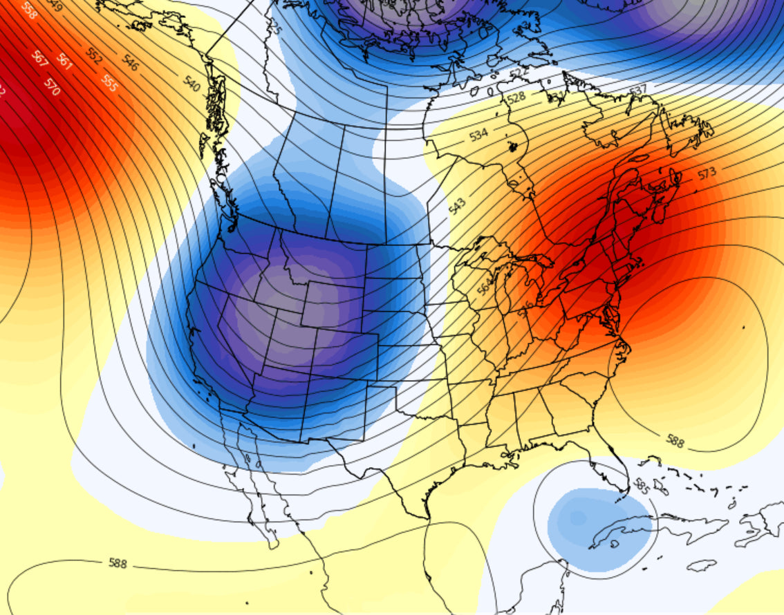
This pattern is a classic negative PNA (-PNA) pattern, which is typical during La Nina and great for the West. See below for the -PNA pattern.

(Image courtesy of www.wisconsinwx.com)
Hopefully we see more of the above through Winter 2020/2021. For now, we will be in this pattern until later this month. Beyond that, the signals don't indicate whether or not this setup will continue.
Alright, time to sleep. We are in Northern Montana chasing, and hopefully getting pitted tomorrow.
Quick AM update of the snowfall so far up here.

Powderchaser Luke


