In desperate attempts to look for deep and cold storms for the West we are in a waiting game. Significant moisture will continue in the PNW with snow levels rising and falling this week (No single sustained cold events) bringing significant snowfall to the peaks of most of the ski ares in the PNW. Monday morning and again Wednesday may offer some decent turning conditions with slightly cooler temperatures. 5-10 inches of snow will be falling at the upper elevations of the Cascades each of the next several days with much less at the bases. Snow levels fluctuate from 3500 to 4500 feet through the early week. Temps will warm even further by Thursday. Whistler will continue to see light to moderate upper elevation snow this week with slightly cooler temps (Rain from the base to near mid-mountain).
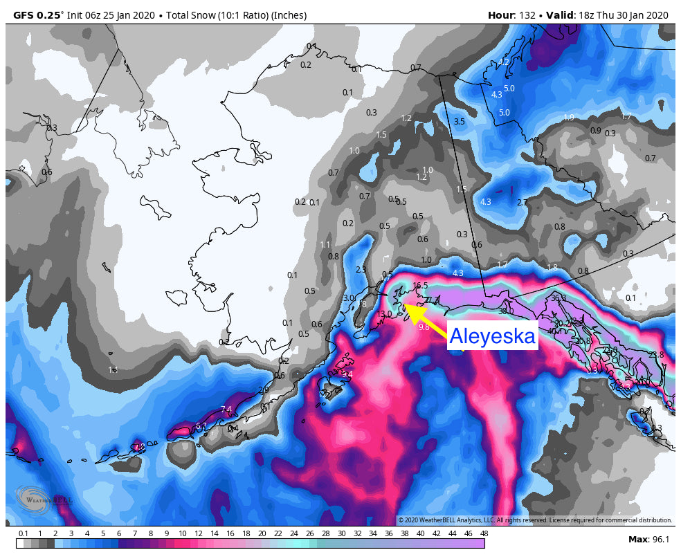
If you want deep and cold blower head to Alaska where temps will remain in the single digits at Aleyeska with snowfall peaking Tuesday-Thursday. It's likely that 12-16 inches or more fall through the period.
Below: Alaska Powder peaking Tuesday/Wednesday

In the Rockies, the Tetons are once again in the flow of the highest moisture with the Wasatch close behind. Sunday night into Monday offer the best glimmer of hope for overnight snow. The Tetons will wake up to 3-6 inches at the summits Monday morning (Jackson is slightly favored over Targhee). 1-2 inches may fall at the bases. Temps are cold enough for decent quality. The Wasatch may bring in similar amounts for Monday morning.
The extended forecast brings another fast moving wave of light to moderate snow for the northern Rockies on Wednesday.
Much colder air and the glimmer of hope for a deeper higher quality storm may impact the Pacific Northwest by next Sunday/Monday but it's still too far out to forecast with confidence. Hopefully those systems track into the Rockies on week #2.
Powderchaser Steve


