
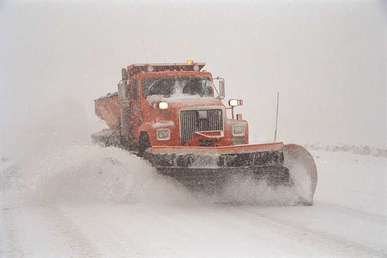
Heavy snowfall blanketed areas of the Sierra and Rockies on Sunday. Moderate to heavy snow continues albeit lighter overall totals for the Sierra. The Central or southern Wasatch could score another 12-18 inches. Moderate snow continues next week with very warm temps and rain/snow by Friday for CA.
Crazy snow totals for the west with 2 feet reported for many Tahoe areas. Utah nabbed 20-25 inches in the central and southern Wasatch ranges from PCMR to Alta, with the highest totals coming from Big Cottonwood. LCC was closed until 11:45 AM Sunday with a major slide on the road during avalanche mitigation. Snow is continuing for the Sierra with the models pumping out 6-13 inches for many ski areas. This will likely favor all resorts from I-80 through the south portion of the lake, especially on the west side. Kirkwood might end up being on the southern end of the heaviest moisture landing more near Homewood, Palisades (Sugar Bowl Wildcard), and Northstar.
Sierra
Below: Total additional snowfall for the Sierra Sunday night focussed on the west side of the lake and also towards Mammoth. Just south of the lake may see less snow. Expect 9-11 inches in these areas for Monday morning. Snow was also falling on Sunday so the numbers Monday will include these totals.

Below: Total Liquid (SWE) in the snowpack is well above normal for the west as of March 5th. Utah, Nevada, and the Sierra Range are in the lead. The event in Portland or near the coast on the last storm in Oregon might account for 581% of the average number there. The Tahoe Basin is near 150% of the average and up to 185% in spots.

Below: Here are the percentages of averages for 2 river basins in the Sierra (Impressive). Remember the slow start we had in California? More snow is on the way!

Utah
In Utah snow will intensify late Sunday night and pinpoint the Cottonwoods and areas along I-80. Expect 9-15 inches for the Cottonwoods by Monday morning and 5-10 for the Park City area. LCC is closing on Sunday night and will likely reopen at some point Monday. This could be a similar situation to what we saw on Sunday morning. Less snow will fall north of I-80 or south of Sandy.
Below: Total moisture through Monday morning is nearly 3/4 of an inch over the Cottonwoods which is going to provide a healthy dump of powder. It's possible Sundance also performs with this storm, with lower confidence for the Ogden Valley mountains. PCMR or DV should also do well albeit with lower numbers. Colorado remains out of the loop for heavy snow aside from perhaps Steamboat which should have some new snow falling by daybreak Monday.

Bottom Line: Great chase for the Sierra (Lighter winds, additional moderate snow- New terrain openings). Great chase for Utah (double digits Sunday night, new terrain openings).
The extended forecast contains more snow for the Sierra and central Rockies with several rounds of light to moderate snow. Unfortunately, there will be a warm-up at the end of the week with heavy precipitation for the Sierra. The Northern Rockies could see double digits or more towards the end of the week.
Extended Forecast:
The models show low-pressure continuing well into the week with 4-8 inches every 12-24 hours for the Sierra range. Some of this snow will spill over to Utah with nothing that stands out until perhaps Thursday (Moderate event). Less snow will be falling over Idaho and Wyoming. The Sierra will continue to build slowly.
Atmospheric River Watch
There might be an atmospheric river forming over the Pacific late in the week bringing a warming trend for California followed by cooling. There might be a significant rain event for lower elevations of the Sierra by Friday or Saturday (Dangerous conditions could evolve). The Rockies stay in the colder air with the exception of a warm-up on Friday. Models show a chance of significant snowfall returning to Idaho, Wyoming, southern Montana, Utah, and Colorado as early as Friday or Saturday. This event could be fairly significant with a warm front followed by cooling.
Below: Significant moisture plume possible for the Sierra for the end of this week (March 10,11, 12) with very warm temps (Liquid Precipitation) initially before a bit of cooling on the tail end. This might bring very dangerous conditions and mudslides to California. This map is 48-hour precipitation totals ending Saturday night (4-5 inches of liquid).

Below: Warm front races into California midday Friday with 10K foot temps at just -1 C. That is near freezing at areas above most of the summits. This could bring significant rain to some areas (Low- moderate confidence being 5 days away).

Below: Warm air over Utah noted Friday night will likely bring snow back to the higher elevations with a cold front due by Saturday. This could be another decent event for many areas of the Rockies including Idaho favoring all areas aside from the south (Wet snow followed by cooling). The Tetons and southern Montana are also in the hunt here.

Below: 48-hour snow totals ending Sunday morning (March 12th). The very high numbers in the Sierra might only be at upper elevations with rain at lower or mid elevations. This could be a decent storm for areas of the central or Northern Rockies. Confidence is low being almost 6-7 days away but deserves watching. The initial warm front could spell some issues. Colorado will also do well with this system and benefit from the higher elevations in many areas.

Don't forget to join our Concierge program for custom chase forecasts or donate here. Our concierge program will provide you with custom forecasts to insure you get into the deepest snow (Our chase secrets). Donations keep our free forecasts going. Members rarely miss the deepest days.
This post will be updated as conditions change.
Follow my Instagram feed for the latest updates @powderchasersteve
Powderchaser Steve - Forecaster


