This week is going to bring one of the most impressive storm cycles of the season so far for much of the west, including the PNW, Sierra, and the intermountain west getting scraps.
Below are some totals in the past 24 hours from some resorts around the west:
- Grand Targhee: 24 inches
- Mt Hood: 16 inches
- Jackson Hole: 15 inches
- Big Sky: 9 inches
- Brighton: 11 inches
- Park City: 10 inches
- Beaver Mountain: 9 inches
- Alta: 8 inches
- Wolf Creek: 6 inches
Starting Tuesday evening, our next storm kicks off in the Pacific Northwest. In Washington, snow will last from Tuesday evening through Thursday morning with light lingering snowfall likely into Friday. Snow levels will reach ~3,000 feet in northern WA and ~4,000 feet in northern Oregon at their highest during the day on Wednesday, meaning this storm should bring almost all snow to most resorts. Temperatures will still be fairly warm, meaning the snow that does fall will likely be dense and heavy. Winds won’t be a concern with this system.
In terms of totals for the PNW, totals will be fairly well-distributed through Washington with lower totals in Oregon. Baker should be the winner with 24-35 inches. Stevens and Snoqualmie passes should end up with 20-30 inches. Crystal and areas south should score in the 18-24 inch range. Northern Oregon will be in the 2 foot range with 12-20 inches further south in the Oregon Cascades.
Below: the ECMWF (left) and GFS (right) projected snowfall totals by Friday morning. Both are showing fairly good agreement, meaning this is a high-likelihood snowfall event. Warmer air filters in Wednesday morning (A bit upside down) before a cold front improves quality for Thursday.
Our multi year sponsor Selkirk Powder Guides in Northern Idaho should grab 20-30 inches of Powder this week and still has Cat seats open including their extensive terrain expansion (Riding up there will be epic). Mention Powderchasers and receive a free swag kit from us.


That same system will bring precipitation into northern California starting on Thursday morning and lasting through Saturday afternoon (lingering snow possible through the rest of the weekend). This is a major atmospheric river that is poised to be the storm of the season for the Sierra.
Below: check out the strong band of tropical moisture extending up to California from the Pacific, the source of this week's Sierra snowfall.

Winds and heavy snow will likely keep upper elevations closed until the winds finally begin to ease up on Saturday.
Below: incredibly strong lower-atmospheric winds out of the southwest on Friday. This will impact upper elevation lift operations on Thursday and Friday.

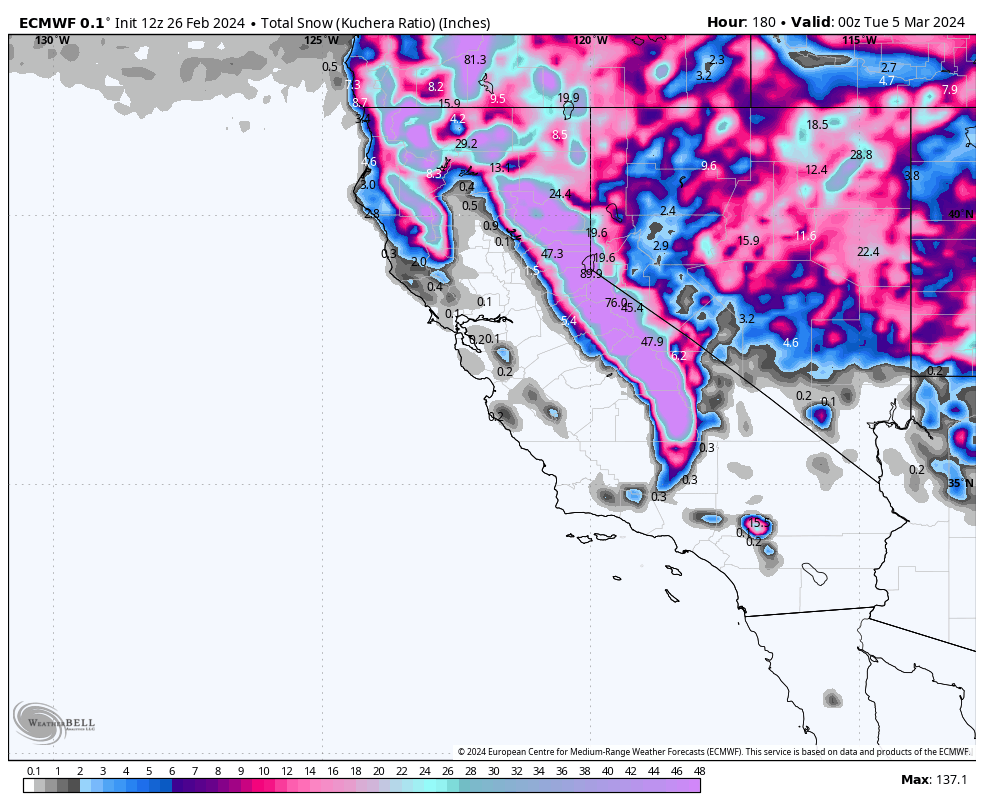
The deepest totals will be found in the western Lake Tahoe basin, with Sugar Bowl, Palisades, and Kirkwood all picking up 45-65". On the east side of the lake, Mt. Rose and Heavenly should see 20-30”. Mammoth should pick up 40-60”. Snow quality will be above-average everywhere with fairly cold temperatures bringing low density snow.
Below: Very impressive snow totals for California through Saturday night along all ranges.

This should easily end up being the storm of the season for California, with the best chasing likely being Saturday and Sunday once upper elevations and steeper terrain begin to open following the intense snow and wind.
Utah, Wyoming, and Colorado also score this weekend. Totals remain uncertain, but they're looking like they'll be in the 20+ inch range for the Wasatch and Tetons with lower amounts favoring central and southern Colorado. More info soon. The Rockies will be primed for deepness again.
Help us out!
If you want to chase powder with Powderchasers sign up for the concierge package for the deepest resorts to chase to and 1:1 custom forecasting with our staff. Also, if you have read this far, please donate to continue receiving these free forecasts. We appreciate the community support. You won't regret chasing with our custom forecasts. We have new swag on the Powderchasers storefront and all larger donations include it at no charge.
Enjoy the powder, everyone!


