A major winter system is about to roll through the Western US and dump incredible amounts of snow in California, providing for excellent powder chasing conditions.
Snowfall will start on Saturday evening in the southern Sierra and will fill in overnight, intensifying and spreading further north into early Sunday afternoon, peaking on Sunday afternoon. Snow levels will start at 4,000 feet and will rise to 5,500 feet during the peak of the storm. By Sunday morning, totals from Saturday night will range from 3 to 7" in Tahoe and 6-10" at Mammoth. Winds on Sunday will be very strong, and especially considering the insane snowfall rates on Sunday, it's doubtful that most mountains will open their upper terrain. Check out the lower-atmospheric winds on Sunday afternoon below:

Resorts in Tahoe will pick up 12-20" during the day on Sunday... for those chasing, that means free refills all day long. Mammoth should see at least that much if not even a little more. Snow ratios will dip near 10:1 on Sunday afternoon, meaning the snow that falls during the day will be on the denser side... not exactly blower powder. Below are the 700mb temperatures, at about 10,000 feet; you can see fairly warm temperatures even at this level, indicating denser snowfall:

Strong snowfall continues on Sunday night, dropping another 8-16" at Tahoe resorts and 12-18" at Mammoth. By Monday morning, the front will have passed through and winds will calm down significantly, meaning resorts will likely start to open up their higher terrain (after doing avalanche control, of course). Light snow will continue during the day on Monday, bringing another 5-10" to Tahoe resorts and slightly more at Mammoth. After the cold front passage, temperatures will drop significantly and snow levels will recover back to the 15:1-ish range, meaning this extra snow on the backside of the storm will ski incredibly well. Considering the lower winds & decreased snowfall rates (more likely upper-mountain terrain openings) and higher quality snowfall on Monday, Monday will probably end up being the best day for chasing.
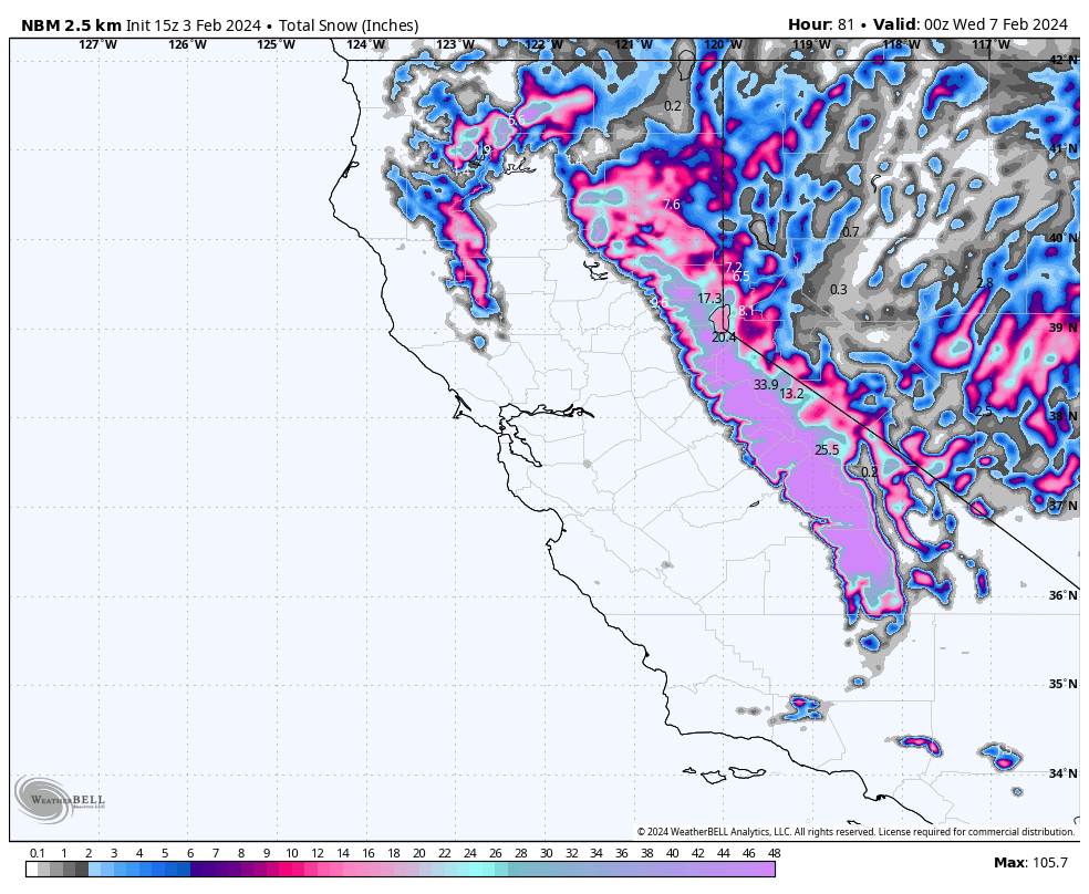
Check out the forecasted storm total from the National Blend of Models below:

Lingering snowfall will continue into Tuesday, which should bring a few more inches.


