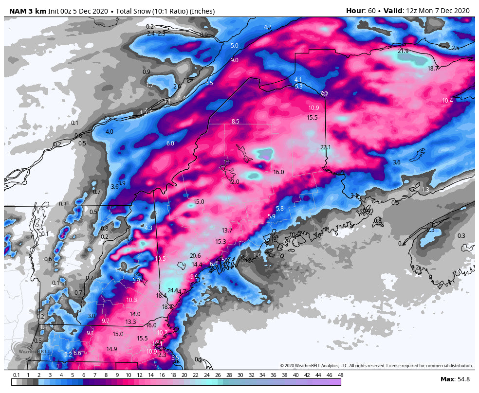
A classic Noreaster is shaping up across the Northeast this weekend, with up to 18\ possible at higher elevations. Although there have been considerable shifts in the storm track over the last several days in the models, they now have come into pretty good agreement. The result is a major winter storm for New England.
The action will start tomorrow around midday, from southeast to northwest, beginning in southern Vermont and Western Mass. For much of the region at lower elevations, the storm will start out as a mix or even rain. However, cold air will be ushered in with northwest winds and quickly turn the precipitation to all snow. This will be the case for nearly all of New England except for the coast from Mass to Maine. The storm will be over for most by Sunday afternoon, but the track is favorable for a period of upslope snow in northern Vermont. The period of terrain enhanced snowfall should lead to respectable totals in the 4-8\" range in northern Vermont, including Stowe, Smuggs, and Jay Peak.
The heaviest amounts will fall in northern New Hampshire and western Maine, where 10-15\" is likely. Saddleback, Sugarloaf, and Sunday River should be on the higher end of that range, while Wildcat and the rest of central and northern New Hampshire should see the lower end of the range. There is still some uncertainty regarding amounts though, as there will be a sharp cut off for snow totals on the northwest side of the storm. A small shift in the storm track would shift the region of heaviest snow, and the aforementioned sharp gradient could result in some unexpected snow totals. Below is the snowfall output from one of the short range weather models.

(Image courtesy of Weatherbell)
Although there is nearly no snow on the ground anywhere in New England, this storm should provide enough snow for some fun turns on grassy slopes. We hope to see some of you getting out there.


