Summary
Please consider joining our custom Powder Concierge program to book your deepest days of the season. We offer specific forecasts that include timing, temps, winds, conditions, custom maps, and timing to nab your deepest days. This also supports our forecasts!
The upcoming 5 days will feature continued weak or moderate features for the Cascades, decent Sierra dump and a Nor Easter that dumps over the metro ares of the Northeast. There will be a build up of powder in the west, with a few chances of 12 plus in 24 hours.
Short Term
The past 3 days remained very active for the west with a sneak up powder day in Utah Saturday (12 inches at Alta), and decent numbers for the San Juan range (20 inches at Taos). Even Powderhorn near Grand Junction and Steamboat in the northern Colorado mountains caught some outside surprises (11 inches in 3 days). On my last post, I mentioned \"higher amounts might happen further west towards Grand Junction or even a sneak up event for Steamboat\". While its always a gamble in picking outliers, the models picked up on these features nicely. Decent totals were found in the San Juan range as well. The southern Sierra range picked up 8-12 inches.
Below: Taos New Mexico Sunday Morning (20 inch storm totals). The bases are respectable right now.

The upcoming 5 days will feature a moderate storm for the northern regions of the Pacific Northwest on Tuesday (storm ski), with another wave expected Wednesday/Thursday. The first storm Tuesday will be have strong winds from the SW switching west late Tuesday morning. Some lift impacts are possible. The upside of 5-9 inches is likely from Stevens Pass and north with less further south (Storm ski Tuesday). Baker might have higher amounts. The 2nd storm (Wednesday-Thursday) PNW storm should drop further south impacting a wider range of the Cascade mountains primarily in Washington State (Moderate event). Less snow is likely in Oregon (moderate amounts). Whistler grabs moderate snow with heavy snowfall further north along the western BC region. The interior of BC will see several light to moderate events this week.
Other spots to watch will be the Idaho Panhandle (Moderate totals keep building up this week) and some light leftovers aimed at the Tetons midweek as storms continue to move east. In the extended forecast, better odds of a deeper powder day exist in these areas.
The Sierra will benefit from a high confidence storm late Wednesday night into Thursday with 12-16 inches of snow. This system might favor the northern regions slightly. Impressive amounts will have fallen by midday on Thursday. Let's hope this happens as the Sierra is catching up. I have high confidence in this scenario.
Meanwhile in the East, a significant nor easter is very likely to slam the ski areas of PA, NJ, and southern MA by midmorning Thursday. Current models, keep the highest totals south through Long Island, PA, New Jersey, southern NY, and the metro areas near Boston. The GFS shown below keeps the highest snow further south, while the European model is further north. If the Euro is correct, the Berkshires might be chase worthy and even spots in southern Vermont (less likely). Let's hope all the models push well needed snow into the core of New England! One sure bet, is resorts in Metro MA, CT, mountains of PA, and if we are lucky Gunstock in southern New Hampshire (Wildcard). I skied Wachusett growing up in New England. I also chased storms there in my College years. They are open!
Below: GFS keeps most of the the moisture south closest to the metro areas. The European models pushes moisture further north over the Berkshires and perhaps extreme southern Vermont.

Below: The European Model for New England Thursday - Further north! Let's hope!

Extended
The extended period continues to bring waves of moisture into the Northwest that traverse over the Rockies. The Thursday-Friday period might bring a decent moderate event to the Tetons and Wasatch. Colorado will also snag some downstream moisture late this week with perhaps a similar path to the last storm (Further west or south). While none of these systems are impressive in their own characteristics the sum totals could be decent.
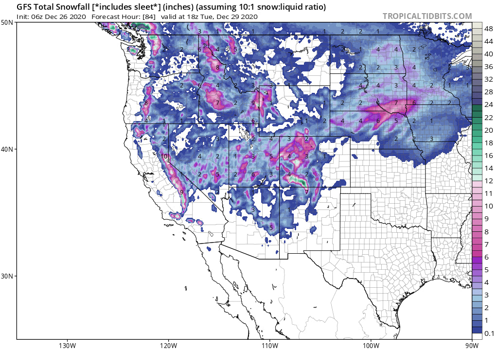
Below: Total snowfall from Monday to Friday over the West. These numbers are decent, however it is a combination of several waves of moisture that slowly add up during the week. The Sierra and perhaps the Cascades will see 12 plus inches on some of these events in a 24 hour period (Ideal chase criteria). The Rockies might see that by Friday (Wildcards).

Enjoy the powder everyone!
Powderchaser Steve


