It has been a fantastic season for fall colors with areas in the 6500-7500 elevation currently peaking in the Rockies. Areas around Park City are full-on yellow. Aspen is peaking at lower elevations. Most of the upper peaks in the Cottonwoods, Maroon Bells, and the San Juan range are beyond peak.
Snow will be falling, heavy at times favoring the Northern Rockies, especially Utah and Colorado from Wednesday to Thursday.
Upwards of 10 inches are possible above 9,000 feet and 4-8 inches between 7-9K. Peak snowfall for the Rockies will be Tuesday for Montana/Idaho (Light to moderate amounts), increasing in intensity as you head south towards the Wasatch Range and most of northern Colorado. Wednesday/Thursday. This storm could be a photographer's dream with snow/foliage abundant in many locations..
Below: A cold front enters the PNW early this week and drags over the Rockies Wednesday into Thursday (the Map is late Tuesday night to Thursday evening). You can see the PNW warms up by Thursday and most of the coldest air stays in the central and Northern Rockies midweek.

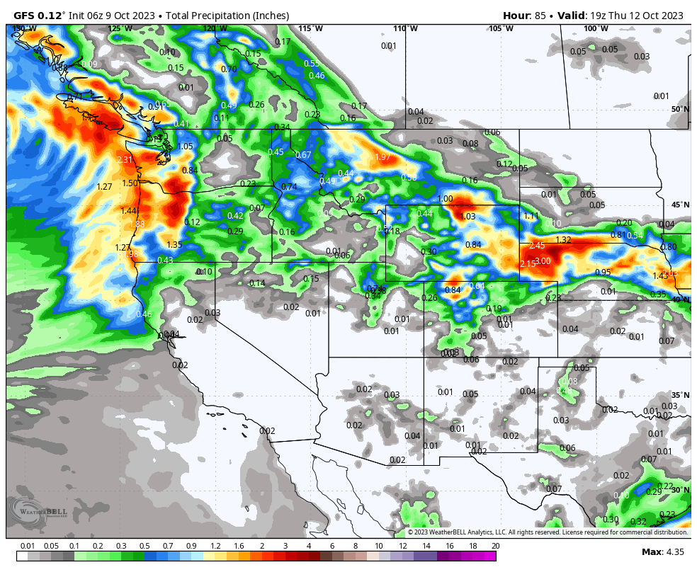
Below: Total moisture through midday Thursday is abundant for the PNW (1- 2 inches) with decent amounts (.5 to 1 inch) over central Montana, northern Utah, and especially northern Colorado (excess of 1 inch of water). Some higher-elevation light snowfall is likely in the Cascades earlier this week.


