The last several days has seen a widespread solution on snow totals for the next storm that is currently just beginning in the Northern Rockies. We expect some ski resorts to nab an excess of 15 inches above 9,000 feet in a few areas.
The highest odds of seeing deep powder will be the Cottonwoods in Utah (North-central Wasatch), Uinta Range , and northern Colorado.
Pass Announcement
Ikon Pass rates go up at midnight today (October 11th) so click here to receive the current discounted rate.
If we were chasing powder mid season, it might be a toss up between northern Utah or perhaps resorts in Colorado from I-70 and north. The model data has trended lower for the Tetons and we still have southern Montana as a wildcard (Big Sky). Some big totals (9-15) are likely In the Wind River Ranges of Wyoming extending into the Snowy Range near Laramie (Ski area to consider).
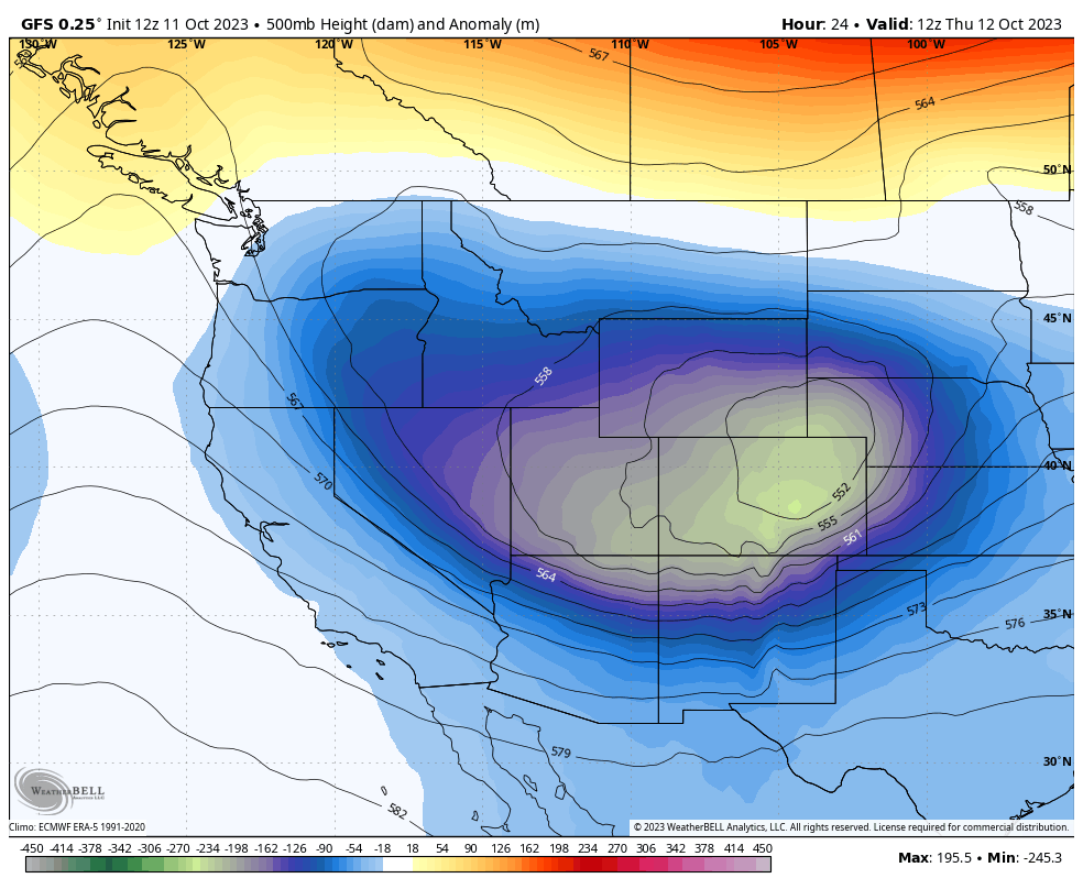
Low pressure tracks over southern Wyoming with cold air slowly progressing into the Tetons late Wednesday evening (Light snow possible at Pass level). Winds are initially favorable for the west side of Teton Pass (Targhee) from the NW but veer more northerly as the coldest air arrives late Wednesday night. It's possible that this northerly wind shift keeps snow totals to just 3-7 inches for the Ski areas (Boom or Bust). Winds from the W, SW, or NW often deliver the deepest dumps to the Tetons.
Models are in better agreement with strong convection over northern Utah, especially the Cottonwoods and areas near the summits of Park City (Canyons side) and even the peaks of the northern Wasatch (Powder, Snowbasin). Amounts on some model runs are in excess of 20 inches at the summits of the Cottonwoods, whereas going conservatively our forecast will be in the 9-15 inch range (Above 9K) with 3-9 inches at 7K. Peak snowfall will be late Wednesday through Thursday morning. The top of LCC and BCC will likely be snow packed by Thursday morning.
Aside from Utah, some big totals are possible at the summits of many northern Ski areas in Colorado by late Thursday. NW winds will push moisture from the low centered in Wyoming into Ski areas along or north of I-70. Models diverge on how far south the highest moisture falls. We think Steamboat could come up with higher totals, or even the Snowy Mountain range ski area near Laramie. Moisture should be plentiful with the coldest air arriving Thursday mid morning and kicking off heavy snow to the I-70 corridor (High mountain passes) by daybreak. We have good confidence in resorts on the western side of I-70 especially Vail with Aspen Highlands, Sunlight or Snowmass wildcards (A bit less confidence south of I-70). We have high confidence that the storm will favor the northern mountains of Colorado followed by areas just south of I-70. Double digits will be reported in some areas by Thursday evening (9-15 above 9,000) with boom or bust dependent on the track with any progression further south or north will make significant differences on totals (WY/CO border). If we had to sum it up, look for possible 10-15 inches above 9K north of I-70 favoring areas near Wyoming and 5-9 inches further south along or near I-70. This could all change.
Our Powder concierge rates are going up on Friday. This program provides you 1:1 forecasting for your trip planning, chases, and is your best option if you want to end up in the deepest spots for powder. We also added a luxury package that plans all your travel and lodging. The Concierge program can be found here. Don't forget about the rate increase on Ikon Pass tonight.
Below: American model is showing very high moisture totals (Water) for central Wyoming, less for the Tetons (Idaho border), with well over an inch of water for the Cottonwoods (South of the Great Salt Lake). In Colorado the heaviest moisture is likely going to be along or north of I-70.

Below: Short Term High Resolution model shows a similar solution (Total snowfall through late Thursday) with some 20 inch totals in the Wind River Range of Wyoming including areas at the Montana border. Some hefty totals are also noted in northern Colorado. The short term HRR below tends to be a bit optimistic, but it's also a good tool for tracking the highest snow potential.

Beyond the short term forecast, we enter a ridge with a general warming trend. Please support Powderchasers with a donation or our swag on the website. You can follow my chase for powder and photography on instagram @powderchasersteve. I just posted my top Bear Shots.
Enjoy the powder everyone!
Powderchasersteve


