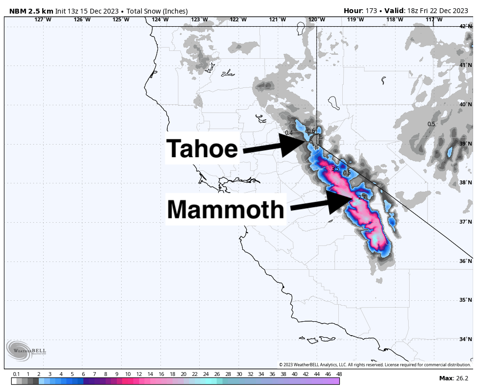
After a quiet week for the West, precipitation will return on Monday morning, impacting California through Wednesday evening. Another system is shaping up to move into southern California, southern Utah, New Mexico, and southern Colorado starting on Thursday through next weekend.
The California storm is beginning to come into focus, although totals still remain fairly uncertain with lots of time for the forecast to change. Check Powderchasers again later this weekend and early next week for updated forecasts as the models begin to figure out what will happen with this system. Precipitation will begin on Monday morning for Tahoe/Mammoth. Snow levels with this system will start high and progressively drop throughout the storm. Snow levels should start at around 8,500 feet. This storm will bring fairly significant rain to lower resort elevations. Unfortunately, the models have been trending warmer over the past couple of days. Just check out the lower-atmospheric temperature anomalies with the start of this storm on Monday morning:

Precipitation will continue to intensify on Monday and Tuesday. Snow levels should be hanging around 7,500-8,000 feet in Tahoe and Mammoth for most of this storm. This one is coming in warm and wet.
Wednesday should be the best day to chase in the Sierra, with decent snowfall from Tuesday and Tuesday night as well as what’s looking like another few inches throughout the day on Wednesday. Wednesday night should bring a few more inches to the Tahoe basin and more at Mammoth. For a multi-day chase, Mammoth is looking like the right move with the most snow on Wednesday and picking up extra on Wednesday night, making Thursday another potentially nice day. Mammoth’s higher elevation will help with the warm temperatures and should make for lower-density, lighter powder.
Check out this GIF from the European model showing significant rain, especially further north in Tahoe. Keep in mind that this model is too low-resolution to resolve snowfall on some of the higher terrain:

Again, there’s a ton of time for these numbers to change, but this will give a rough idea of what we’re looking at with this system. Totals will vary drastically with elevation. The western Tahoe basin will see mostly rain at mid-mountains until Monday night. When it’s all said and done, elevations above 8,000 feet should see 4-8” at Palisades, Kirkwood, and Sugar Bowl. Between 7,000 and 8,000 feet should see between a few inches and up to 6” (it all depends on how quickly the cold air is brought in, which the models are struggling with at the moment). Central Tahoe resorts are lower elevation, meaning their mid-mountains will switch over to snow later, likely during the day on Tuesday. This storm will likely only bring a few inches of wet snow with slightly more at the summits. I think resorts in the eastern Tahoe basin (Mt. Rose, Heavenly) could do pretty well with this storm due to their higher elevation, switching to snow earlier and seeing higher snow-to-liquid ratios (better snow). 4-8” at mid-mountains with potential for more (as much as 12+ at the summits). Mammoth should see little-to-no rain at mid-mountain and should see 10-15” of decent-quality snow.
It's worth noting that considering how this system has been trending (warmer and drier), this is not looking like an amazing chase. Be prepared for low to mid elevation rain and wet snow where temperatures allow for snow.
Another system looks like it will move in just as the first one is wrapping up, although this storm will take a much more southerly storm track, moving into southern California on Thursday/Friday and sweeping into southern UT, NM, and southern CO into the weekend. Arizona could also pick up some good snowfall up high. It’s still too far out to pin down specific totals, but look for potential chases in these regions next weekend… we are not expecting a major system, but 10+ inches is not out of the question for resorts in these regions.
Check out the European model throwing this system into the southwest. Still lots of uncertainty, but we will keep you updated:

Please join our powder concierge program to support powderchasers. This program provides 1:1 forecasting, chase locations, and custom trip planning to get you in the deepest snow with each storm. You can also donate on our website or purchase some swag to support us. This keeps the free forecasts going. Any Donations of $50 or more get you free swag (Shirts and stickers). Please support our Pow Cast.


