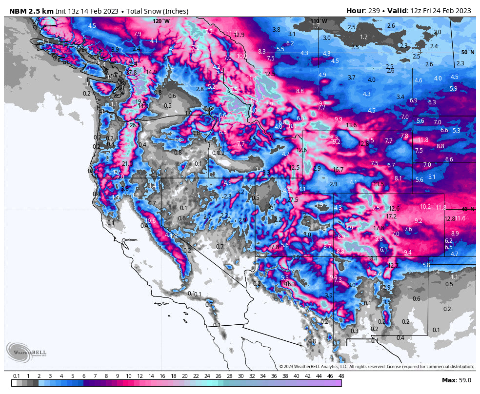
The West is in for an active week, with winners basically everywhere except for California.
Over the last day, there have been two separate storm systems that are currently converging in Colorado and bringing big totals. The first is what’s known as a cutoff low, when the jet stream weakens and reverses on the north side of a low pressure system and forms a loop rather than a big dip. You could see this especially well at 10am yesterday before the system started to merge back with the main westerly flow. Notice the closed pressure bars (in black) and easterly winds along the north flank of the low:

Overnight, this cutoff low brought some decent totals to the region, highlighted by Taos with 10”. This storm will continue to hammer New Mexico and southern Colorado tonight into Wednesday morning. Check out the optimal southwest flow winds hammering the San Juans. This is especially favorable for Wolf Creek:

During the ski day on Tuesday, there will be 2-5” in southern Colorado and New Mexico and 6-10” in Arizona and southern Utah, keeping conditions fresh all day. Central Colorado will see 2-4” during the day and northern Colorado (including I70 resorts) will only see around an inch at best. Then Tuesday night things really crank up. Southern Colorado resorts are looking at 6-15” with 18-24” at Wolf Creek. Southern Utah and Arizona Snowbowl will see another 6-10” overnight. New Mexico ski areas are looking at 6-12” of overnight fluff. Central and northern Colorado will see 2-6” overnight, with winners at Powderhorn, Crested Butte, and Monarch. Steamboat will only pick up around an inch overnight. The I-70 corridor is on the northern edge of the highest totals. Aspen might deliver just to the south.

Above: Tuesday night snowfall. Wednesday should be amazing!
Snowfall tapers during the day on Wednesday, bringing an additional 1-4” to central and southern Colorado and slightly higher amounts in northern New Mexico, with most of this snow falling in the morning. It’s worth noting that temperatures will be excellent with this storm, so snow density will be low and the conditions will be truly epic.
Another system moving into the Pacific Northwest brought some pretty epic overnight totals, making for great skiing and riding conditions, led by Alpental with 18” and Mt. Hood Meadows with 17”. There will not be any additional precipitation for the PNW until the next shot at snow on Thursday and this weekend.
Below: Follow @powderchasersteve on Instagram for the latest in deepest snow. He was at Alpental for 1st chair on Tuesday and it was deep. Photo: Powderchasersteve

Things will quiet down across all of the West for a few days before a small burst of snow returns to the PNW on Friday morning. Whistler and Mt. Baker could pick up a few inches on Friday, but we’re talking about maybe 4” at best.
Better chances for snow will come on Sunday as a major system begins to move through the West. There may be light accumulations during the day on Sunday, especially further north at Baker. On Sunday night, there should be somewhere in the 3-8” range and a few more inches on Monday. The major wave then moves in on Monday night, which is shaping up to bring 4-8” overnight and 5-14” on Tuesday, favoring southern Washington and northern Oregon.
The Intermountain West will also do well next week. A high pressure system building over the Pacific off the coast of California will keep the Golden State dry and steer the moisture and storm energy into the Pacific Northwest and down through Idaho, Montana, Wyoming, Utah, and Colorado. This is a pretty classic La Niña pattern, one that we ironically haven’t seen much so far this season (despite the persistent strong Niña signal). The models have a nearly constant parade of moisture diving down this path all week. It’s still too far out for specifics, but look for good chase conditions in Washington, Oregon, Idaho, Montana, Wyoming, and northern/central Colorado. This ridge may start to break down and allow some snow into California/Utah/southern Colorado starting next Tuesday/Wednesday, but it remains to be seen.

Take a look at next week's pattern in the multi-model blend below. Keep in mind that we're not so focused about the specifics yet, but the fact that the models are onboard with a nearly constant barrage of storms in the West is a great sign!
 ANNOUCEMENT
Powderchasers is now offering some great apparel, featuring high-quality US-made beanies and sweatshirts. This store will be expanded in the future but we are offering pre-release pricing on some great items. Please check out our store and support us with some Powderchasers gear that supports our site: https://powderchasers.com/store.
Don't forget to join our Concierge program for custom chase forecasts or donate here. Our concierge program will provide you custom forecasts to insure you get into the deepest snow (Our chase secrets). Donations keep our free forecasts going. Members rarely miss the deepest days.
Forecaster: Staff
Steve will see you on the first chair on Wednesday.


