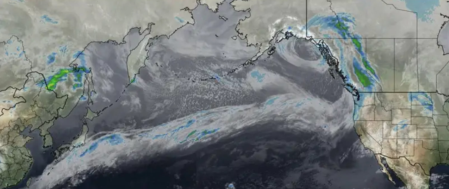
An atmospheric river will pump significant moisture into into the Cascades from Sunday afternoon to Tuesday. Warm air will invade a cooler airmass with the arrival of this moist system Sunday night. Snow levels will hover near 4,000 feet in the southern areas of Washington and near 3500 further north Sunday night into Monday. In western BC snow levels will be similar where moderate snow will continue to fall through Monday night.
Below: Atmospheric River stretching out into the Pacific Ocean aimed at the PNW.

A colder airmass under NW flow enters the PNW by late morning Monday improving quality through Tuesday as temps cool. The highest snow totals will likely come with the warmer air late Sunday night through Monday. Deep surf snow is likely early Monday with a chance of some medium or better density pow with the cold front. (It's likely the cooler air will be arriving up north around daybreak Monday).
Below: Warming begins Sunday night, however snow levels will likely stay near the bases at many resorts as these temps are near freezing at 4800 feet. Actual snow level is often 1,000 feet below freezing level especially in heavy precipitation rates (Plan on 3500-4,000 foot snow levels Monday morning which is at or slightly above pass levels in WA). They will drop significantly during the day Monday.

Below: Cooler temps are moving in beginning in the northern regions of the Cascades by Monday morning. Snow will increase on the lower mountain passes from mid Monday to Tuesday. Last chair Monday may offer some decent quality.
Please check out the lowest renewal and new IKON pass rates for the 22/23 season above.

Moderate snow continues in the Cascades including Oregon resorts for Monday night and Tuesday morning. Tuesday is likely a day to dig out the lifts that stay closed on Monday. 20-30 inches are likely for storm totals from Sunday PM to Tuesday AM. Winds are very strong Monday, Monday Night decreasing on Tuesday (Sustained winds in the 40's near the coast). It's unclear how much of these extreme winds will reach the inland areas (Models show very high gusts just east of the Cascade range) but expect some possible lift delays or closures especially on Monday. Bottom Line: Very moist system, primarily snow versus rain, dense initially followed by better quality later Monday or Tuesday. Caveat: Strong winds, Increasing Avalanche Danger, it's not easy to predict how well this pow will ski and what opens or how much the wind will play in quality. Things could ski really well late Monday and Tuesday.
Below: Total snowfall for the Cascade Range through Wednesday on the National Blend of models (Pretty impressive totals in the 20-30 range for many ski areas).

For the Rockies moderate snow will be falling Monday-Tuesday for Northern and eastern Idaho, Southern Montana, through to the Teton Range in Wyoming. Heaviest totals appear to be the central panhandle of Idaho (Eastern border with Montana), followed by the Tetons. Most of the moisture is decreasing as this system moves east. The Tetons will likely end up with 5-9 inches of dense snow from Monday mid- day to Tuesday morning. Strong winds will buff out some areas. Higher amounts might fall over Togwotee Pass and areas east of JH. This could be a fun surf day for the Tetons. In Utah, the highest totals fall east of the Wasatch Range however some snow will be possible Monday PM to Tuesday AM (3-7) in the Cottonwoods (Strong winds initially).
Below: Total snowfall for the west through Wednesday morning. Let's hope the Sierra grabs a storm that is advertised in the long range models for week #2. They really need it!

Colorado grabs some snow this weekend (Sunday) followed by the storm in the PNW on Tuesday/Wednesday. Amounts look to favor the southern mountains this Sunday (Today) and the north/central mountains on Tuesday--Wednesday. Amounts look to stay moderate at this time.
Below: One of my top photos- @powderchasersteve via instagram- Comet Neowise over the Teton Range in 2020. You can follow my adventure travel on Instagram.

Thanks for following Powderchasers! I think we can keep posting as conditions warrant. Week #2 looks active in the west.
Please support Powderchasers by either joining the powder concierge or making a donation for our powder forecasts. The Concierge gets you custom chase forecasts and travel tips. The donations are used to support our forecasts. Please support us. It will keep the forecasts coming!
Forecaster: Powderchaser Steve
Please support Powderchasers by either joining the powder concierge or making a donation for our powder forecasts. The Concierge gets you custom chase forecasts and travel tips. The donations are used to support our forecasts.


