Good morning everyone and welcome to our o joke\"- April fools forecast. Currently April is showing signs of some decent snowfall in the west. In the short term we can look for an active pattern for Canada, the Pacific Northwest and the northern and Central Rockies. Another swath of low pressure may move ashore in week #2 bringing snow back to the Sierra. Amounts will exceed 1-2 feet in the PNW with many resorts in the Northern Rockies doing well early next week. Some areas could pick up 20-30 inches by late Tuesday.
Please support Powderchasers by either joining the powder concierge or making a donation for our powder forecasts. The Concierge gets you custom chase forecasts and travel tips. The donations are used to support our forecasts.
Short Term Powcast:
Light to moderate snow will be falling in the Cascades Friday night with western Canada and most of Washington favored for some freshies for Saturday morning (3-8). Central Washington Resorts might see the upper end. Timing is good for overnight snowfall and temps are cold for this time of year. Quality will be high on this moderate teaser for Saturday morning.
A stronger system moves ashore Saturday night for western Canada bringing storm ski conditions for Whistler Sunday, and cool temps. Areas into Washington will see less snow until Sunday afternoon (Last chair). This system is very moist and brings in a warm front Sunday night pushing snow levels near 3500 or 4,000 feet. Fortunately, a cold front swings in for Monday morning cooling temps and increasing quality during the day. If terrain opens on Monday it could ski very well with some colder pow topping the denser snow from Sunday night. Timing of the colder air will be key. Snow continues in the PNW through Tuesday morning with a cooling trend. Oregon resorts will do well with this storm from late Sunday night to Tuesday (Decent amounts with less storm totals). Bottom Line: 12-16 inch storm totals for the southern Cascades including Oregon with 1-3 feet possible for northern or central areas. Interior BC will see moderate snowfall with some warming periods Sunday.
Below: Cold front moving into the PNW by Monday morning with snow levels falling to pass levels. The coldest air due late Monday night into Tuesday. Map: 4800 feet in Celsius.

View the least expensive options above for your IKON renewals and new passes for 22-23 above
Interior Washington Resorts will also benefit with moderate snowfall from this storm (Mission Ridge) and especially Selkirk Powder Guides in the northern regions of Idaho near Sandpoint. Expect to see 7-14 inches in these areas with both Monday and Tuesday being powder days. If you have not checked out Selkirk Powder please do with a wide variety of offerings from Cat, Heli, Snowmobile tours and unlimited terrain. Ride anytime next week for the deepest totals but additional snow is likely into the 2nd week of April.
In the Rockies the focus will be from the Central Idaho Panhandle (Ski Lookout), Northern- Montana (GNP and edging into Whitefish), and the Tetons. These areas will see snowfall Monday/Tuesday. Amounts look pretty deep, especially in the eastern Panhandle of Idaho with more moderate amounts towards western Idaho. The Tetons look to outperform the Wasatch on this storm with perhaps 4-8 inches by Tuesday morning. The Tetons start out with dense snow Monday, however a strong cold front Tuesday will put down some light finishing touches to the totals (Right side up). Higher snow totals are noted east of the Tetons. For Utah the European models Is more optimistic than the American model but neither show a significant event (Light or moderate snow Monday-Tuesday).
Colorado sees light or moderate snow for the Central and northern Mountains Sunday with a southern piece of energy. This could bring powder conditions to southern and central regions(I-70 and south) as early as Sunday morning. Snow increases late Monday to Tuesday afternoon with the northern branch of energy moving down from Wyoming. Expect several periods of light or moderate events late this weekend with increasing intensity Monday PM to Tuesday PM. The central regions are favored (Summit County- I-70 Corridor- Aspen) on the GFS with the European digging energy further south into the San Juan Range. It's likely that many areas of Colorado report storm totals (Sunday-Tuesday night) in the double digits.
Below: Strong low pressure noted over the PNW late Sunday. A small piece of energy is noted further south that will swing into southern Utah and most of Colorado by Sunday (Light or moderate amounts).

Below: Low is tracking over the Northern Rockies Monday/Tuesday.

Below: Total snowfall through Tuesday morning with most of the pow falling Monday-Tuesday in the Northern Rockies with Colorado both on Sunday and again late Monday night to Wednesday (Small piece of the puzzle adding up to double digits).

Below: Total snowfall for the west through Tuesday morning favoring the PNW and western Canada with decent amounts noted for northern Idaho, eastern panhandle, north central Montana, extending into the Tetons and Colorado. Many chase options with this storm.

Extended POWDER FORECAST:
High pressure takes grip on the west mid to late this week.
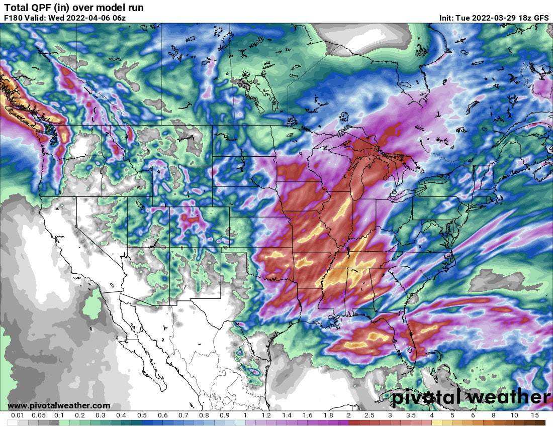
The models are advertising an unsettled pattern during the 2nd week of April. It's possible that low pressure remains over the west during most of the week
It's likely the PNW will stay unsettled with some decent chances of snow for much of the west. These storms will likely favor the Northern Rockies and perhaps the Sierra. We have high confidence in a trend for storminess, but lower confidence on amounts or exactly where these storms will set up.
Below: Low pressure noted on these 3 maps (April 10, 12, 14) and through much of the 2nd week of April (Woo hoo).


Follow @powderchasersteve on Instagram for the latest travel adventures, Photography, and adventure.
Enjoy the powder everyone! This is not an April fools Joke!
FYI: Jackson Hole has voted to construct a 25 story hotel attached to the Tram Building in Teton Village. This will have an underground tunnel to the Tram Dock for convenience of its guests and those that want to put their skis in line early (Wearing slippers). - Now that is our April Fools Joke!
Powderchaser Steve


