Summary:
The highest snowfall totals in the next 12 hours will be in New England, as coastal areas get slammed with 10-18 inches of snow. In the west a moist system will approach Vancouver Island late Saturday night and spread south over the Cascades Sunday-Monday.
If you want to chase powder to the deepest spots and support our forecasts please join our Concierge program that starts at just $95 bucks.
Forecast:
New England is getting slammed with the heaviest snow falling over the metro areas of Boston, Cape Cod and skimming the NH coast. Models have trended a bit further east on Saturday morning with 10-18 inches for Boston, 7-8 inches for Portsmouth NH, and 2-4 inches further inland towards the Lakes Region of New Hampshire. Unfortunately most of the deep totals will stay east of most Ski Areas with the exception of eastern MA. Winds will be gusting to 60MPH over the Cape.
Below: The Short Term High Resolution Model does a good job of depicting snowfall in the near term with only light to moderate snowfall for inland New Hampshire (East towards Gunstock) and higher amounts in east central Massachusetts. Some light to moderate snowfall amounts high also fall near Sunday River. Chase: With very strong winds I might elect to hold off chasing this storm. Sunday will offer openings. Look for eastern MA to have the deepest totals (Wachusett or Nashoba Valley).

Below: Wind gusts Saturday morning in the 50-60 Knot ranges for the Cape and 40's for the eastern portions of MA. Lighter snow and less wind can be found just inland from the coast so if you are headed north towards N. Conway or Guilford New Hampshire (Gunstock region) gusts should be manageable (Light snow)

For the west, a strong low pressure system will provide some storm skiing for Whistler Sunday with 7-10 inches of freshies for opening lifts. Snow continues through Sunday with totals in the 10-15 inch range. Quality will be dense for lower elevations (some rain might mix in at the base) and decent up top.
In the Cascades, look for snow to be falling heavily in the northern regions of Washington by 2AM Sunday. Moderate snow for the north Cascades and a slight warming trend Sunday will provide 7-14 inches of base building snowfall (They need the denser variety right now) by last chair. Snow will also be falling Sunday albeit slightly later timing for the central regions near I-90 and to a lesser extend in the Mt Hood region.
Very cold air will replace the warm temps in the Cascades late Sunday night as snow transitions to very light density and continues through Monday morning. This will favor Stevens Pass and I-90 resorts. Mt Baker will see additional light to moderate amounts for Monday morning. Further south towards Mt Hood (Crystal) amounts will be in the 4-8 inch range. Monday could be decent!
Extended- Keep reading
In the extended forecast the action moves inland Sunday night to Monday, for moderate snow for interior BC (Heavier amounts in the northern regions) with lighter snows extending south to the US border. Northern Idaho resorts and areas towards Whitefish Montana should grab some moderate freshies for lift openings on Monday. This might be a decent chase.
Moderate to heavier snow is also noted along the central Idaho Panhandle (Western regions) and areas in central Montana. Even Montana Snowbowl will see some freshies Monday morning.
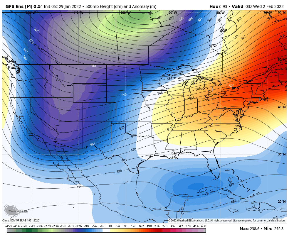
The action skims over the Tetons (Light snow) and takes aim for Colorado Tuesday PM to Wednesday. The GFS American models wants to slow the system and bring higher totals to most of Colorado where the European and Canadian are less optimistic. Its likely that moderate snowfall will be found for most of the I-70 corridor Wednesday morning with perhaps higher amounts further east near the Divide (Loveland, WP, RNP, Eldora). There is also good moisture noted for the southern San Juan Range towards Wolf Creek and Taos New Mexico. This is a storm that might land advisory level totals to the San Juan Range in excess of a foot and will need to be watched. If the American Model plays out the northern mountains and the I-70 corridor will see 4-10 inches. Caveat: Warm temps Tuesday night might keep snow ratios low so amounts could come up short. Very cold air behind the system might increase snow showers under NW flow especially for Vail pass, Copper, and Breck late Wednesday into Tuesday (Additional light amounts of higher quality). Bottom Line: Optimism for the southern San Juan Range of Colorado and northern New Mexico. Moderate confidence in decent Front Range Ski area event and perhaps west along I-70 and towards Aspen and even Telluride. Winds are NW in the western sections of Colorado (Good for snowfall) and NE towards the Denver Metro (Upslope). Moisture is a bit limited with this storm.
Below: Total western US snowfall through Wednesday night. PWW-Sunday,Monday, Colorado, New Mexico Tuesday-Wednesday.

Believe it or not, I might head to Europe and chase a storm in Austria this week. If anyone is out there or would like to shed some guidance on a chase please comment. Follow my chase and travels on Instagram @powderchasersteve
Enjoy the powder everyone! PCS


