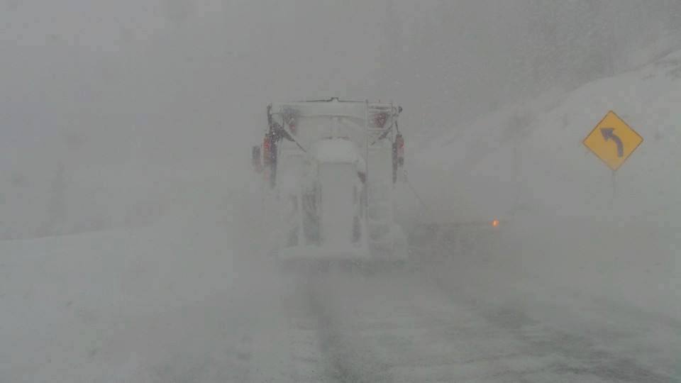
Officially, we are putting the Cascades (Northern Regions favored) back in the full powder game with several feet of snow in the past 3 days. Mount Baker as of Wednesday morning has a 60-inch base (Had almost 0 - 2 weeks ago) and another 16 inches has fallen in the past 24 hours per telemetry that I pulled. Stevens Pass also has scored a respectable 23 inches in the past 3 days. Areas south have seen less snow. Crystal managed to open the Rainier express chair on Wednesday and plans some limited openings of Chair 6 Friday or Saturday. The real winner might be Whistler who has seen 31 inches in 7 days. Below: That 31 inches does not include what happened last night! WOO HOO

My forecast for the Tetons was 5-10 inches earlier this week. Targhee grabbed an incredible blower Wednesday with only 2 inches on the snow report quickly adding up to 11 inches by noon (Epic is an understatement). JHMR also reported 11 inches by the end of the day. Teton Pass was skiing great!
In the Wasatch, most resorts grabbed light to moderate snow (2-5 inches). The Cottonwoods were favored with a strong NW flow on Wednesday that produced 11-15 inches (LCC favored). Most of that snow will be available for the 1st chair on Thursday with multiple lift closures on Wednesday due to strong winds (Gusts to 75 MPH and higher). Don't expect consistency in the new snow due to wind drifting or in some cases a complete blowout.
Colorado scored in the areas as forecasted. Most areas picked up light snow closer to the Front Range with heavy snow further north and west. Steamboat is reporting 11 inches and mostly since 3 PM. Hopefully, you're there right now! Telluride was also highlighted in my last post who scored 8-10 inches. The Aspen area had similar amounts (Highlands at 8 inches). These areas benefited from moisture from the Tetons and Utah dropping over the northern part of Colorado and swooping south through the 4 corners. NW winds favor Steamboat, certain Aspen-area mountains, and Telluride. Vail and Breckenridge also are favored with this pattern, however, most snow stayed west of these areas (3 inches at Vail). Snow quality will be very good with low-density powder.
Forecast Update
The next several days will feature a long fetch of moisture for the Pacific Northwest. Heavy snow will fall again today, with a brief break on Saturday (Might be a good day for rope drops). The models show the highest amounts will favor central and northern regions of Washington and BC. Temps have been rising in the PNW so avalanche danger will be rising (Check the report before venturing out). Next week features additional moisture with a tendency for higher snow levels (Rain at the bases). Northern resorts will see slightly cooler temperatures. There is a chance that some snow filters south into the northern Sierra on Monday (Euro is tending to this solution, where the GFS completely discounts it).
The Rockies are in a holding pattern. Next week does not offer any chases for these areas. It's possible some light snowfall over the Tetons midweek. Additional snow may begin to impact the Rockies by next weekend (9 days away) and into XMAS week (Stay tuned).
Chases? If you're in the NW line up now! Whistler will be snorkel deep (Limited terrain). Rope drops will be happening in the next several days! The further north the higher the amount of snow. If your in the Rockies grab leftovers in the Tetons or new snow in Utah where lifts were closed yesterday. In Colorado, my top pick would be Steamboat, followed by the Aspen area (Highlands Bowl could be epic) or Telluride. The next 7 days features lots of moisture for Washington and BC. Higher snow levels would have me watching Mount Baker (Slightly cooler temps) or spots in interior BC or Whistler. In my books, snow levels approaching 4-5K are not chase worthy. We will narrow in the forecast on a later post.
FYI: Today is the last day to purchase your IKON Pass!
Powderchaser Steve


