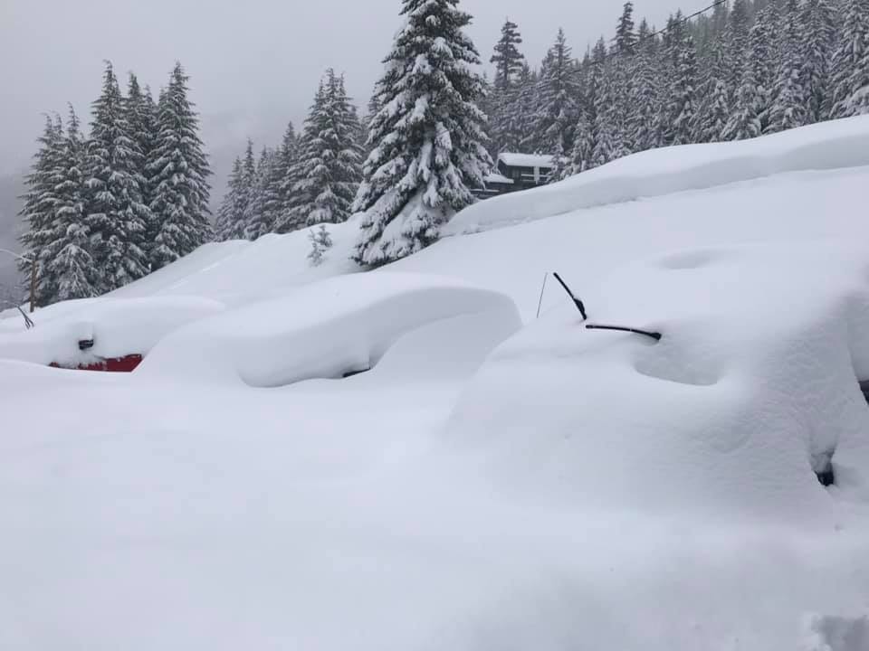
SUMMARY: Pretty excited this morning to see several waves of moisture moving into the Pacific Northwest and western BC this week. Snow amounts will slowly add up with each successive wave being a bit stronger and colder. Snow levels start out above most base areas midweek before falling to 4,000 feet late. Whistler may nab 10-20 inches at the summit by the end of the week! The Rockies will see some deep snow late this weekend in the extended forecast.
FORECAST: Light rain and snow will increase over BC and the Cascades today. Areas north towards Whistler could score some moderate snow by late Wednesday. A pattern of successive waves of energy will continue this entire week with each one dropping temps slightly. Each period will see light to moderate snow at upper elevations (Rain at the bases) with the exceptions of heavy snow at the summit of Whistler. If I were chasing powder my eyes would be glued to the Cascades or BC for Friday when temps drop snow levels to around 4,000 feet with snow increasing. The models are most bullish initially for the northern areas of Washington (Summit of Baker). By Friday winds shift from the SW/W to the Northwest which will drop temps and push more moisture into many areas of the PNW (Oregon and Washington). Some snow may also be falling at the bases. Snow will also increase to moderate levels in interior BC and northern Idaho. The heaviest dumps in the Cascades will occur in Western BC, and northern and central areas of Washington through Saturday. Interior BC and Alberta will see moderate snow through the period.
Below: Total snowfall through early Sunday highlighting the PNW and western BC). Decent amounts likely for central Idaho and the Tetons with the Wasatch a wildcard (See extended forecast). Some of the highest elevations of western BC could exceed 2 feet easily by the weekend.

Chases (Lets dream that every resort is open)- Time to live vicariously.
Whistler (Upper elevations) Wednesday/Thursday (Snowing heavily with wind impacts and some lift closures)
Baker- Friday (Temps drop snow levels to the upper base area).
Crystal or Stevens, perhaps Timberline or even Bachelor by late Friday or Saturday
Double digits are likely at most resorts of the PNW this week adding up to perhaps 15-20 inches or more by Saturday (upper peaks with northern areas favored)
EXTENDED: ROCKIES
ROCKIES: The 1st trough may trickle into the mountains of Wyoming or Montana by Thursday or Friday. Light rain/snow is likely for these areas before the coldest air arrives Saturday. Snow will increase for western Idaho (Brundage) on Saturday and the Tetons by afternoon. The highlights will likely come late this weekend when temperatures cool increasing snow for the Tetons and Wasatch into Sunday morning. The most bullish areas seem to be the Tetons where double digits will be likely at upper elevations. The Wasatch has high confidence for snow on Sunday with my gut telling me the areas north towards Logan (Beaver Mountain) may see greater amounts. Park City, Alta, Snowbasin, Solitude, Powder all score some freshies but its a bit early to predict totals (Moderate amounts likely).
Colorado will start to see snowfall late Saturday night or early Sunday. Models are most bullish for Steamboat areas peaks extending down to to I-70 (Summit County) Sunday through late Monday. It's possible that Sunday morning ends up being a bust on the southern areas but by Monday things get deeper. I am relatively confident for moderate amounts in many areas (5-10) but it may slowly evolve into the beginning of the following work week. It's too far out to predict with confidence.
Below: Significant snow highlighting the upper elevations of the Tetons through early Sunday.

Chases: (Dreaming it's mid winter).
Brundage on Saturday (Snowing during the day), perhaps PM versus AM
Tetons- Late Saturday or early Sunday
Wasatch- Wildcard Sunday (Snowing). Heaviest might occur north towards Logan (Beaver Mountain).
Colorado- I-70 mountains and areas north Sunday PM/Monday
Don't forget to support our sponsors at the top of the page and sign up for our powder concierge!
Powderchaser Steve


