
Skiers across the West have spent this winter refreshing webcams, squinting at brown runouts, and defaulting to thin-cover tactics. The numbers back up the mood. In California, the mountain snowpack sat around 59% of average in late January, and the long-running Phillips Station reading near Lake Tahoe was roughly 46% of average. In Colorado, SNOTEL basin indices on February 2 hovered in the 40s and 50s, with the Arkansas basin near 48% and the Upper Rio Grande near 51%. A thin early base and repeated warm, dry windows have kept the cover extremely fragile. Check out the abysmal snowpack across the West as of yesterday:

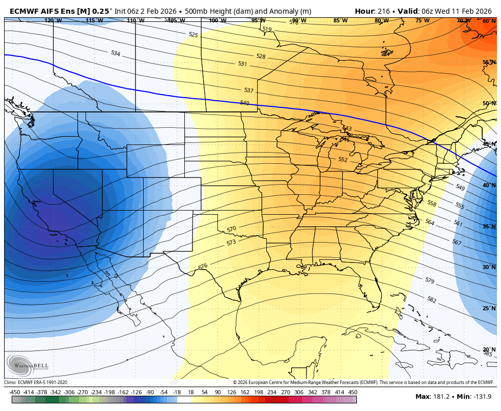
The atmosphere has settled into a pattern that keeps looping. A broad ridge sits over the Intermountain West with another ridge upstream over the North Pacific, and that combo keeps the storm track at arm’s length. On the other side of the continent, deep troughing keeps loading the eastern half with arctic air, and a strong block near Greenland helps anchor that wave setup. When heights stay high over the West, storms shear apart, detour north toward the Aleutian Islands, or slide south and spin up near Baja California. The jet stays active, but it keeps aiming away from the West.
This season has also found two different ways to fail. In the Pacific Northwest, storms have arrived, but warmth has lifted snow levels and turned many wet pushes into rain at elevations that usually fall as snow. Farther south and inland, the storm parade has been sparse, so the deficit is simpler. Across much of the West, early-season warmth pushed precipitation toward rain rather than snow, and major basins ran near record warmth through December. Warm rain strips what little base exists and accelerates settling, while snow that falls cold and sticks behaves like savings, sitting in place until spring. Unfortunately, we just haven’t seen that so far this season.
Powder to return to the West
Next week, finally, shows a crack in the lid. The ridge over the West is expected to slowly break down as Pacific shortwave energy reaches Washington and Oregon, opening the door to more substantial precipitation. The Cascade Range looks best positioned for the first meaningful reload, with lighter spillover into the Northern Rockies and some moisture possibly sagging into far northern California late in the weekend. Temperatures still lean above normal across much of the West in this window, so snow levels and the timing of colder air will decide whether this refresh feels like midwinter or late March…

SUPPORT OUR GOLD SPONSORS


The 8 to 15 day window carries a broader hint of hope, with the usual long-range uncertainty. Ensemble guidance brings a trough into the West Coast and favors a shift toward above-normal precipitation across much of the West, with a signal that reaches beyond the coast into interior terrain. The same guidance has a possible lee-side cyclone somewhere east of the Rockies, and those setups can turn a modest Pacific wave into a wider snow footprint from the Great Basin into higher ranges farther east. Looking a bit beyond that, the mid-to-late February window tilts wetter for the Pacific Northwest, northern Rockies, and perhaps the Sierra (Some models are deep).
Below: low-pressure periods from late Sunday (2/8) to Friday (2/13). 3 systems are showing up on this map. We are still in the 7-12 day period, so confidence is low beyond the first system aimed at the PNW this Sunday. We have decent confidence in a welcome pattern change for the West.

High Mountain Heli, located in the Tetons, is offering a special 20% discount on all seats for this upcoming week. They are still grabbing upper elevation untracked lines. Mention PC and get a free swag bag.
HELP US OUT- Please support your love of powder and our free forecasts with a donation here, or join our concierge program. We have merch on the website.
We appreciate the support.

Forecaster: Clay Marlot


