Summary:
Many areas of the west are grabbing freshies with warmer temps, good base building, and some new ski area openings. You could chase now and ride powder tomorrow.
Forecast:
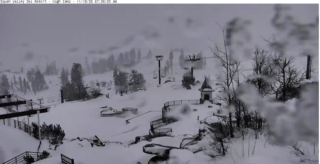
The west continues to grab snowfall Wednesday morning with the highest amounts in the Sierra. Automated telemetry shows that 15 inches has fallen at 8,000 feet at Squaw, with a decent amount likely at most Ski Areas on the west side of the lake. The northern areas near I-80 may have higher amounts. Models show another 5-9 inches are likely above 7,000 feet on Wednesday. Temps are around 30 degrees F which will make for the perfect base build!
Below: Squaw Valley Webcam Wednesday morning- Looking like winter!

Elsewhere warmer temps and precipitation is focussed on on central Idaho, Tamarack, McCall, and to some extent Sun Valley Wednesday morning. 5-9 inches of wet snow have fallen in these locations. The Cascades are in a cool down phase after snow and warming yesterday that likley will formulate a crust layer today. Crystal Mountain opened today with 54/85 trails and 7/11 lifts open!
Below: The definition of \"Wet\" snow- Tamarck Ski Area- Idaho Wed

Below: Sun Valley -Wednesday morning.

A new system will move into the Pacific Northwest Wednesday afternoon through Thursday. The models show the highest amounts north towards Mount Baker and further south from Mount Hood through the Oregon Cascades. Northern Washington and a good portion of Oregon Cascade range is likely to see 12-18 inches by Thursday afternoon. Snow levels will decrease significantly so the quality is likley to be high. Best time to ride will be late Wednesday or early Thursday. That system drags through Idaho and Wyoming Thursday.
Below: Snow from Idaho on Wednesday (Brundage, Tamarack, Sun Valley) trickles into Wyoming for some wet 5-10 inches above 8,000 feet favoring the northern Tetons on Thursday. Very little snow will accumulate below 7,000 feet. This will continue to add to the bases for the Tetons. At last check, Jackson Hole has already seen 96 inches YTD. They will break 100 by late Wednesday night.

Extended Forecast:
The weekend is likey to bring a return of unsettled weather to the Pacific Northwest. Temps appear near seasonal norms with cooling at night and slightly rising snow levels during the day (4,000). There could be some decent amounts at some point early next week. Stay tuned.
ANNOUNCEMENT:
We lost a member of the Powder Community today to Cancer. Steven Horwitz from Frisco will be remembered as \"The Powderman\" (License plate). I met him on a chairlift at Wolf Creek during a deep dump. He was chasing powder and shared the same passions that many of us did. Let's remember Steve as a person who lived life to it's fullest, rode powder and also loved Dirt Biking. He will be missed by the Powder Community. My next powder run will be dedicated to Steve.
Below: Steven Horwitz enjoying a powder day in Summit County Colorado.

Stay safe! Avoid COVID, Gatherings, Wear your mask, and lets hope we can ride deep pow all season! Its shaping up to be a good season in many areas of the west.
Powderchaser Steve


