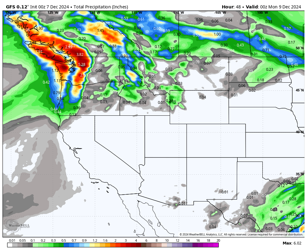
Very warm temperatures have overspread the Cascades, and rain is falling in many areas. Colder air will overspread the PNW by later Saturday, bringing moderate snowfall to many places through Sunday. Leftovers will move into the Panhandle of Idaho and northern Montana before weakening over the Rockies.
If you want to chase double-digits, head to the Pacific Northwest, where rain will change to snow by mid to late on Saturday. Interior BC is colder with moderate snowfall and better quality initially.
Snow levels crept up as high as 9,000 feet on Friday in the Pacific Northwest and should drop to near 3,000 by late Saturday. Rain is falling in most locations as of Friday night/Saturday morning.
Below: 4800-foot temperatures in Celcius are well above freezing in most areas of the west, especially the BC and Cascades coastal ranges. Colder air is noted for inland BC and regions on the eastern side of the Cascade Crest. Rain was falling in many locations on the western side of the Cascades and lower to mid elevations in Coastal BC.

Below: A cold front moves in by Saturday evening, bringing snow levels near 3,000 feet. This will bring several inches of wet snow to the Cascades and mid-to-upper elevations of BC. No more rain thankfully!

Below: If you are chasing snow this weekend, head to inland BC for 5-10 inches of medium to dense snow on Saturday or the upper elevations of Whistler (5-10). Snowfall will be most evident for the Washington Cascades later Saturday into Sunday. You can see 12-plus inches at many ski areas through Sunday in the Cascades. Stevens Pass might be favored due to some enhancement with a convergence zone. This map shows snowfall through Sunday morning (December 8). Upside totals could see a few spots in the central Cascades of Washington exceeding 14 inches (Mid to upper mountain) by Sunday mid-morning (Upper elevations near Stevens Pass). The key will be in dodging the warmer air initially and then grabbing the deeper snow on Sunday.

Below: Details highlight this convergence zone over noted near or just north of Stevens Pass by Sunday morning. Areas of the northern or southern Cascades (Baker, Crystal) will generally see 5-11 inches above 3,000 feet, possibly higher amounts near or north of I-90. Inland areas will grab lower totals, but the temps are colder on Saturday morning.

Below: Total snow through Tuesday morning (December 10). The moisture gets wrung out as it heads over the Rockies with the low splitting and dissipating. Moderate totals are evident for the Panhandle of Idaho and inland BC with cooler temps. Lighter totals are evident in Montana and Wyoming, along with scraps for the southeastern section of Colorado by Tuesday morning as the low splits.

Below: The trough has split apart as moisture moves west to east over the Rockies, resulting in less snow early next week.

Announcement: The last day to purchase both IKON and the Mountain Collective Pass is December 12th (links above).
Extended Powder Forecast
Below: We often look for cold fronts in the 10K elevation range when looking at extended models. You can see temperatures. You can see a brief warm-up Monday-Wednesday with a cold front just entering the BC coast (Wednesday night, December 11).

Below: That cold front stays in the northern tier States of the PNW and Rockies from Thursday to Saturday next week. This is likely where the most snow will fall.

Below: 48-hour snowfall totals display the highest odds of snowfall from Thursday, December 12, to Saturday, December 14th next week. It's too far out to forecast with accuracy. Warmer temperatures might limit totals for the Sierra range. Utah and Colorado appear too far south of most of the action. The Sierra is a wildcard. The four corners also stay dry.

Below: The map is from Thursday, December 12, to Saturday night, December 14th. The central and southern Rockies seem stuck in high pressure, while the storm track aims at the PNW and Canada. The Sierra is a wildcard.

Please follow our social media pages @powderchasers on Instagram and FB.
Powderchaser Steve - @powderchasersteve


