We have an active week in store for the Pacific Northwest. With an upper level low over Alaska, and an active jet stream, numerous short waves and fronts will spin off the upper level low towards British Columbia, Washington, and Oregon, bring widespread precipitation to the region. Below is the upper level pattern for the week.

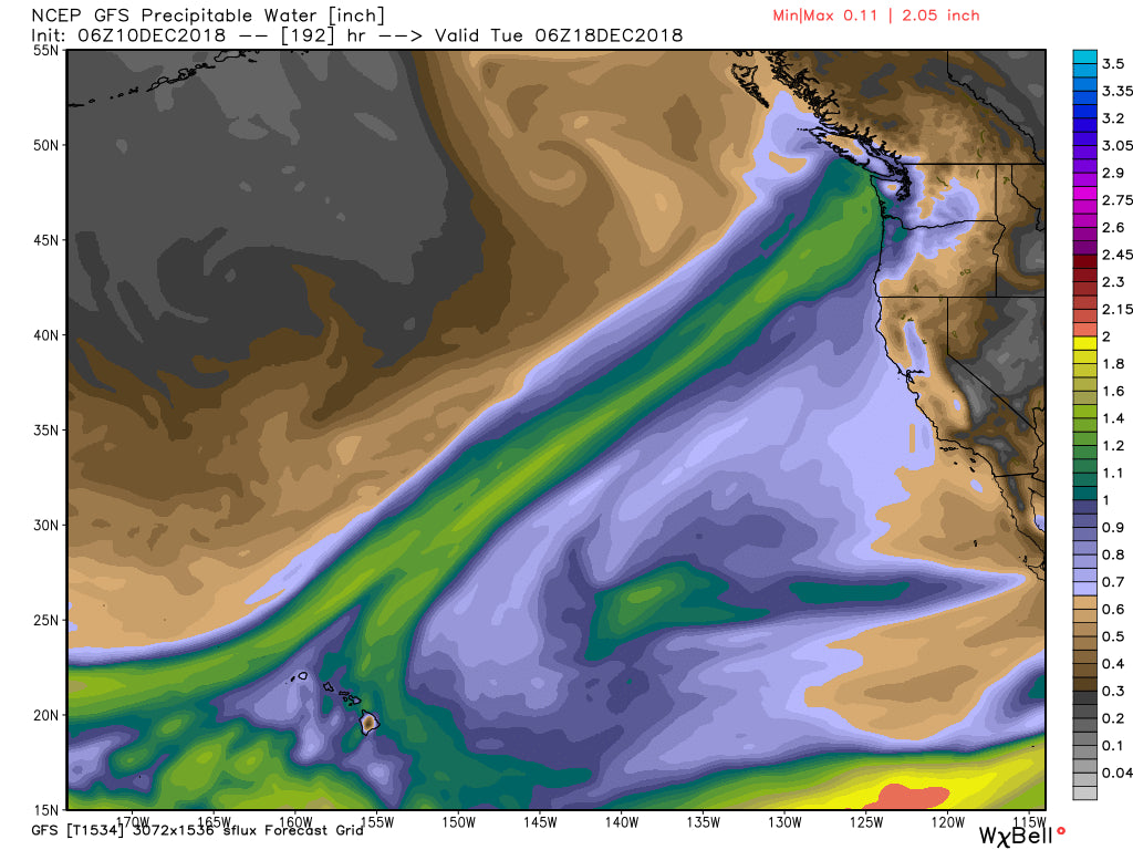
Later this week into next, the jet stream sags farther south, as does the upper level low that was previously over Alaska. This will allow the storms to head farther south, increasing the chances for snow in the Sierra and Central/Southern Rockies. However, this round of storms may feature warmer temperatures, as an atmospheric river event is possible with warm air originating from the tropics, as seen in the precipitable water map below valid on Tuesday the 18th.

Even with the warm air, though, mid and upper elevations should receive good base building snow. And, since its still a week away, there will likely be adjustments in the forecast.
There may be a break in the action around the 20th, and then a possible return to strominess before Christmas, however this far out the models don't have a consistent solution yet. See the 12/20-12/25 period on the GFS and ECMWF ensembles below.


Both are hinting at continued storminess for the West, but the lighter colors indicate low confidence in this solution at this time.
Check back in next Monday for your weekly Long Range Forecast.


