
SUMMARY
The Forecast yesterday brought true results with the only Ski Areas highlighted being Whistler and Baker. Double Digits hit last night and it's still snowing cold freshies! Snow continues in the Pacific Northwest. The Rockies and Sierra get snow Saturday/Sunday while interior BC also fires up. Midweek might see a southern storm impact Mammoth pushing East over the San Juans. Late next week might bring a decent dump to the northern Rockies.
FORECAST
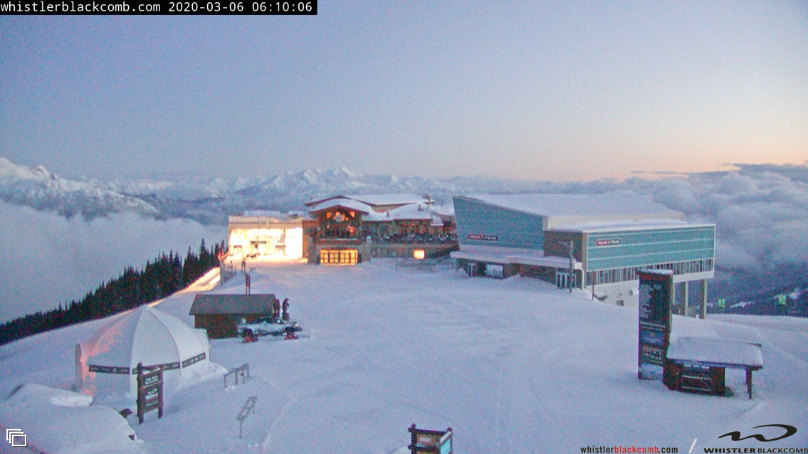
Heavy snowfall and dropping temps Friday morning will bring one of the best powder days of the season to Baker with 16 inches at 5 AM and it's still snowing. Whistler is reporting 11 inches with strong winds. Hopefully, those that have been reading the Chase Forecast headed to either of these resorts.
Snow will continue albeit lighter intensity for the next 24 hours. It's possible another 3-5 inches fall by late Saturday near Mount Baker, and 2-3 inches further south. At post time, only a few inches had fallen towards Stevens Pass with the bulk of all moisture in the northern Cascades. Snow has pushed south with moderate snow falling in the central and southern Cascades so even Crystal will see during Friday (2-4). Snow will continue albeit light on Saturday for most of the Cascades with very cold temps and high quality.
In the Sierra, Saturday will be a storm ski day with strong winds and 5-9 inches of snow. You may wake up to 1-2 inches at the base with higher amounts at the summits (Dense snow). This is going to favor the northern regions of Lake Tahoe Meanwhile in the Rockies, the Tetons will grab 3-5 inches for Sunday morning albeit warm conditions (Dense snow).
While the interior of BC has been accumulating 1-3 inch events all week, there appears to be an uptick of precipitation Friday night and Saturday focussing on the central regions just south of Revelstoke. Alberta is likely to be in play, perhaps even Castle Mountain scores.
EXTENDED
The extended Chase shows another trough impacting the southern Sierra by Tuesday night that might bring some decent totals to the San Juan Range of Colorado midweek.
There is also an increase of moisture in the Tetons Monday night/Tuesday that may also impact the Wasatch. It's possible that Tuesday brings a moderate event to these areas.
The longer-range models still advertise a solid cold front and increasing chances of decent snowfall for the northern Rockies towards the end of next week.
Enjoy the Powder everyone!
Powderchaser Steve


