
Every morning, I search endlessly for deep powder in the models. The great thing about my job is that I can usually find some deepness to get my endorphins going. There are not many choices in the next 3 days but some hope for southern BC and even Alberta as cold air and moderate snowfall could squeeze out 7-10 inches by late Saturday night. The focus of any chase should be above the Washington Border (West of Idaho) perhaps near Big White, Whitewater, Red, or Fernie (Wildcard being a bit East). Even the southern Tip of Alberta may see some snow, however the heaviest moisture may fall just south of Castle (Wildcard). As of 6AM it is snowing at many of these resorts with a few looking kinda decent on webcams.
Below: Big White Ski area looking very winter like this morning (light to moderate snow last night and still snowing).

Schweitzer reported 5 inches this morning in Idaho and some additional snow will fall there on Saturday (Good option).
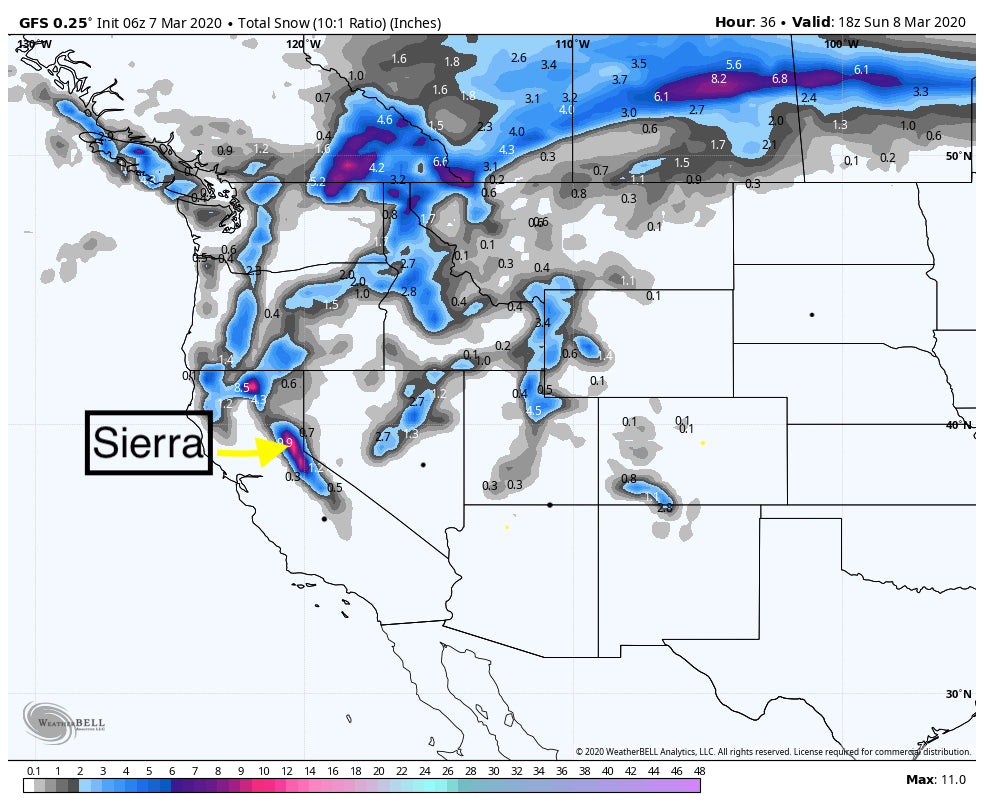
The Sierra will see a teasing 4-8 inches split between late AM Saturday and late PM (It has slowed slightly). That storm will definitely focus on the north side of the lake. Consider Squaw, Alpine, Sugar Bowl or others in the north. Winds will likely keep upper lifts closed at times so Sunday may be the best pick of the weekend.
Elsewhere in the West a teasing 2-4 inches is likely for the Tetons for Sunday and again for Tuesday morning The Tuesday event should be a bit deeper (Warm- slowly cooling- Mixed rain/snow at the base with all snow just above the base). You may be able to score 5-7 inches at the summits of the Tetons Tuesday morning (Creamy down low, dense up top). The Wasatch and southern Colorado also sees light snow Sunday (Not worth chasing). Tuesday may offer slightly more.
Below: Total snowfall from today through Tuesday morning with snow for Sunday AM and again Tuesday AM. The Tuesday event will be slightly deeper (3-6 inch events).

Midweek, will also see a southern storm enter from the BAJA that will skirt over the 4 corners bringing some additional snow primarily to Colorado (Stay tuned).
Below: Sunday morning snow totals from late AM Saturday to PM favoring the north Sierra and southern BC

In looking for my endorphins, it's possible that some heavier snow and colder air moves into southern BC and the northern Panhandle of Idaho late this week. Cold air and decent snow are possible for northern Montana as well.
The models also point to a significant storm possible for the San Juan Range of Colorado extending into most of New Mexico. If what I am seeing holds up (Low confidence this far out) someone might Deep Pow to stir the upper end of my endorphins. I am not going to post a map just yet since we are still 7 days out.
Its not over!
Powderchaser Steve


