A fast-moving but relatively moist system will overspread the Sierra Friday night to Saturday. A 2nd storm will approach the west mid to late next week with many uncertainties on the track. Northern Montana and Idaho may get into scoring positions. January 7-9 might be active in the extended.
A few minor changes from yesterday's forecast feature slightly higher snow totals for the southern Sierra Ranges for Friday night to Saturday. The next storm will be a fast mover with southerly flow favoring the southern Tahoe Basin (Kirkwood) but more especially Mono County (Mammoth, June) and areas south. Light or moderate amounts are likely found closest to the Lake (2-5) and higher amounts towards Mammoth (4-8). Most of these totals will occur above 7500 feet.
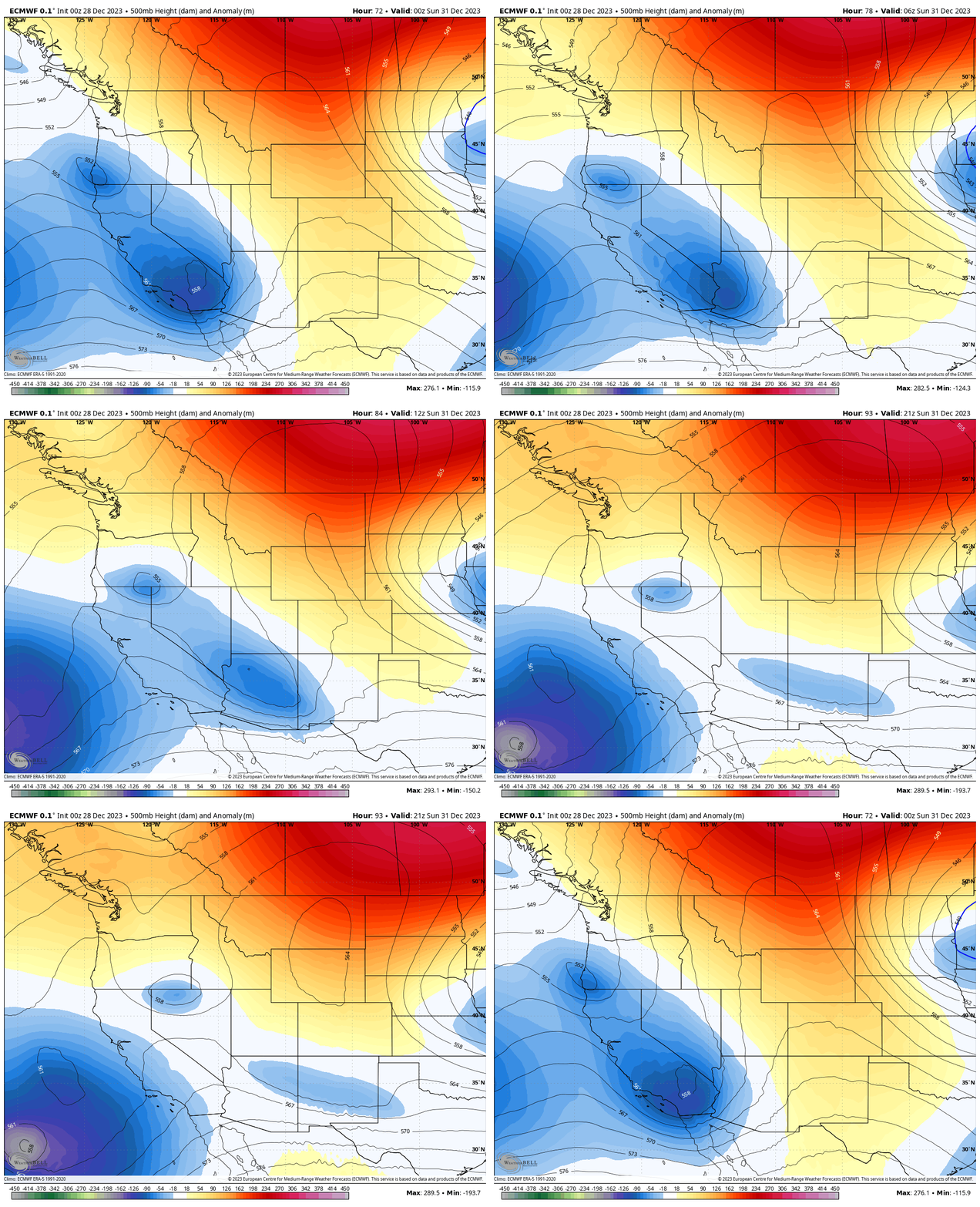
Below: You can see the main low rapidly moving along the CA coast with weak waves extending inland towards Arizona by Sunday. Some light or moderate snow will be falling in the Sierra with higher amounts further south.

Below: The American GFS is the most bullish showing up to 10 inches in areas of the southern Sierra favoring the eastern slopes (Seems a bit high to me). The European shows less snow. Plan on some light snow up north and moderate snowfall further south in Mono County. Some upside may be found, especially south of the lake. Snow levels will be 7,000 feet Friday night lowering to 6500 on Saturday. We would gamble on Mammoth with the higher base elevations and a decent chance of moderate snow.

This storm rapidly moves south over Arizona and fizzles with its eastward movement with little hope of any chases further east.
The extended has mixed signals with another storm due for the west mid to late next week. This storm might offer some snowfall to return to the PNW, Northern Idaho, and even Montana. Another storm might approach the west towards January 7th.
Selkirk Powder Guides is in their 21st year of Cat Skiing situated in northern Idaho. They offer advanced and entry level Avalanche Courses and fantastic backcountry skiing. They expanded their terrain by 6,000 acres this season (All new terrain). Please check out Selkirk Powder Here. They often stay in the colder sector of these warm fronts. Snow is possible mid next week. They still have seats available.
Extended POW
There will be another system moving into the west in the January 3rd to 5th period (Mid to late next week). That system has 2 very different solutions in comparing model runs. The American GFS splits this system with a moderate to strong wave heading north into the PNW, BC, and northern Idaho with a weaker piece dragging south over the CA coast (Optimist solution).
The European model keeps the focus further south over the Sierra with very weak energy (The Boo solution).
Below: American GFS shows storm #2 due for the middle of next week (January 3) heading south along the coast into the Baja with a decent piece of energy breaking north over Idaho and BC (Interior could score). This will eventually bring snowfall back to Montana (Northern areas favored), and eventually the Rockies including the Tetons towards the middle of next week.

Below: The European solution keeps the midweek (January 3-5) low intact with a more southerly solution dragging along the coast of California midweek. This would result in less snow to the north. This model is also pessimistic for any significant event for the Sierra and may take a similar southerly track as the incoming storm this weekend.

Looking out to fantasy land for the period from January 7-9 a strong low might approach the Pacific Northwest and with some colder temps. This low might progress over the core of the Rockies during this period. I would expect an active period towards the end of next weekend. Let's hope it holds up.
Below: Low pressure is possible to overspread the PNW and Rockies toward the end of next weekend January 7. Models this far out lend low confidence but it's certainly worth watching and dreaming.

Below: Total 7-8 day snowfall through Friday, January 5th for the west per the European Solution keeping most moisture to the south. The American GFS shows higher totals for the PNW and northern Rockies next week with more energy breaking north into BC etc.

Help us out!
If you want to chase powder with Powderchasers sign up for the concierge package for the deepest resorts to chase to and 1:1 custom forecasting with our staff. Also, if you have read this far, please donate for the holidays to continue receiving these free forecasts. We appreciate the community support. You won't regret chasing with our custom forecasts.
Follow us on Instagram and Facebook @powderchasers
Powderchaser Steve @powderchasersteve - Instagram


