SUMMARY
The weekend brings a decent trough to the coastal BC resorts and northern Cascades of Washington. Moderate snow will fall further south in the Cascades. That system drops south along the Pacific Coast teasing the Sierra by Sunday and pushes some moisture into the Rockies (Sunday/Monday). The extended forecast brings a better trough to the West by midweek.
FORECAST
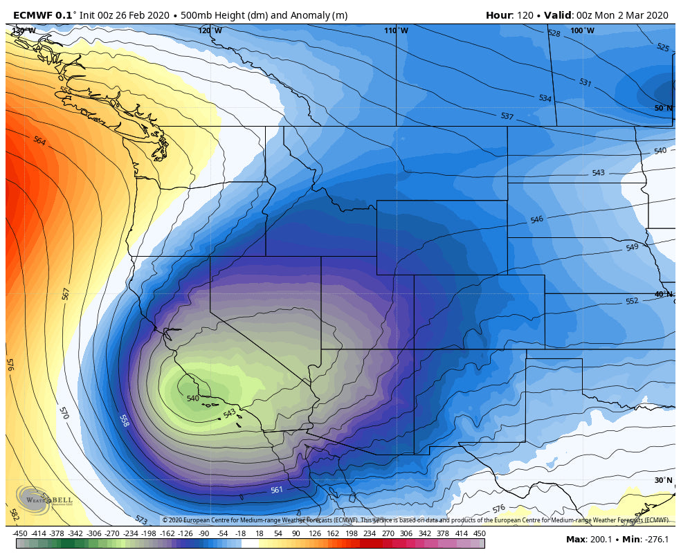
The trend over the next several days is to push a decent storm into the northern Cascades of Washington Friday night into Saturday. This will also impact Whistler. General trend is 5-10 inches with higher amounts possible near Mount Baker for Saturday morning. Further south expect 4-8 inches. Lighter snow will fall over interior BC. Snow levels drop to around 3500 feet by Saturday morning (Most bases will see all snow). This system drops the parent low due south along the CA coast through the weekend. As the trough splits some energy pulls due West impacting southern BC (Light or moderate amounts), Northern Panhandle of Idaho and eventually the northern Rockies by Sunday. Chase: Northern Washington Cascades, Western BC with the interior a wildcard for lower amounts.
Below: Very warm temps initially this weekend will create spring like conditions in most areas except the NW (Map at 4800 feet in Celsius).

The Sierra finally sees some white flakes Saturday night into Sunday albeit amounts should stay below chase criteria. Very warm conditions in the west this weekend will create spring like conditions until a brief cooling trend moves over the Rockies by Sunday/Monday. There will be light or moderate snow for Wyoming and Utah late this weekend, but its unclear on amounts (General trend is 2-7).
Below: Energy from the PNW drops due south over the CA coast while some moisture trickles over the Rockies (Northern Branch) late this weekend (UT, WY, CO, ID). Some snow will be falling in all of these areas.

The Extended chase forecast has some higher moisture odds for many areas in the West especially by midweek.
EXTENDED
The extended chase forecast brings decent odds of increasing moisture continuing for the Pacific Northwest midweek. This may also impact the interior sections of BC and Whistler. The models are not in agreement for the Rockies with the Euro pretty bullish on a decent round of snow for the Tetons, central Montana, and the Wasatch for the midweek period. The GFS is less bullish. What I like is that temps trend cooler midweek so the odds of a decent dump to chase are increasing.
Below: Colder Temps finally move into most of the west by mid next week that may enhance snow totals (Map at 4800 feet in C).

Below: The Euro ensembles show decent odds of trough moving over the Rockies midweek with moderate or higher amounts.

Below: The GFS is trending moisture further east with lower amounts (midweek).

We will have to see what happens but optimistic for some chase worthy events midweek. Enjoy the powder or spring like conditions this weekend.
ANNOUNCEMENT -CHASE NOW WITH OUR TRUSTED CHASE PARTNER BELOW. THEY LEAVE FOR FRANCE ON 2/29.
Powderchaser Steve


