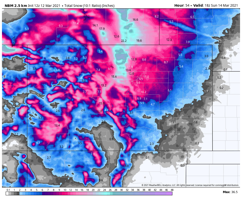
This post will be brief since I am up in Alaska currently. The latest models slowed the system slightly which puts most of the snowfall for Colorado later Saturday into Sunday evening. Models are still not in good agreement even this close to the storm. The GFS still is pumping out excessive numbers of 3 feet for the Boulder Foothills,, Red Feather Lakes, Rocky Mountain National Park, with perhaps higher amounts north in the mountain ranges near Wyoming. The European Model shows less, while the NAM seems to agree with this. Here are the new take home messages (Plain and simple with no fancy maps). Due to the warm nature of the storm, urban totals especially roads near Denver will be much less. Boulder should see 10-20 inches in town.
* Heaviest Precipitation will be late Saturday into late Sunday. Areas East of the Divide grab 3 feet or more*
1) Ski areas on the Divide especially north of I-70 will see 15-28 inches by Sunday afternoon
2) Ski areas south of I-70 into Summit County could see 11-22 inches during this period (Includes Ski Cooper)
3) Ski areas west of the Divide into Eagle County grab 10-16 inches through late Sunday
4) Ski areas in Central Colorado especially towards Aspen, and even Powderhorn grabs 7-15 inches. There might be an additional push of snow late Sunday/Monday that increases these totals.
* Snow will continue into Sunday night due to the slow nature of this storm. Resorts along I-70 west of the Divide may score an additional powder day for Monday morning (3-6 additional is likely under NW flow).
I will be able to update this post either late Friday or early Saturday.
Powderchaser Steve


