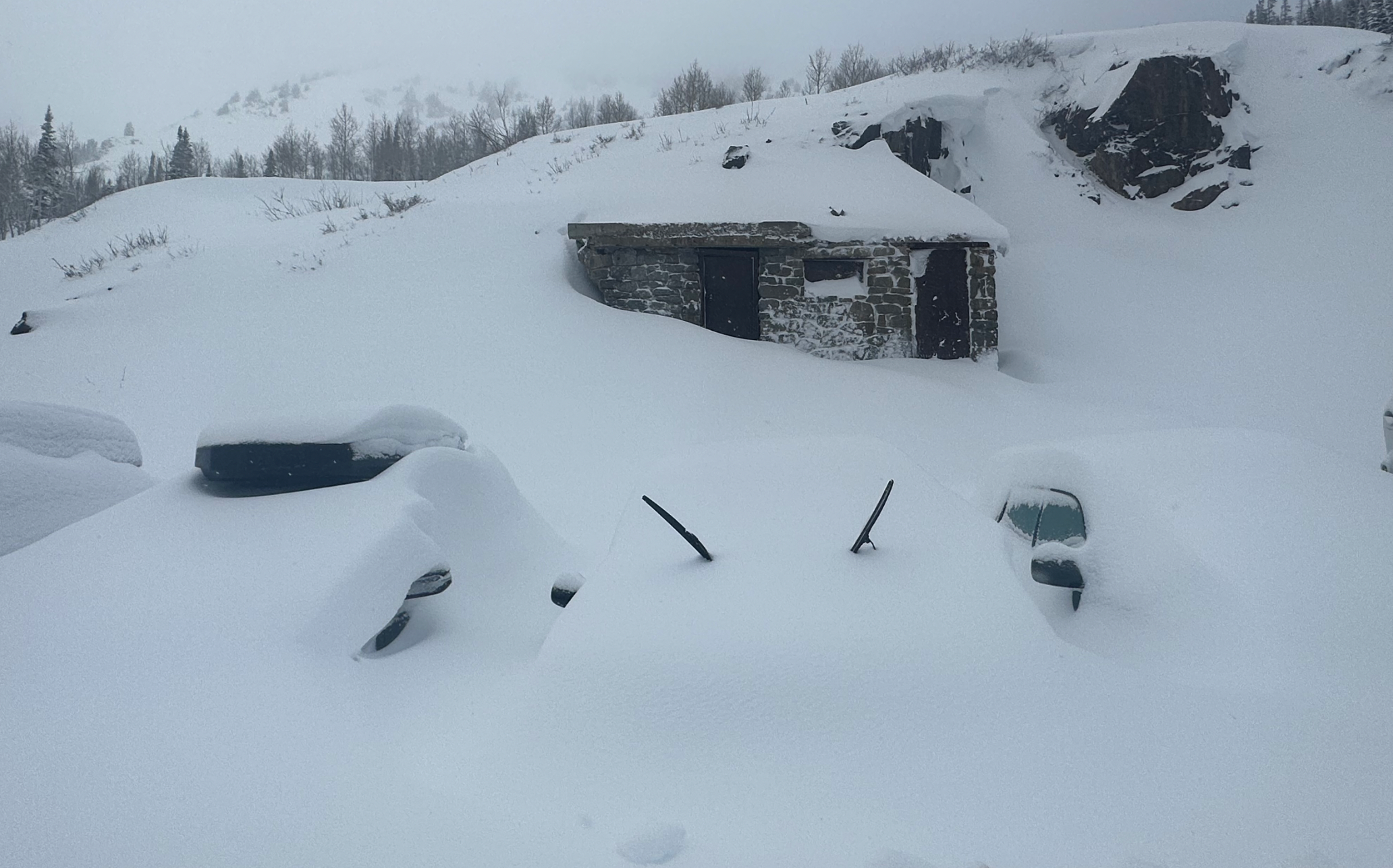
A major system is currently wrapping up after dropping several feet of snow all across the west. California saw 3-8”. In Utah, Cottonwood resorts picked up 35-50” (with a maximum of 45-50 at Alta and the Bird). Powder Mountain saw 43” and Park City picked up 29”. Powderchaser Steve was skinning at Beaver mountain on Saturday with storm totals by Monday at 35 inches. They will be making an opening announcement soon.
Below: @Powderchasersteve via Instagram at Beaver Mountain Saturday. Storm totals are 30-35 inches.

PNW totals before the rain on Sunday were as follows:
- Stevens Pass: 37"
- Snoqualmie (Alpental): 24 - 28"
- Baker: 29"
- Crystal: 16"
- White Pass: 33"
- Mt. Spokane: 6"
- 49 Degrees North: 1”
Colorado also got deep, with the deepest totals at Steamboat and north of Summit County:
- Winter Park: 26"
- Steamboat: 24”
- Copper: 23”
- Vail: 22”
- Breck: 21”
- Eldora: 20”
- Telluride: 22"
- Monarch: 23”
- Crested Butte: 20”
- Aspen Highlands: 11”
In the Tetons, Targhee won this storm as expected, with 33” of snow. Jackson picked up 25-30” (depending on which station you look at for telemetry.
Below is the estimated 3-day liquid precipitation as of Sunday morning. Most regions picked up more during the day yesterday (Sunday) and overnight, but this gives a good picture of where the precipitation winners were:

We are on the very tail end of the system, and the precipitation is largely wrapped up, except for lingering snow showers primarily in Wyoming.
PNW
The next system is already beginning in the Pacific Northwest, and this will be yet another warm and wet atmospheric river. This system will be truly impressive in terms of moisture and temperature and will bring significant high-elevation rain to the Pacific Northwest and even further into the interior.
The warm precipitation will hammer the PNW with significant rain on Monday through Wednesday. The precipitation (rain) bullseye is looking like northern Washington, where 3-8” of rain will likely fall. The models remain a bit unresolved, but Wednesday-Friday should bring some opportunities for heavy, wet snow for PNW resorts on the tail end of this push of moisture, likely 8-20” at mid-mountains over that time period. Another storm looks to be moving into the region on Saturday; this system is looking colder and could bring better odds for healthy snowfall. It’s still too far out to pin down specifics, so stay tuned for more forecasts this week as the models converge on a solution.
Below is the European model showing major rain shifting to potential for decent snowfall on the tail end later this week (Green to Blue)

California
That same storm should slide down into California on Wednesday. Snow levels will likely be 6,000-7,000 feet and allow for 2-6” of snow. Not much, but the way this season has been going in California, we can’t complain about seeing anything white.
Utah
The moisture arrives in Utah on Thursday night and snowfall will last through Sunday. It’s still too far out to get very specific yet, but it’s looking like 8-15” for the Cottonwood resorts and 5-12” Park City and Deer Valley. Northern Wasatch could do well depending on the storm track, but resorts in that region will also likely end up in the 5-12” range as well. Note that this storm has good upside, and there's a decent chance totals could end up above these ranges.
Below is a multi-model blend depicting the weekend storm in Utah:

Colorado
Snowfall should begin on Thursday night and last through Saturday morning. As of right now, it looks like this storm will heavily favor the northern and central mountains and the southern mountains will likely miss out on anything over an inch or two. Steamboat could pick up 8-15”, 4-8” for I-70 resorts, and 5-10” for the central mountains (Estimated with medium confidence being 4-6 days out).

Wyoming
Between Thursday and Sunday, the Tetons could do quite well with 10-20” at Targhee and 8-15” at Jackson. Once again, the outcome for this region is a bit more dependent on the eventual storm track, so the final outcome will become a bit clearer later this week as the models begin to converge. We are still too far out for high confidence.
ANNOUNCEMENT: Please join our powder concierge program to support powderchasers. This program provides 1:1 forecasting, chase locations, and custom trip planning to get you in the deepest snow with each storm. You can also donate on our website or purchase some swag to support us. This keeps the free forecasts going. Any Donations of $50 or more get you free swag (Shirts and stickers).
Sponsor Alert:
This post is sponsored by Skis.com and Snowboards.com. Powderchasers supports them being family-owned and with a vast selection of quality gear and clothing. We will donate a PC tee shirt for every purchase over $200 (Email us). They have an incredible selection. Please support them as a family owned shop and sponsor.Stay safe everyone! Thanks for following.Powderchasers forecast team.


