Snow is back in the Andes this weekend as the first major storm in a few weeks rolls through the region. Snowfall is already underway, with the first wave winding down over the course of Friday evening and the second wave moving in on Sunday.
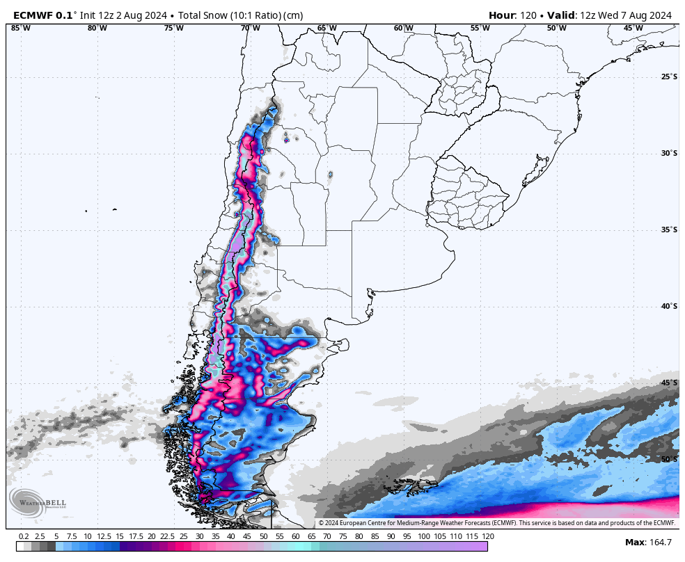
Below: the ECMWF model forecast for snowfall in the region by Wednesday morning:

Precipitation from the current (first) wave will gradually fade from north to south between Friday morning and Sunday morning. Snowfall in the north at Portillo, Valle Nevado, and Las Leñas should be mostly wrapped up by Saturday morning, with Portillo picking up 12-18" (30-45cm), Valle Nevado picking up 20-28" (50-70cm), and Las Leñas seeing 15-20" (40-50cm) by Saturday morning.
Steadier snowfall will persist further south throughout the weekend with steady 0-0.5" per hour snowfall rates. By mid-day Sunday, Cerro Catedral should see 8-15" (20-40cm), Cerro Bayo should pick up 12-20" (30-50cm), and Chapelco should see about 8-12" (20-30cm).
The second system should roll on Sunday evening, starting in the south and quickly propagating north. This storm will be smaller, but still bring decent snowfall to the mountains. This storm should be mostly wrapped up by Wednesday morning. Las Leñas will recieve by far the most from the second storm, picking up at least a foot. By then, here are projected totals between both storms around the region:
- Cerro Catedral: 12-20" (30-50cm)
- Cerro Bayo: 16-26" (40-65cm)
- Chapelco: 12-18" (30-45cm)
- Las Leñas: 26-35" (65-90cm)
- Portillo: 14-24" (35-60cm)
- Valle Nevado: 23-33" (60-85cm)
Looking ahead, high pressure will return on Wednesday, blocking any more chances for snowfall. However, models agree on another storm system moving in on Saturday or Sunday of next week, which will once again bring chances for snowfall to the region. Below is the ECMWF (left) and GFS (right) forecasts for the storm next weekend. Placement and timing is unclear, but we do know that there will be a storm next weekend:


