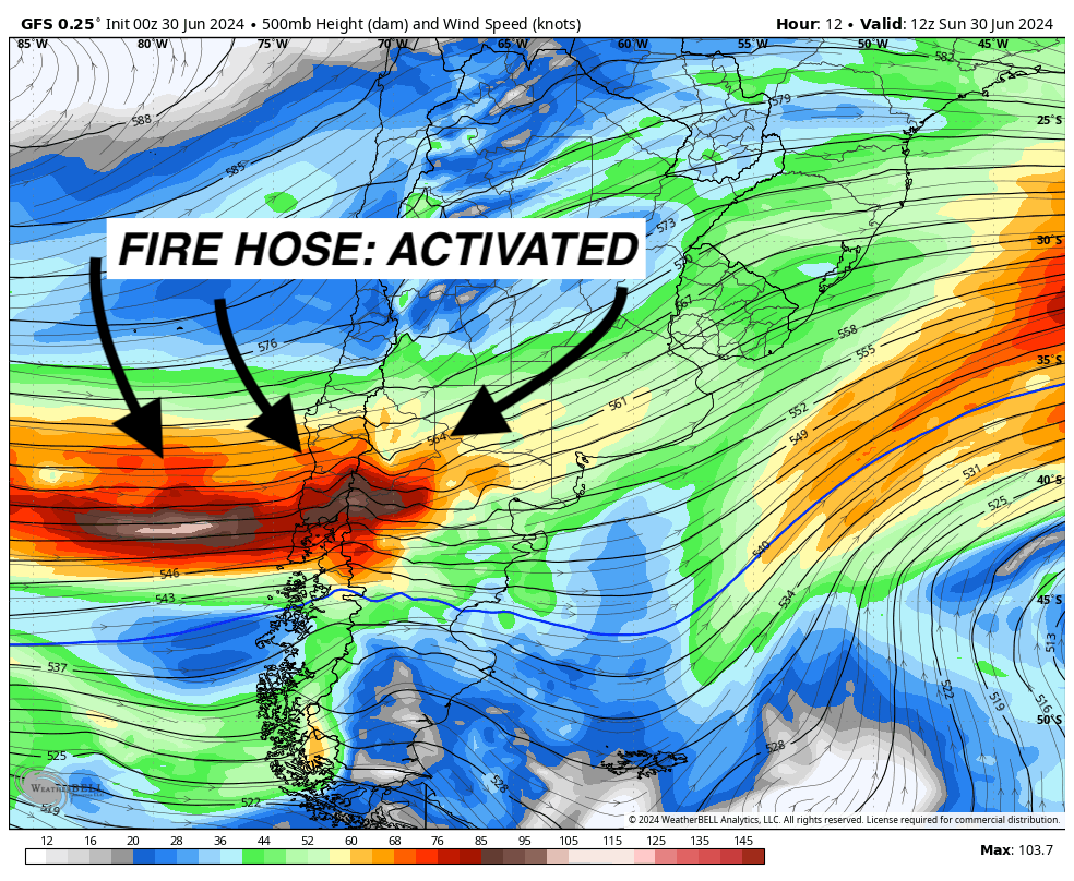
South America will continue a historically strong start to their season with yet another storm cycle, lasting into next weekend (Sunday evening). Most of the snowfall will be relegated almost exclusively to the central and southern mountains (mostly south of Corralco), opposite of what we've seen with the last few systems where they've absolutely hammered the north.
In fact, Portillo has already exceeded their annual average snowfall. They've reported 569cm (224 inches) so far, two feet more than their average annual snowfall of 200". And all that despite their snowiest month usually in August! This is the South American equivalent of Mt. Baker hitting their annual average of 640 inches... by January 1st. Holy smokes, what a season!
Check out the storm cycle in the GIF below from the European model. Basically constant moisture until Sunday evening:

In terms of totals, the highest totals will be found between La Hoya in the south and Caviahue in the north. Here are some notable projected storm totals around the region by Friday morning (although keep in mind precip will last into the weekend):
- Pucon: 50-100cm
- Chapelco: 55-85cm
- Cerro Bayo: 50-85cm
- Cerro Catedral: 50-85cm
- Corralco: 50-70cm
- Antillanca: 40-70cm
Resorts in the north might pick up an inch or two late in the week, but it's looking unlikely. Stay tuned for a bit of snow at northern resorts next weekend, if anything, but don't expect much at all.
Looking ahead, high pressure will move over the Andes late next weekend and into the following week, but will be short lasting, with near to above-average storminess creeping back in mid-week, especially in the north. This certainly doesn't guarantee snow, but certainly makes it more likely. Stay tuned!


