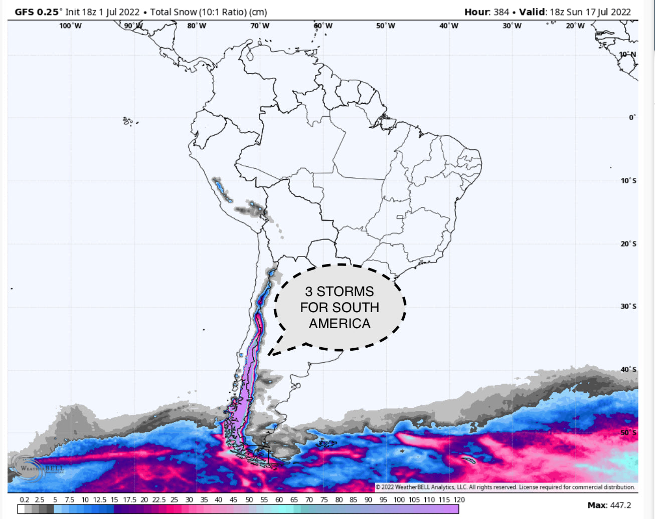
POWDER ALERT- 4-7 FEET for South America This Week!
After a slow start to the season so far, things look to be kicking into high gear this week in South America, where many resorts in Chile and Argentina are looking at anywhere from 3 to 8 feet. The highest totals will be located south of the Mendoza region at resorts like Pucon, Antillanca, and Corralco.
A train of powerful, cold storms are lined up in a train that will hammer the region this week. The first major system will move through on Friday night and Saturday. On Saturday night, things will die down for a short time before system #2 arrives. By the end of storm 1, here are forecasted snow totals from the ECMWF (European model):

Widespread 40+ cm totals. Love to see it! Keep in mind that this model is forecasting snow based on 10:1 ratios. However, at ski resorts in the region, I see these snow-to-liquid ratios being much higher, between 13 and 16, for the majority of the event.
Storm #2 lasts from early Saturday morning to Monday mid-morning. This storm will impact southern Chile and Argentina first before working its way further north and dumping the highest totals around Bariloche.
After a very slight lull in precipitation rates on Monday morning, storm number 3 is already on the doorstep. Here are what snow totals might look like on Monday morning after the first two storms.

Shown above is the ECMWF (left) and the GFS (right). Pretty consistently amazing between both models, and both are likely underestimating the actual precipitation due to erroneous SLR forecasting!
Storm #3 starts off remarkably similar to storm #2, starting strong in the south and working its way further north. However, the storm energy stays offshore for longer in the north, allowing lingering precipitation all the way into Wednesday night. As the storm core sits offshore, it will warm up, bringing slightly denser snow in the north. This is great for base-building early season snow, but the highest quality skiing will likely be found earlier in the week.

Pink=DEEP!
Some possible totals by Wednesday night:
- Pucon: 95”
- Las Araucarias: 85”
- Corralco Mountain: 70”
- Nevados de Chillan: 70”
- Cerro Bayo: 45”
- Cerro Catedral: 40”
Storminess lingers well into next week, but the models are having trouble pinning down the specifics as
of now. Stay tuned for a post after the weekend with more information on those storms!
Overall, it’s looking like a fantastic weekend and start to next week in South America! Try to pick resorts that are higher in elevation that have pre-existing base for the best chance of catching terrain openings and the lowest chance of shark-induced core shots!! Happy chasing!!
Powderchasers Forecast Team- Follow us on instagram and Facebook @powderchasers or sign up for our powder alerts at www.powderchasers.com.


