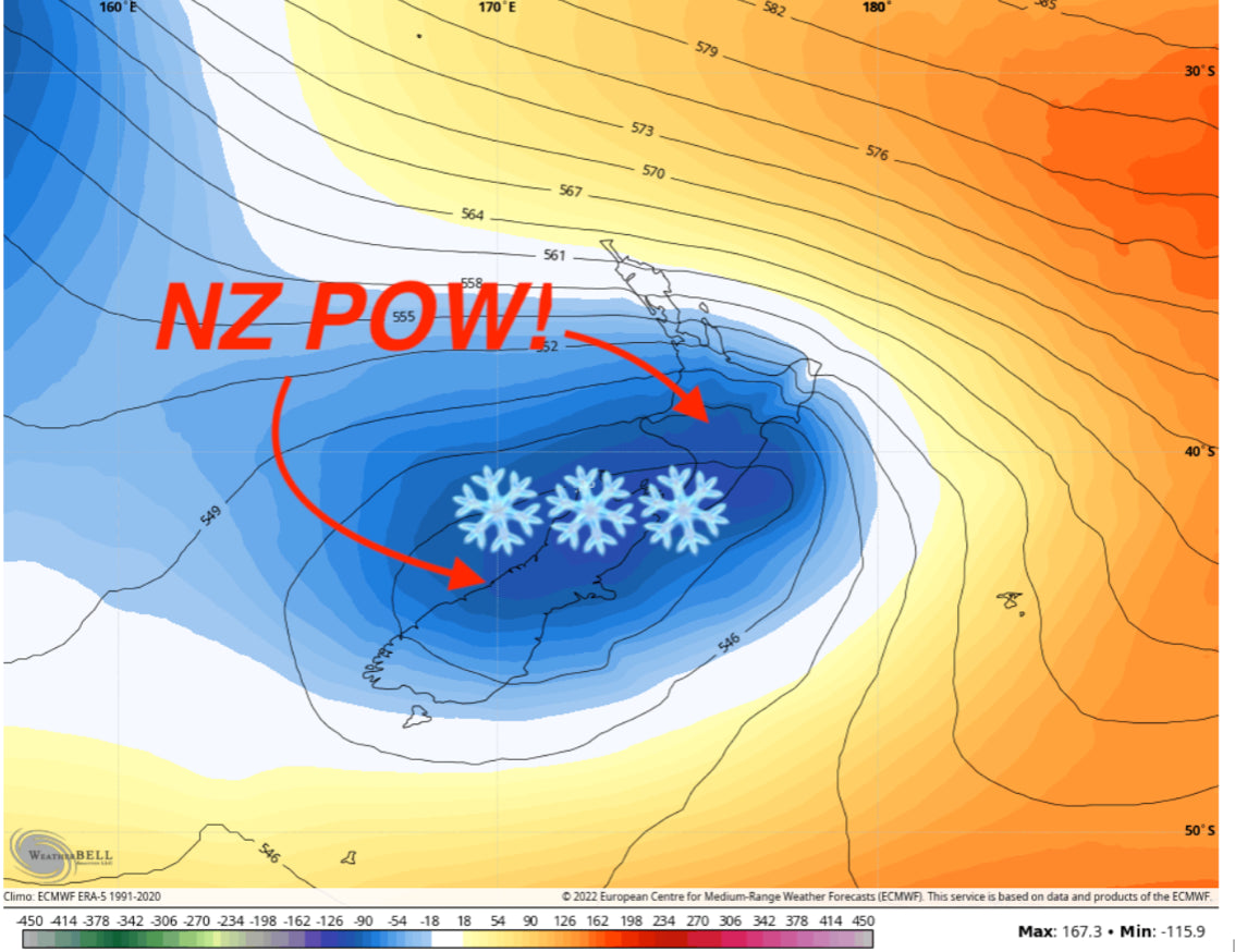
A robust series of storms will affect New Zealand this weekend into next week, bringing significant snowfall to the region. Temperatures will be too warm for significant accumulation on the northern island, and precipitation will be too meager in the southern region of the south island, so the sweet spot is going to be right in the central region of NZ’s southern island. The chase is likely going to be Mt. Hutt for the best conditions.
The first storm began yesterday (July 9 in New Zealand). The storm started off quite warm with rain at all ski area bases before shifting to heavy snow by mid-afternoon. As of the time of writing this article, central New Zealand was right in the crosshairs of a significant surge of moisture, bringing intense precipitation to the region, particularly along the western flank of the Southern Alps.

Satellite imagery shows the moisture plume completely blanketing the southern island with cloudy and stormy conditions.

As the storm pushes to the northeast, it will pull that moisture along its warm sector, bringing it closer to the core of the storm and pulling precipitation away from the coast. Conditions will dry out for around a day and a half but remain cloudy. By Monday morning, here are what I see as possible totals at a few resorts in New Zealand:
- Mt. Hutt: 13-20”
- The Remarkables: 2-5”
- Ruapehu Turoa: 8-15
- Mt. Dobson: 9-14”
- Cardrona: 2-5”
Temperatures will gradually warm throughout the next few days, but the snow should still be okay, with temperatures at the resorts generally staying below freezing and cloud cover protecting the fresh-fallen snow. The one exception to this will be resorts near Mt. Ruapehu on the northern island. Since it’s so far north and closer to the equator, Ruapehu will be subject to warm maritime temperatures, which will subject the snow to much warmer temperatures than resorts on the south island.
On Tuesday afternoon local time, the start of an impressive surge of moisture from the equator will begin to pass over the north island, working its way south. This surge of moisture contains nearly 4.5 times as much atmospheric moisture as is typical for this time of year!

The north island will bear the brunt of this warm moisture, meaning lots of snow may fall but it will be quite dense (6-8:1 SLR throughout the event), making for worse overall ski conditions. The northern island will also see rain before snow on Tuesday morning, so those planning on skiing on the northern island on Tuesday should be prepared for suboptimal conditions if you love dry snow.
In terms of the highest totals, we love the setup for Mt. Hutt for this storm. As the storm pushes to the southeast, the warm sector will wrap around and both upper and lower level winds will be slamming moisture straight up the eastern flank of the mountains, right where Hutt is located. Other resorts are either not in the moisture bullseye or are in a less favorable geographic location for significant orographic lift, so I don’t see any other resort rivaling Hutt’s snowfall. By the time the storm dies down on Wednesday morning, here are some possible totals I see around the region (both storms combined):
- Mt. Hutt: 35-43” (90-110cm)
- The Remarkables: 5-10” (12-25 cm)
- Ruapehu Turoa: 18-32” (45-81cm) (of very wet snow)
- Mt. Dobson: 28-44” (71-111cm)
- Cardrona: 4-10” (10-25cm)

ECMWF snowfall output. I think it’s probably grazing the Mt. Ruapehu area on the north island due to lower model resolution, which can’t pick up on the SLR boost that Ruapehu’s higher elevation provides..
So, the powder chaser verdict? MT. HUTT! A great combination of sufficient moisture, cold temperatures, and pre-existing snowpack should create for a fantastic week of skiing at Mt. Hutt. Snow-to-liquid ratios at Hutt will be hovering between 10-12:1 for most of the precipitation early next week, so while the snow won’t be the lightest, it could certainly be worse (north island!).
Unsettled odds for storminess return late next week, so stay tuned for another Powderchasers forecast with an update on next week’s NZ storm systems after the weekend!
Please follow our Instagram and Facebook feed at @powderchasers and sign up on our website for Powder Alerts (North America Emails).
Forecast Team- Powderchasers.com


