Resorts in California are reporting incredible May totals. There are 4 resorts still open for skiing and riding in California today:
- Palisades Tahoe: 26" overnight
- Mammoth Mountain: 10-12" overnight
- Mount Baldy: (no report)
- Donner Ski Ranch: (no report)
Very little additional precipitation is expected. Temperatures on Sunday will be unseasonably cool with light winds out of the west. It should be a great day of powder skiing and riding.
This same system is absolutely hammering Oregon, and will dump almost nonstop through Wednesday. Mt Hood should end up with another 20-25" by Wednesday morning with 14-20" at Mt Bachelor with high model certainty. Just check out how good the ensemble agreement is at Mt Hood:

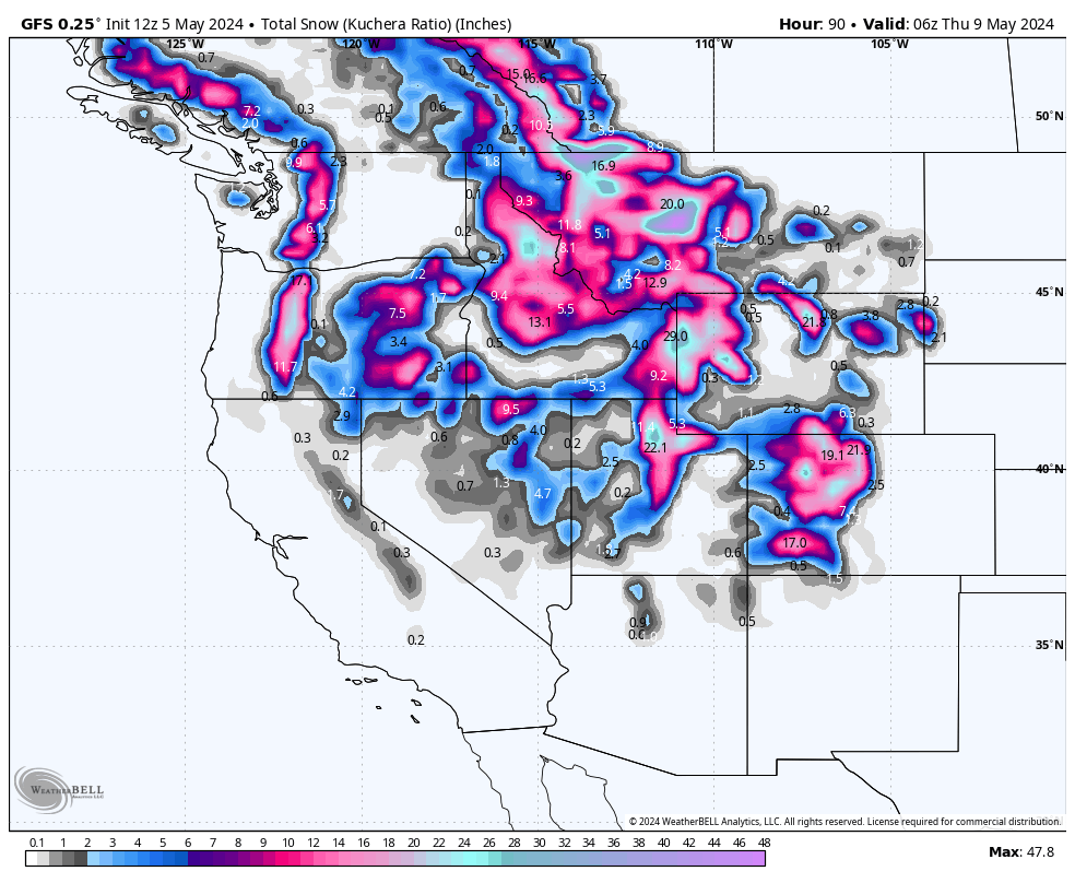
The moisture that dumped all that snow in California will surge east today, lighting up Utah and Colorado early this week with modest totals in Wyoming.
In Utah, precipitation will fall steadily throughout the day on Sunday, generally increasing in intensity into the afternoon. Steady snow will continue on Sunday night and during the day on Monday, decreasing in intensity by Monday evening. A second wave hits early Tuesday morning, and should dump additional snow well into Wednesday morning. Snow levels this system will be between 6,000 and 7,000 feet for the first part of the storm and then 4,500 to 5,500 feet for the back end of the storm. Snow quality will increase throughout the storm as temperatures continue to drop following the cold front. You can see the cold front sweep through on Sunday:

In terms of totals, we're looking at the following ranges by Wednesday morning:
- Cottonwood resorts (Alta, Snowbird, Brighton, Solitude): 25-35"
- Park City/Deer Valley: 16-22"
In Colorado, snowfall will begin on Sunday night. This storm will favor the central and northern mountains, especially on the west side of the Continental Divide. Unfortunately, the five ski resorts that are still open in Colorado (A-Basin, Breckenridge, Copper, Loveland, and Winter Park) are all too far east to see major snowfall, but should still pick up decent totals. Below is the ECMWF (left) and GFS (right) snowfall forecast by early Tuesday morning. You can see 3-7" totals in the Front Range where all the remaining open resorts are located:

This is a bonus post for 23/24 and encourage all of you to please donate on our website or purchase the swag. The donations help us more so if you have taken advantage of chasing powder, or living vicariously through Powderchasers please contribute here. We survive on your help from the powder community. Donate: https://powderchasers.com/pages/donate-to-powderchasers
Swag is available here with a special sale on all the new tee shirts. https://powderchasers.com/collections/frontpage


