Summary:
The trend is for lighter systems to continue for the Cascades favoring Oregon, and weak leftovers coating some spots of the northern Rockies and Colorado. I don't see any significant events in the long term.
Forecast:
The past 5 days have been very active. In the forecast last week, the Tetons, Wasatch, and Sun Valley were highlighted. These areas grabbed from 8-15 inches by Tuesday morning. Steamboat was also highlighted on that post who picked up 9 inches. Northwest winds also freshened up the slopes along I-70 (6 inches at Vail). for Wednesday. My chase took me to Jackson Hole Mountain Resort for Tuesday morning where 9-12 inches fell for 1st tram. It snowed for most of the day with some clearing in the afternoon.
From Wyoming, I drove to Salt Lake and flew to Seattle, and grabbed deep powder at Crystal Mountain on Wednesday (13 inches overnight). Crystal had strong winds Tuesday night with temps in the mid to high 20's the snow was a bit dense \Let it rip\", no bumps, and very good if you were there early. The 6 pack chairlift loading procedure was a \"Let Down\" as being there early enough for 1st chair did not work. The loading procedure had no rules, with the lady overseeing this taking any groups of 6 first and letting smaller groups wait behind. The excuse provided was 6 people chairs move the line faster (Lame). This also set up a frenzy to get into a group of 6 (Not a safe move). The mountain tracked out rapidly but the patrol did a fantastic job in getting the terrain open fast.
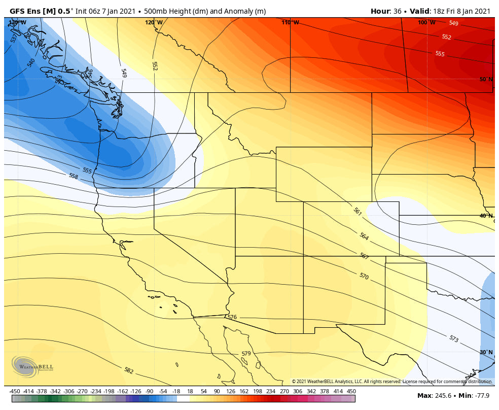
The next several days look to offer a break for those looking to chase deep powder. A moderate system will swing into the southern Cascades of Washington, albeit favoring Oregon by Friday. There is a cold front associated with this system so conditions could be decent by Friday morning with overnight snowfall, especially in central Oregon. That system racing across the Rockies transporting light snowfall to Idaho, Utah, Wyoming, and Montana. The highest amounts albeit not impressive, will land in the Wasatch or perhaps southern Idaho (2-6) early this weekend. Colorado sees the highest amounts in the SE corner of the State away from most ski areas. But wait, there is some hope of deeper amounts possibly setting up over New Mexico for Sunday Morning so stay tuned!
Below: Low pressure taking a southerly track over the Cascades, especially Oregon by Friday morning.

Below: Weak low-pressure system taking aim at the Rockies early Saturday morning.

Below: Late this weekend- Low pressure takes a southerly track over New Mexico while the rest of the west stays dry. You can see the next system edging into the northern sections of the PNW for early next week.

Extended:
The Jet will force any systems to the north next week. It's likely that British Columbia or even the northern Cascades of Washington see a moderate storm for early next week. Otherwise, a ridge of high pressure will develop for most of the west through perhaps at least the middle part of January. Strong high pressure may try to break down somewhere after the middle of the month but currently, that signal still has me guessing it's going to be a while for the next deep dump in the west.
If you have a comment on conditions, skier experience, deep powder you scored or missed, please comment on this post. Overall it's been a struggle, demand is way up to hit the slopes, and that first run might be your only untracked line. We should be happy that resorts are operating. Hunter Mountain in New York has a temporary closure but is expected to reopen on January 8th.
Powderchaser Steve


