Good morning. This is Powderchaser Steve with your Saturday morning update for New Mexico. Light snow Is currently falling from the Front Range of Colorado (DIA, Metro areas) south to northern New Mexico. Currently the models show upslope easterly flow that often is not great for Taos nor Wolf Creek.
Our forecast calls for this system to drop further south than originally forecast. The Most models favor areas east and south of Taos. Angel Fire is a wildcard sitting east of Taos, however better moisture may land south towards Santa Fe.
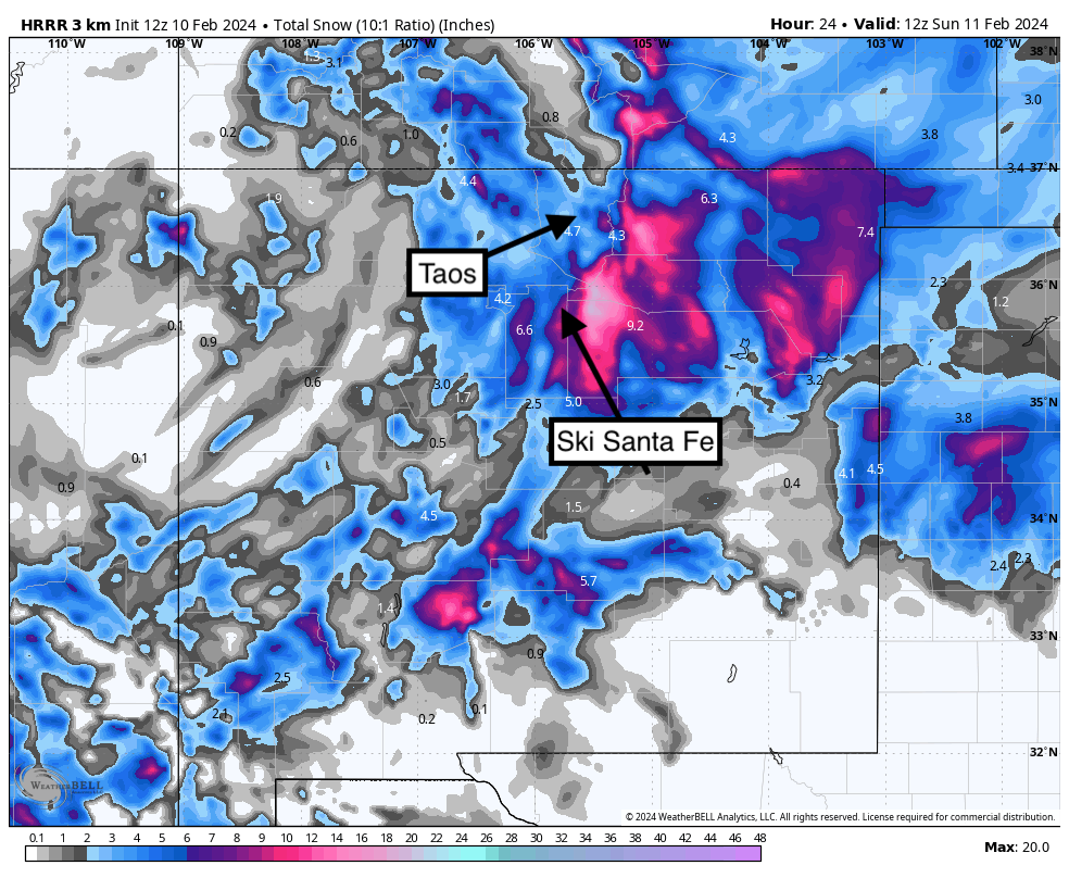
Below: Short term high resolution models pushing moisture east and south. This would be a bust of Taos (4-7) with slightly higher amounts at Angel Fire.
 Below: NAM (Short term model) pushing the system a bit closer to Angel Fire (East of Taos) and decent totals extending to Ski Santa Fe. This model has less for Taos.

Below: The deterministic European Model shows much less snow for Taos County and pushes moisture east of Ski Santa Fe. I would lean a bit more on confidence with both models above (Short term).

If you are on the chase, stage near Angel Fire, or in Santa Fe and base your decisions on PM snow Saturday into the evening (You will know what is happening by 6-7 PM). The storm is unfortunately split between late AM or early PM Saturday to early Sunday. By your bed time, I think you will know where to chase for Sunday.
Help us out!
If you want to chase powder with Powderchasers sign up for the concierge package for the deepest resorts to chase to and 1:1 custom forecasting with our staff. Also, if you have read this far, please donate to continue receiving these free forecasts. We appreciate the community support. You won't regret chasing with our custom forecasts. We have new swag on the Powderchasers storefront and all larger donations include it at no charge.
Enjoy the powder, everyone! Remember, your deepest resort is not always the best chase. See you in the first chair somewhere on Monday.
Enjoy the powder, everyone!
Powderchaser Steve @powderchasersteve on Instagram


