It is dumping over the 4 corners as of Wednesday morning. There are some very impressive totals coming out of AZ and NV. Strong winds might keep a few lifts closed, especially at the AZB, but if and when it opens will be as epic as can be.
Here are a few reports as of 6AM Wednesday with snow continuing to fall.
Arizona SnowBowl: 26 inches-Epic Alert
Lee Canyon (Las Vegas) 22 inches- Epic Alert
Mt Baldy (LA): 14 inches
Wolf Creek: 13 inches (Estimated)
Snowbird: 9 inches (6 overnight)
Purgatory: 7 inches (Webcam)
Below: Dumping at Purgatory Wednesday morning with snow continuing.

A cold front moves over the Sierra on Wednesday bringing 5-10 inches of high quality powder. This might favor the southern mountains or areas just west of the lake. Chasing to the 4 corners will offer great storm skiing with additional powder adding up through the day.
The snow intensity will pick up over the Wasatch range on Wednesday from mid morning to the last chair. An additional 5-10 inches is likely for the Cottonwoods and 4-8 inches for the Canyons side of PCMR. Conditions will be good for thee first chair but better for your last.
In Colorado, NW flow and colder temps push some action north from Aspen to Steamboat (The Boat will be deeper) later Wednesday to Thursday. The models show varied solutions for I-70 with 4-8 inches on average. However, the short-term HRR shows 10 plus inches possible for Vail Pass and perhaps even Steamboat by Thursday. This is an area that needs to be watched. Someone sill score Wednesday night.
Below: Total snowfall in Colorado from Wednesday morning to Thursday AM. This is a bullish model (Short-term experimental RRFS) and shows decent amounts (7-10) pushing into Steamboat (Northern area of the map), Aspen, and perhaps Vail Pass. Less snow is likely further east (4-8). Ride south on Wednesday and north on Thursday in Colorado. Quality improves with a cold front noted below.

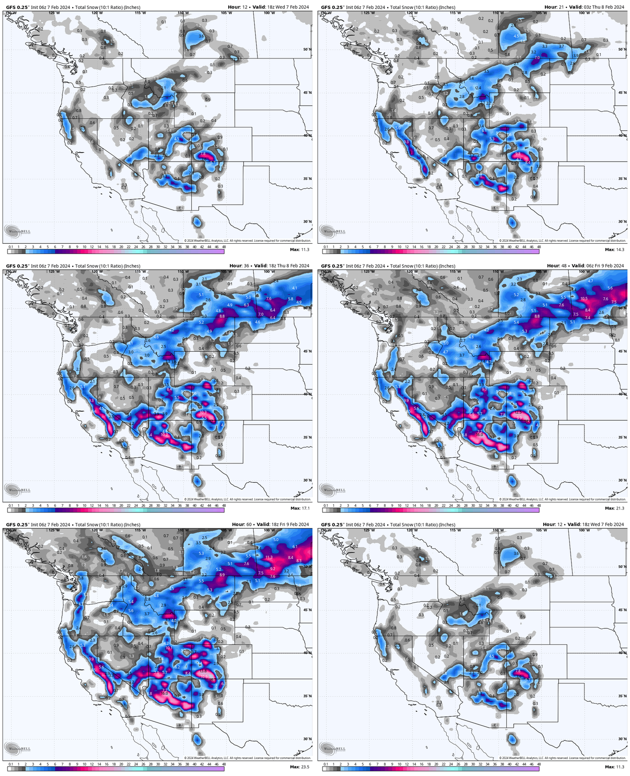
Below: Additional snowfall for the west from Wednesday to Friday. The Sierra grabs high-quality low-density snow on Wednesday (Southern areas favored 5-9). Arizona is going ballistic with another 6-12 followed by the San Juan range. Northern Colorado sneaks up late Wednesday night to Thursday. Taos is a wildcard with likely 8-11 inches by Friday (Might over-perform). A few spots in the 4 corners might exceed 3 feet.

Below: Cold front currently in the Sierra (High quality pow) will move into Utah mid to late Wednesday and into Colorado by late Wednesday evening and Thursday. Conditions will improve (Drier density) with NW winds kicking out the warm and wet southerly flow (Denser snow). Late Wednesday into early Thursday could offer very high quality turns. Action shifts north of the southern San Juans to the central and northern mountains of Colorado (Telluride can sometimes continue to score with NW winds).

Help us out!
If you want to chase powder with Powderchasers sign up for the concierge package for the deepest resorts to chase to and 1:1 custom forecasting with our staff. Also, if you have read this far, please donate to continue receiving these free forecasts. We appreciate the community support. You won't regret chasing with our custom forecasts. We have new swag on the Powderchasers storefront and all larger donations include it at no charge.
Enjoy the powder, everyone! Remember, your deepest resort is not always the best chase. See you in the first chair somewhere on Monday.
Enjoy the powder, everyone!
Powderchaser Steve @powderchasersteve on Instagram


