NOTE: Please support Powderchasers with a donation, Merchandise purchase such as a hat or stickers, or sign up for our custom Concierge Powder Forecast Package where we provide 1:1 phone and email support to get you to the deepest locations possible. Outside Magazine listed Powderchasers in the top 3 sites with the custom concierge program. These ways to support us will allow us to keep you chasing the deepest snow all winter! It's time to start trip planning and chasing pow!
November brought impressive weather across the western United States. Below is a graphic showing precipitation for November 2024 as a percentage of the month’s averages. Here are a few notable takeaways:
- Near-normal precipitation was observed in the Pacific Northwest.
- Southern Oregon and northern California saw more than double their average rainfall, largely due to last week’s atmospheric river.
- Idaho and the Intermountain West experienced slightly above-average precipitation.
- Colorado and Utah enjoyed a healthy month, with average to above-average totals.

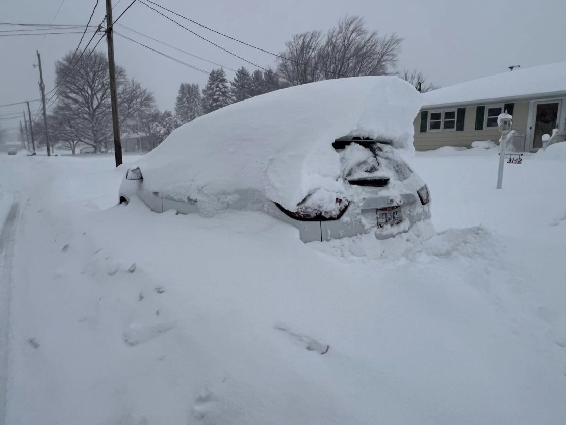
However, this good streak is winding down with a significant shift in the pattern. The western U.S. is drying out, while the eastern part of the country is ramping up. This transition began dramatically with a robust lake-effect snow event, dumping several feet of snow across Upstate New York.
Announcement: Skis.com is having a Cyber Monday Sale with merchandise up to 70% off!
The Tug Hill Plateau, located along the eastern shore of Lake Ontario in New York, recorded over five feet of snowfall during this event. Elsewhere, widespread reports of snow ranging from 12 to 36+ inches have emerged along the shores of Lake Erie and Lake Ontario.

To better illustrate this remarkable event, gridded model data from the NOHRSC reveals extensive areas with snow accumulations exceeding four feet. This graphic effectively highlights how impressive this storm was:

Additionally, one of the lake-effect snow bands on Lake Erie spawned a pretty sweet waterspout:

Looking ahead to the next six days, here are the projected 500mb geopotential height anomalies from the EPS. Broadly speaking, the northeastern U.S. will remain cold and snowy, while the western U.S. is forecasted to stay dry and warmer than average:

There is some relief for the West on the way later this weekend and early next week, as a small clipper system could move through from Saturday to Wednesday. While details remain uncertain, ensemble models offer some insight into this system’s snowfall potential. Below is the ECMWF ensemble mean for snowfall from Saturday morning to Wednesday morning:

As you can see, there’s limited consensus, evidenced by the “blurry” or “smoothed out” appearance of the forecast. Still, recent deterministic models indicate some positive trends. The more recent ECMWF deterministic run from December 2nd at 0z (on the left) shows a shift favoring snowfall across Utah and Colorado, compared to the earlier December 1st 12z run (on the right):

Similarly, the GFS model has made comparable progress, as illustrated below with the December 2nd 6z run (left) next to the earlier December 2nd 0z run (right):

It's still far too early to predict exact snowfall totals. The eventual outcome will hinge on how the western ridge develops in the coming days. This ridge will influence how much cold air and moisture can penetrate southward into the West during this weekend’s system.
At present, models indicate the Pacific Northwest will experience warmer temperatures with rain to start on Friday and Saturday. Snowfall is expected to develop later on Sunday as snow levels drop. Elsewhere, snow levels won’t be a concern since colder air will accompany the moisture that reaches the Rockies. This cold air will be pulled in behind the warm front, which will stall and dissipate over the Pacific Northwest early in the weekend (before Sunday) and won't push into much of the rest of the west.
Looking further ahead to mid-December, conditions appear increasingly promising for snow in the West. The ECMWF ensemble 500mb geopotential height anomaly forecast for December 12–16 shows a strong signal favoring the West. This robust signal is especially noteworthy, given it’s 10-15 days out, so it’s worth keeping a close eye on. While it’s still unclear which specific areas will benefit most, we’ll gain more clarity as models continue to converge over the coming days.

Stay tuned for an updated forecast later this week as we get a better picture of the upcoming weekend and next week’s developments. While this week looks relatively quiet, exciting weather patterns may soon start to take shape.


