For chasing powder, I have received requests from first responders and community leaders to communicate that they do not want a lot of people coming to town and definitely don’t want to deal with potential snow-related injuries when their focus should be on COVID-19. There is not yet a government-mandated travel restriction, but please consider what I just wrote before heading off to chase. At the very least, please be extra responsible and cautious so that you’re safe and do not cause a burden to healthcare workers. I do not suggest this means to not consider some outdoor activities but just use extra precaution and good common sense. Also, stay inside if you feel sick! We are a proponent for outdoor activities if you are healthy just for your sanity or mental health. This is really an individual decision. Remember social distancing even on the trails.
FORECAST
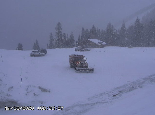
Snow is falling in the 4 corners with automated snow telemetry showing 3/4 of an inch of water for Wolf Creek Pass. This might equivocate to 7 inches of snow. Webcams show that is it is snowing rather heavily Thursday morning on Wolf Creek Pass. Models show another 3-7 inches is likely primarily on Thursday morning.
Rain is falling over the Front Range with light snow occurring in the mountains West on I-70. Snow telemetry for Berthoud Pass looks to be only an inch overnight but with CDOT cams showing that snow is falling at a pretty good clip. The mountain ranges west including Loveland Pass seem to have picked up 1-3 inches Wednesday night. Snow will increase over Colorado West of the metro areas early Thursday morning (Foothills, Berthoud Pass, Loveland) with the metro areas getting onboard by Noon.
Another area of Colorado that will see heavy snow in the mountains near Grand Junction to the Utah line. Significant high elevation snow will fall on the Western side of the State. Heavy snow is also possible near the Gunnison Valley.
The models still are on track to kick out 7-15 inches for the Foothills West of Boulder, Rocky Mountain National Park and perhaps Berthoud Pass. Less snow might fall further west at Loveland Pass. Nederland is a wildcard. Peak snowfall will happen late Thursday morning through midnight. Further West in Summit County amounts will be less (3-6). Some additional light snow will fall on Friday especially East of the Divide. The deepest snow will be found late Thursday and early Friday.
Honorable Mention: It's likely that the mountains outside Flagstaff received 9-15 inches of snow in the past 24 hours but no confirmation. The Wasatch of Utah kicked in Wednesday morning with 5-9 inches of decent quality powder for Big and Little Cottonwood.
Yesterday, I chose to take a break and hit the White Pine Cross Country Center in Park City for 30 minutes of great skate skiing. While they are officially closed, some volunteers have been grooming sections of the fantastic terrain there.
Below: Berthoud Pass Webcam early Thursday morning. It does not look deep, but snowfall rates appear to be increasing.

EXTENDED FORECAST
This might not be what you want to hear, especially during these tough times. The models are picking up on a decent trough that enters the Pacific Northwest favoring Oregon late this weekend. That trough is likely to bring a decent dump to the Sierra and drag East over the Rockies early next week. Significant snowfall is likely, especially for the Wasatch and perhaps most of Colorado early to midweek.
Keep optimistic everyone! Hopefully, you had good turns this year. Some of us are continuing to get turns in the Backcountry or resorting to new winter activities.
Powderchaser Steve


