SUMMARY
For chasing powder, I have received requests from first responders and community leaders to communicate that they do not want a lot of people coming to town and definitely don’t want to deal with potential snow-related injuries when their focus should be on COVID-19. There is not yet a government-mandated travel restriction, but please consider what I just wrote before heading off to chase. At the very least, please be extra responsible and cautious so that you’re safe and do not cause a burden to healthcare workers. I do not suggest this means to not consider some outdoor activities but just use extra precaution and good common sense. Also, stay inside if you feel sick! I am a proponent for outdoor activities if you are healthy just for your sanity or mental health. This is really an individual decision.
FORECAST
Snow for the short term is continuing in the Tetons (6-7 fell Friday night). 2-4 additional inches are likely Saturday to Sunday. Backcountry conditions should ride relatively deep at upper elevations of the Tetons Saturday morning. The models show some additional snow will fall into Sunday albeit lighter. Both the telemetry at Targhee and JHMR confirmed these numbers listed above.
Below: Grand Targhee \Stick of truth\" on Saturday morning. Someone is just starting to skin the background. This is all overnight snow.

That system will sneak into Colorado Saturday evening to Sunday with some light snow showers for most mountains West of the Divide. It is possible that the summit of Rabbit Ears Pass or even south towards Aspen see higher amounts (2-5). Otherwise, along I-70 it's likely that a few inches fall into Sunday freshening up the backcountry.
The past several days brought epic amounts of snowfall to the Front Range of Colorado. Nederland was deep on Thursday with reports of 2 feet by Friday morning. Rocky Mountain National Park per snow telemetry appears to have picked up a minimum of 12 plus inches by Friday morning. Another 2-5 may have fallen Friday night and Saturday. The East entrance of the park is closed.
Below: Nederland was deep late Thursday. Photo: Powderchaser Steve

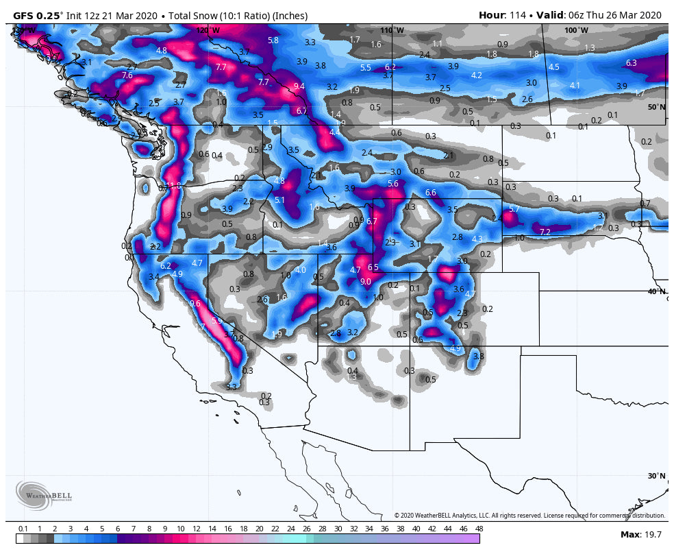
The extended forecast has a sigificant amount of snow due for the Cascades and the Rockies. This will tease us next week as we watch cameras and telemetry get very deep by mid to late week. Oh I wish we were in a different position. Keep living vicariously or if you live near the mountains get outside for different activities.
Remember, if you decide to venture into the Backcountry, don't go if you don't know (Always consult with the Backcountry Forecast and be aware of rapidly changing conditions). Many ski areas are closed to uphill traffic.
EXTENDED:
The extended forecast is going to bring colder conditions to the Pacific Northwest with moderate to deep snow primarily Monday into Tuesday. That system will impact the Sierra next early next week with the Rockies getting deep Tuesday-Thursday. It is initially warm for the Rockies turning colder mid to late week. Right side up snow will accumulate in many areas next week with (2-3 feet) with more details on the next post. The Cascades of Washington, Oregon, Sierra and most of the central and northern Rockies will see snowfall next week.
Below: Crystal Mountain (Closed). These graphs tend to be overdone somewhat this far out. Peak snowfall Late Sunday to Tuesday (5-20 inches with a large spread of uncertainty for Monday-Tuesday).
 '
'
Below: Here is the range of snowfall for Steamboat (Closed) primarily Tuesday to Friday (Tight lines = higher confidence). Looks like steady periods of light to moderate snow for much of next week.

Below: Same graph for Alta (Deep by Wednesday). Tighter lines indicating better model confidence.

Stay healthy and remember there is always another season ahead of us.
Powderchaser Steve


