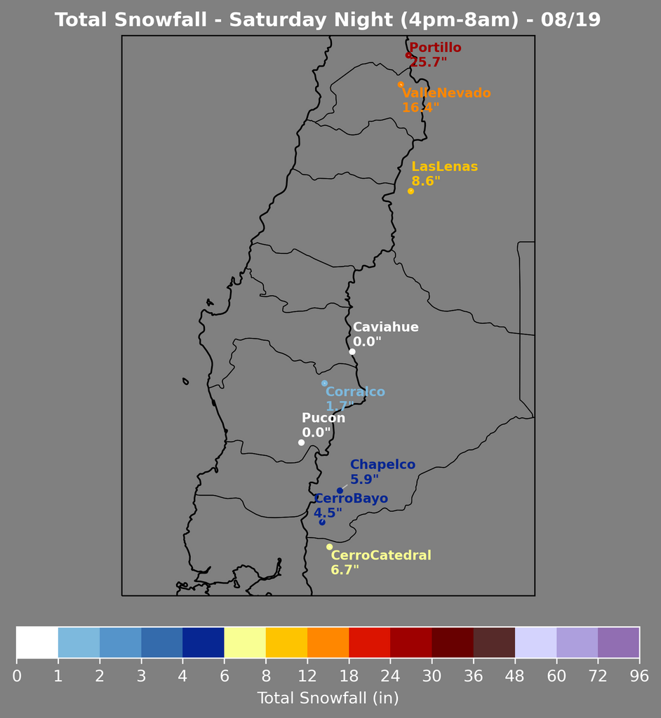
Above: Total snowfall through next Wednesday is at the tips of the charts at 120 inches or more. Totals could exceed 200 inches at the highest peaks.
A massive winter storm cycle will hammer the Andes this week, weekend, and into next week, dropping totals that are almost unfathomable. We’re talking about widespread totals exceeding 100 inches (250cm) at resorts with some resorts making a run at well over 150 inches (380cm). The most favorable resorts will be found in the northern mountains; resorts like Portillo, Valle Nevado, and Las Leñas. Fortunately, this cycle is also fairly cold, meaning most resorts will see all snow all the way to the base. Truly a legendary storm cycle!
The main surge of moisture will arrive on Friday afternoon and will hammer the mountains well into next week. For now, we’ll forecast until Tuesday night, which should roughly be the end of the storm.
The main surge of moisture arrives Friday afternoon. Expect very little accumulation during the day before the resorts close. Friday night will see widespread 2-6” totals with as much as a foot at Portillo.
Saturday will be a little warmer, as a strong push of moisture makes its into the mountains. Freezing levels will likely be hovering up to 4,500ft (~1,400m) in the south and up to 8,500ft (~2,600m) in the northern mountains. The high elevation of resorts in the north makes these the chase targets for Saturday; 2-6” (5-15cm) for Las Leñas an Valle Nevado resorts and 8-12” (20-30cm) at Portillo.
Elevated snow levels and warmer temperatures will persist on Saturday night. Saturday night is where things could really explode. In the south, the low elevation could make it hard for lower mountains to accumulate much snow. The highest totals in the south will be at Cerro Catedral, where 8-12” (20-30cm) overnight is a good bet. In the north, high elevations will keep things almost entirely snow, and it is going to DUMP! We see the following overnight totals being entirely reasonable: 8-12” (20-30cm) at Las Leñas, 12-18” (30-45cm) at Valle Nevado resorts, and 22-28” (55-70cm) at Portillo.

Fortunately, temperatures will drop sharply on Sunday morning, and virtually all resorts will return to snow to the base areas by the end of the day. There won’t be a ton of snow during the day on Sunday, likely 2-5” (5-13cm) at resorts that will see snow, with the exception being 6-10” 15-25cm at Portillo.
Cold temperatures and copious moisture on Sunday night will lead to big totals across the board by the time lifts are spinning on Monday:
- Northern mountains (Portillo, Valle Nevado, Las Leñas): 10-16” (25-40cm), less at Valle Nevado
- Central mountains (Caviahue, Pucon, Corralco): 9-16” (23-40cm)
- Southern mountains (Chapelco, Cerro Bayo, Cerro Catedral): 5-10” (12-25cm)
Monday will be another snowy day, with 8-14” (20-35cm) in the northern mountains, 7-10” (18-25cm) in the central mountains, and 3-6” (8-15cm) in the southern mountains. Monday night will bring 8-14” (20-35cm) to the central and northern mountains (with 18-24” (45-60cm) at Portillo) and 3-6” (8-15cm) for the southern mountains.
Tuesday and Tuesday night will bring another few inches to the southern mountains and 6-14+ inches to the central and northern mountains.
Lets take a look at some very bullish storm totals at a few resorts around the region by next Wednesday morning:
- Portillo: 115-140” (290-350cm)
- Valle Nevado: 60-80” (150-200cm)
- Las Leñas: 50-75” (125-190cm)
- Cerro Bayo: 25-40” (65-100cm)
- Cerro Catedral: 35-50” (90-125cm)
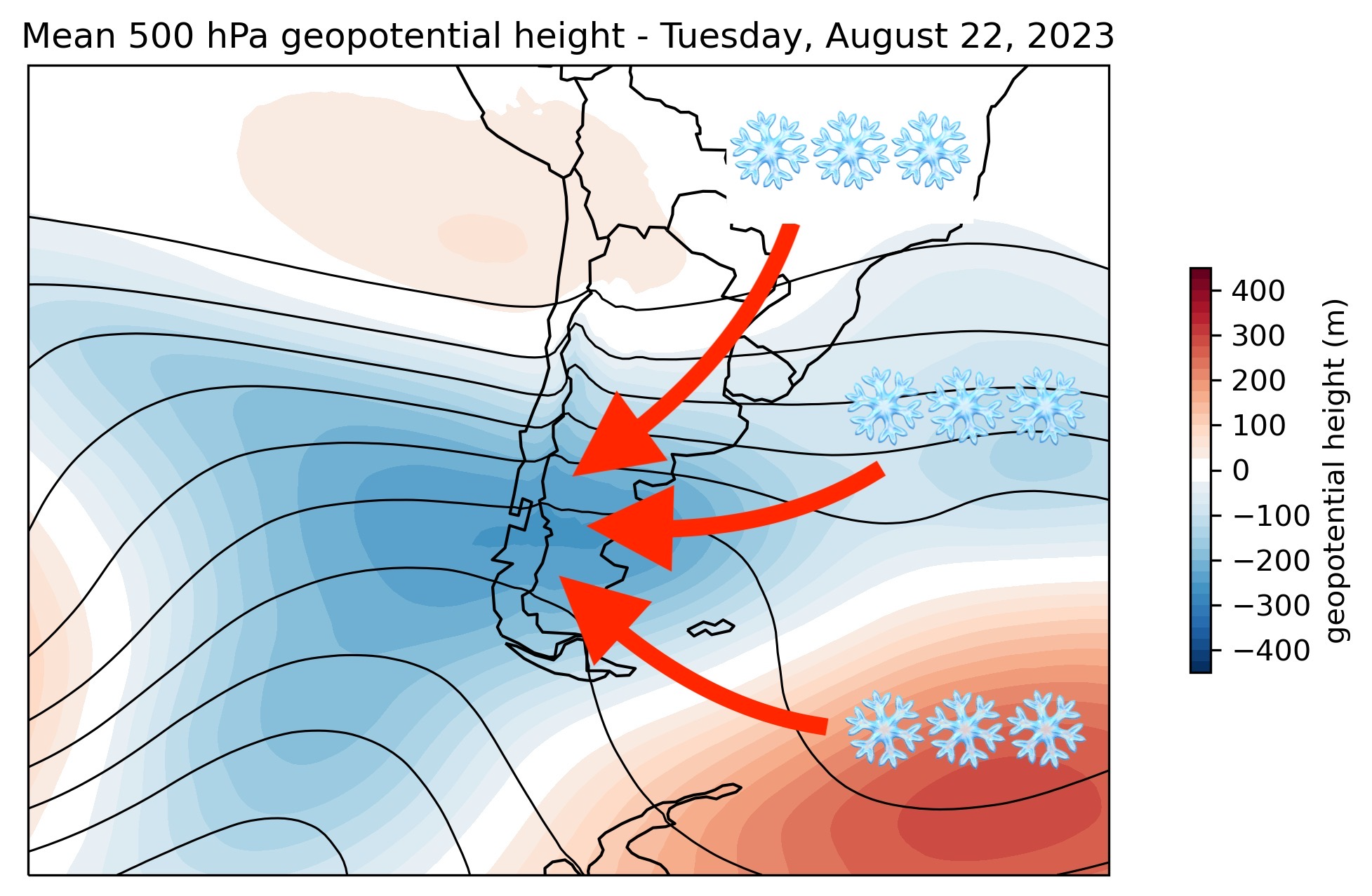
Ensemble models have slightly stabler conditions returning around August 26th as the map dips up, but they’re still forecasting a stormier than average pattern into the end of the 15 day forecast window. Below is a 103 member ensemble for geopotential height anomaly (a rough measure of how stormy it is):

PLEASE SUPPORT POWDERCHASERS WITH A DONATION OR JOIN OUR CUSTOM POWDER CONCIERGE PROGRAM. We are always looking for new sponsors on the website that reach over 2 million views per season. Reach us at powderchasersmedia@gmail.com if you are interested in supporting our small tribe of forecasters.


