
Summary
There are 2 main pieces to the next storm with complicated wind shifts and decent chances of double digits in many areas. The take home message is a warm teaser for Colorado Tuesday night followed by a colder push of heavy snow for Friday/Saturday. Utah could score in isolated areas as well as the southern Wind River Ranges in Wyoming Wednesday and Thursday.
Forecast:
In the weather world, this is not a simple storm nor a slam dunk for any particular location. There is high confidence that significant snow will fall along the Continental Divide of Colorado from Tuesday night to Saturday. Tuesday night will initially bring a warm blast of only 3-5 inches for higher terrain around Summit County, Loveland Pass, RNP, and other areas favored by SE winds. Higher amounts might come over the south Hoosier Pass just south of Breckenridge (SE winds pushing in from Park County). The metro areas around Boulder or even Fort Collins could grab some light snowfall especially on the grassy surfaces (Warm sun angles will melt anything on the pavement Wednesday, and likely no travel impacts at lower elevations).
Meanwhile In Utah complexity of S, SE, SW and finally NW winds on Wednesday will bring hit or miss snow totals. Snow levels are high initially Tuesday night (7,000 feet) with strong winds from the SSE, switching to the S, SW. Models show highest moisture Tuesday night will fall over the Uinta Range (East of Park City) and stretch north towards the Cache Valley of Utah (Logan Summit). Expect 2-5 inches of dense snow in these areas. The Cottonwoods might see 1-4. On Wednesday snow levels decrease significantly, snow ratios increase (12:1) and snow should increase over the Cottonwoods (2-5 additional- better quality) with very strong winds decreasing by 10AM. Some models show higher amounts by last chair Wednesday. With a southerly flow at times Tuesday night and early Wednesday it's also possible some decent amounts come from the peak of Sundance (closed). Bottom line: Initial storm amounts Tuesday/Wednesday could total 3-9 inches by late Wednesday over the highest terrain of northern or central Utah. You might get some good turns in by mid morning or early afternoon in the Cottonwoods (Not deep but fun surf quality followed by some colder medium density).
If you are in Wyoming, most of the snowfall will fall south of Jackson. Look for some decent amounts possible through late Wednesday over the southern areas of the Wind River Range, and perhaps even the higher peaks and Ski Areas near Pinedale.
Below: Total snowfall for Utah favoring the Cottonwoods and perhaps Provo areas mountains through Thursday morning. Aim for midday Wednesday or Thursday. Isolated pockets of 12 inches above 8,000 feet are possible, but its hit or miss with confidence being a bit lower than normal.
PLEASE SEE THE LATEST EARLY OFFERS FROM IKON.

Let the fun begin!
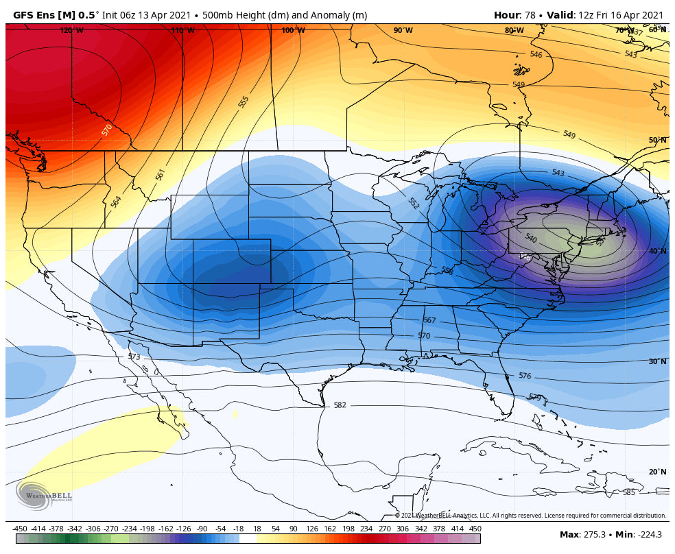
In the extended period action increases with better chances of higher quality powder, especially for Colorado. Increasing moisture, colder temps and decent snowfall is likely along the Front Range Mountains Thursday PM to Saturday AM. The coldest temps and best orographic snowfall should occur from Summit County, and along the spine of the Continental Divide. The GFS is still showing 10-14 inches for Berthoud Pass (Totals from Tuesday to Saturday), 5-9 inches in the western mountains (Vail Pass, Aspen) and perhaps higher amounts in the highest terrain surrounding Boulder (Estes Park). The European Model is less optimistic (7-10 inch totals). Aim for riding Friday and Saturday In Colorado with colder temps. It's likely that Breck, Loveland, WP, report moderate amounts both Friday and Saturday. Vail might sneak in some light to moderate powder with NW winds noted on the models on the western corridor. Even the 4 corners could see some light powder by Friday or Saturday. Storm totals for Colorado might exceed 20 inches by Saturday in some isolated areas.
Utah (Cottonwoods) will also see an increase of some light to moderate snow that continues Thursday and Friday (Slowly building up In the Cottonwoods), however temps will be warmer (7-12 inch storm totals Tuesday to Friday).
Bottom Line: You can score light or moderate pow in Utah or Colorado Wednesday morning (Teaser). Higher amounts will fall especially over Colorado Thursday night to Saturday. You could score some late season pow both Friday and Saturday. Depending on the speed of this low moving east, things might be deepest late Friday or early Saturday (Decent quality). Temps will be significantly below normal especially along or east of the Divide late this week. Some low elevation snowfall and road impacts are possible north of Denver.
Below: The GFS continues to pump out significant snowfall for many areas of Colorado through Saturday. The Euro is less optimistic. Not sure I can believe the 27 inches near Berthoud Pass at this point. Lets hope!

Below: SREF Guidance (The SPC Short-Range Ensemble Forecast (SREF) is constructed by post-processing all 21 members of the NCEP SREF) is likely a better average showing totals in the 12-16 inch range through Friday night fro Summit County east along the Divide (Includes RNP, WP, Berthoud, Hoosier Pass). Eastern sides of the Divide might be deeper. Western and Central Colorado will see moderate totals. I have higher confidence in this solution.

Below: Ensemble mean for Loveland Pass from Tuesday to Saturday showing an average of 10-12 inches with some models (Outlier lines) showing up to 15-18 inches (lower confidence on a solution). I think the 10-12 is with higher confidence at this point.

Below: Coldest temps at 10K feet are depicted east of the Divide Friday morning as very cold air drops into the Front Range of Colorado. Northern Colorado, even west of the Divide also will could (North of I-70).

Enjoy the Powder everyone! Please donate to support our forecasts this season and hopefully next.
Powderchaser Steve @powderchasersteve via instagram.


