
A moist system will move into the Pacific Northwest this weekend, primarily bringing mid or high elevation snowfall to both western and interior BC, and Alberta. Rain will be falling in the central and northern Cascades of Washington. Cooler air in Canada keeps snow levels near 5,200 feet in western BC and a bit lower for the interior regions of BC and western Alberta (4800). A weak warm front might raise these numbers slightly (Sunday) before a strong cold front Sunday night/Monday. Cold air will infiltrate the Pacific Northwest into early next week with snowfall finally returning to many ski resorts in both Washington and Oregon. Snow levels drop as low as 2,000 feet below all bases in the PNW.
Highlights:
*Double digits expected for Western Canada above 5300 feet this weekend.
*Double digits extend into interior Canada and Alberta resorts early next week.
*Cold Front for the PNW Sunday night with snowfall at most bases of the Cascades Monday.
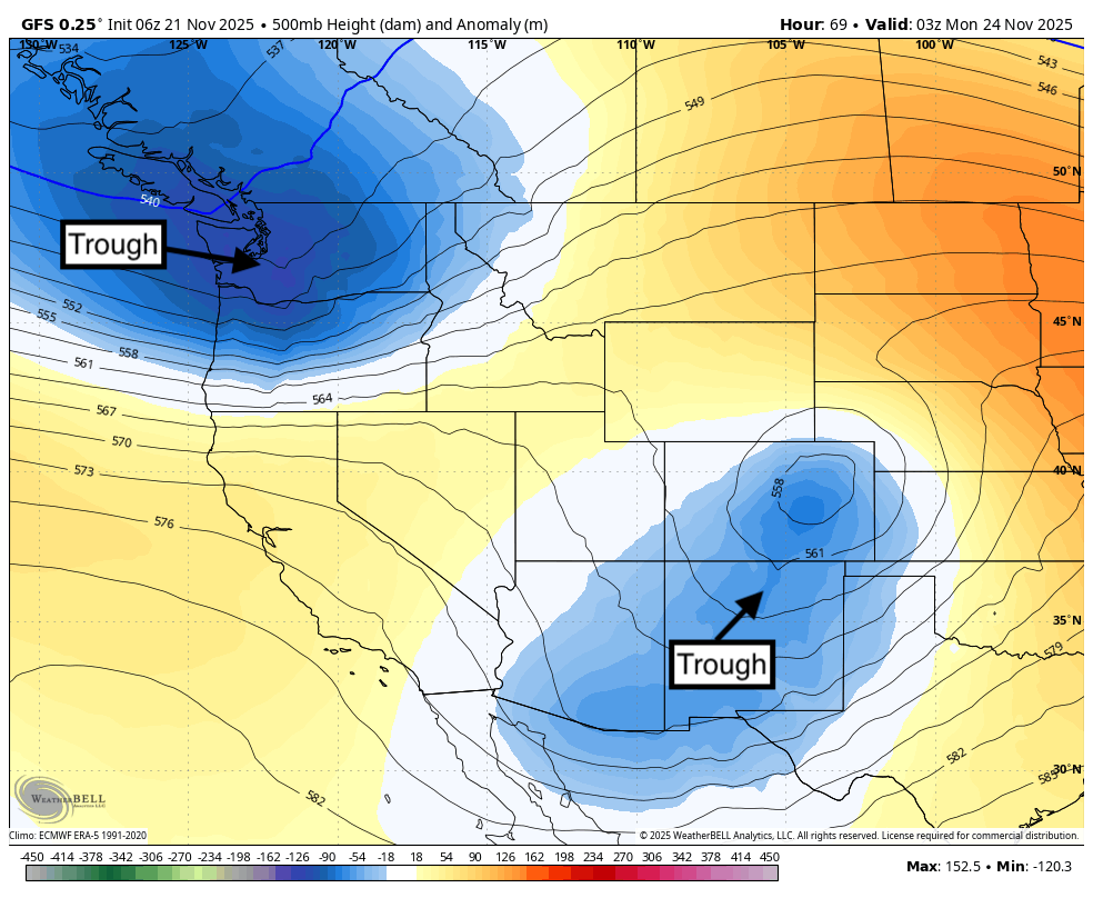
*Teaser Pow possible for the southern Rockies (NM, CO) and perhaps the southern Sierra Sunday/Monday.
* The Extended Forecast is colder and snowier for the West.
The Bad:
* Rain in the PNW this weekend before the snowfall later Sunday.
* High snow levels in western Canada keep snowfall this weekend confined to mid or upper slopes.
Below: Strong low pressure in the PNW focuses on the PNW and western Canada this weekend into early next week. A weaker system will move into New Mexico and spread some light or moderate snow into a few areas of the southern Rockies by Monday.

OUR GOLD SPONSORS


 Below: Loop is from this Friday to Monday night (Nov 24). Initial snowfall is confined to Canada this weekend (Rain in the Cascades) above 5,000 feet. Snow fills in nicely Sunday night into Monday towards the end of this loop for a wide area of the Cascades. Cold air will bring snow levels in the PNW down to 2,000 feet. Another low in the southern US will bring some light snow to the southern Sierra and a few areas of New Mexico and Colorado on Sunday PM.

Below: Total snowfall from the weak trough that impacts the southern Sierra and a few areas of New Mexico and Colorado from Sunday to Monday. Models are not in great agreement on totals, but it is reasonable to forecast 3-8 inches in the southern San Juan ranges, including northern New Mexico, and 1-4 inches further north.

Below: Total snowfall through Monday afternoon in the PNW. Whistler is the overall winner (Above mid-mountain with 10-18 inches possible. The Cascades benefit Sunday night into Monday (Cold front) with generally 5-10 inches. If convergence zones set up near I-90, you might see higher totals at Stevens Pass or Snowqualmie. Rain will be falling this weekend, before the cold front on Sunday night.

Below: Loop from Friday to Monday (Nov 24). 4800-foot temps in Canada are near -1C, rising slightly on Sunday (Weak warm front) before crashing to -7C Monday. This cold front will kick off some much-needed base-level snow for the Cascades. Whistler and interior BC/Alberta resorts will see snowfall this weekend at mid or upper slopes. Cascades score powder Sunday night (Rain prior).

EXTENDED POW
The extended offers some good news to resorts in the west with colder temps and some decent totals as we go into late November/early December.
Below: The Map is from Wednesday (Nov 26) to Tuesday (December 2). 10K foot temps plunge to -20C in the northern Rockies/Canada. Cold air moves south over most regions of the West later next weekend.

Below: Low pressure noted later this week from the PNW and possibly cutting off somewhere in the 4 corners by next weekend or early the following week (Map is Thursday, Nov 28, to Tuesday, Dec 2)

Below: 24-hour incremental snowfall from Wednesday (Nov 26) to Tuesday (Dec 2nd). Current models will change as we are outside the 5-7 day confidence period. The good news is that the signal is for another storm for the Cascades mid next week, which extends into the core of the Rockies towards the end of next week. There is likley going to be a snow god flipping the switch to snow for many areas that have not seen powder this season. This map is based on the GFS Ensembles.

Below: European Ensembles "Total 7-day snowfall" ending Tuesday, December 2nd (Fantasy map, but it could happen).

Bottom Line:
* Colder temps as we get into the end of next week
* Decent odds of some double digits in many areas of the west, possibly favoring the Rockies and the 4 corners. The Sierra is still in the hunt.
* Model data will change as we are still 6-10 days out. Our confidence is relatively good right now.
Please support our sponsors! Tire Rack has a promotion on Blizzak Tires with a $80 prepaid Mastercard rebate with the purchase of any 4 tires. Please support your love of powder and our forecasts with a donation here, or join our concierge program.

Forecaster: Powderchaser Steve (@powderchasersteve)


