Summary:
The next several days will offer snowfall for the Sierra, Pacific Northwest, Wyoming with Colorado, and perhaps Utah getting into the spotlight early next week. Santa might be late in delivering due to timing.
Recap: The previous forecast was on track with generally 3-7 inches for Colorado on Wednesday (We highlighted Steamboat and Aspen Highlands who saw the upper-end numbers) and our \Over perform the models\" pick was the Cottonwood Canyons. 16 inches fell at Alta/Snowbird between late Tuesday and early Wednesday. Lake effect kicked in, colder temps, NW wind direction, high snow ratios (20:1) all made for a deep day Wednesday morning. Big Cottonwood saw less with around 7 inches for Solitude and only 4 inches at Park City Mountain Resort. Another winner was Beaver Mountain in northern Utah with 10 inches for day 2 of their season! Snow quality was \"blower\" but in the early season, we are still looking for some storms that bring heavier density snow to build up the snow base at the resorts and clean out a lot of those nasty weak spots in our fragile early season snowpack here in Utah right now.
Announcement: Beaver Mountain is now open in northern Utah with fresh powder and $50 lift tickets. Be sure to check them out and support family run ski areas.
Powderchasers has partnered with Alaska Backcountry Guides in Valdez. This outfit while newer to Alaska brings a ton of experience to the industry with small group heli skiing and top notch service. We know this operation and felt it was a good fit for those of you looking to chase endless powder, steeps, and intermediate terrain. HELI skiing in AK would be a great reprise from the challenges this season. Powderchasers has a special offer with ABG so be sure to mention that we sent you. We highly recommend this outfit based in Valdez.
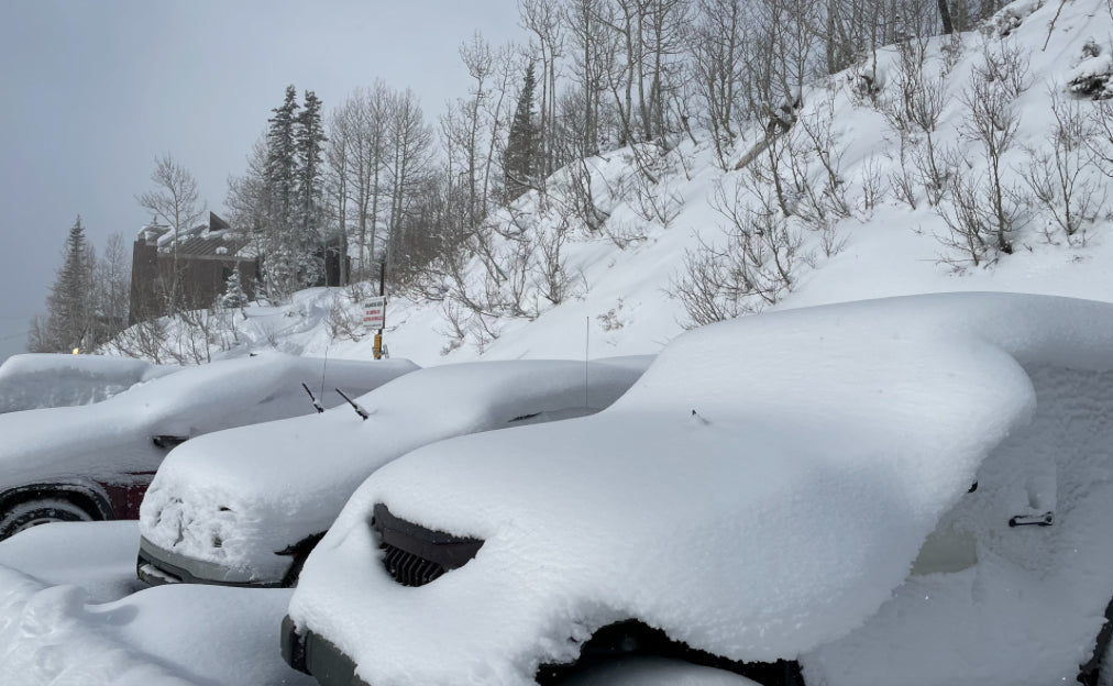
Below: Little Cottonwood Canyon Wednesday morning- Photo: @powderchasersteve via Instagram

Santas Forecast:
If you are looking to chase powder the Sierra and the Pacific Northwest are favored for Friday/Saturday. Santa will have delays on XMAS, with snow in the Sierra Friday night. Saturday will favor the northern Sierra Ranges (Sugar Bowl, Squaw-Alpine Meadows). These areas have good overnight timing (Santa will be moving fast), with 9-12 inches for 1st chairs. Mount Shasta further north could see higher amounts. The southern lake areas will likely grab 5-10 inches with perhaps even lower amounts for Mammoth.
In the Pacific Northwest temps are very warm currently. Snow levels go from 5-7K to a respectable 3K with the next approaching storm due on Friday night. The models show the highest amounts south of Crystal towards White Pass and the Oregon Border, with moderate amounts for Mt. Baker. Resorts in Oregon including Timberline, Mt. Hood Meadows, and Bachelor will likely score decent powder days Saturday morning (12 plus) with the bulk of the precipitation favoring the southern Cascade ranges. Caveat: Warm temps preceding the cold front Friday night might bring some crust layers Saturday, however with snow levels not excessively low it's possible this storm refreshes the bumps with a good mid-density coating.
Below: Pacific Northwest for Saturday morning. Just a slight push further north will result in higher amounts perhaps for Crystal. Oregon and extreme southern Washington are favored for Saturday Pow.

Elsewhere in the west, there is a moderate storm we are watching for PM Saturday to Sunday AM for the Tetons. This could land 5-10 inches for the higher peaks near Jackson. That storm fizzles as it moves east towards Colorado Sunday/Monday (Light snow).
EXTENDED:
Another low-pressure system moves ashore early next week. This storm appears to be taking a southerly track that may bring decent snow to the southern Sierra (Mammoth), Mount Baldy (Near LA). It appears to split some energy east towards the Wasatch on Monday before taking better aim at the 4 corners for late Monday or Tuesday. This might produce decent snow for the San Juan Range including Colorado and New Mexico. Arizona will also likely see some snowfall. Snow is also likely going to be falling in central and northern Colorado with the highest amounts further west along or south of I-70. It's too early to predict which resorts end up with the highest amounts but deserves watching.
Below: Tuesday morning powder for the 4 corners is possible for the west. Most of Colorado will also benefit with moisture pushing north but favoring resorts along or south of I-70. It's too far out to offer details.

In Conclusion, Santa will be able to traverse the west this week, albeit late perhaps by a day. The East Coast is getting slammed with rainfall. Santa will have to resort to wheels on his sleigh, and perhaps will start there on Thursday evening and end up in the Sierra for Saturday powder. Let's hope we can keep Santa safe this week as everyone deserves gifts after this difficult year. Hey, all I want is Powder, so if you can deliver that you skip my pad and catch up with the others. You might see Santa on the slopes Saturday grabbing faceshots with his reindeer anywhere from the Pacific Northwest to the northern Sierra.
Be sure to check out our custom powder concierge program (Custom Forecasting for your chase) on the website. This supports our forecasts and keeps you in the deep all season.
Happy Holidays everyone! Enjoy the Powder!
Powderchaser Steve


