Our Powder Watch continues primarily for an upcoming storm that will likely see the highest totals over southern Colorado Saturday/Sunday.
PNW
The latest models bring a cold front into the Pacific Northwest and BC (Western areas favored) Friday that kicks off snowfall for the Cascades. This system does not have a good moisture tap and will likely land 4-8 inches to many regions of the Cascades favoring Stevens Pass and areas north. If we were on the chase, it might be worth watching Baker for higher totals. Most of the snow will fall during the day on Friday (No overnight deep dump). Snow levels will lower to below pass level. Western BC will see similar totals with interior BC a bit less (Revy could perform with the cold air on Friday). Quality will be decent.
Rockies
That cold front with decaying moisture stretches into the panhandle of Idaho late Friday and into the Tetons and Wasatch for Saturday morning. Unfortunately snow totals look below powder alert criteria and in some cases might only be in the 3-6 inch range. Regardless, it won't be a deep storm but will provide some freshening of the slopes for Saturday turns.
NWS still shows 6-12 inches for the Wasatch but we have not bought into this. Our forecast remains in the 3-6 inch range, perhaps even lower. Let's hope that changes but the models are going in the wrong direction.
Colorado Powder Watch
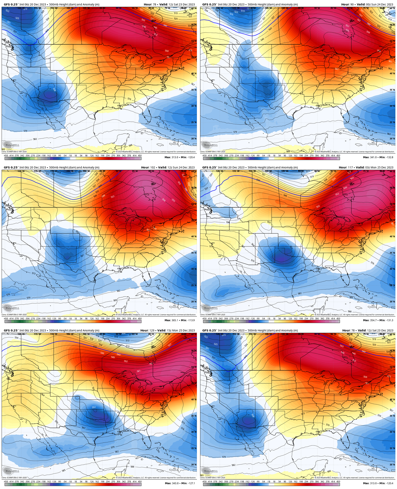
The real action takes place as this cold front merges with the moist low that is currently spinning in Southern California. That low will merge with the cold front over Colorado Friday night into Sunday. Models have high confidence for moderate snow Friday night increasing Saturday morning for the southern mountains of Colorado. Southerly winds might favor resorts closer to Durango versus Pagosa.
I would watch for some decent totals at Purgatory, Silverton, and Telluride. Telluride often prefers NW flow, but in this case strong moisture and south winds might still sneak out some decent totals. We think areas just to the south including Red Mountain Pass might be deeper. Wolf Creek will be another contender for good totals but will likely fall a bit short of their neighbors to the west (The last storm saw equal numbers for Wolf, Purgatory and Telluride which was pretty unusual).
Below: You can see the low over the PNW branching off energy over the Rockies and rapidly moving south to merge with the deeper low moving east from California over Colorado by Saturday.

Below: The cold front over the PNW Friday reaches the northern Rockies Saturday and into Colorado on Sunday. Snow in the 4 corners will initially be dense until this colder air arrives.

Below: We are still 4-5 days out with model data changing. Here is a best guess scenario currently for southern Colorado as of mid morning Saturday. Some significant totals might land in the southern San Juan Range by late Saturday night into Sunday, with moderate totals as early as Saturday morning. Early snow totals for the southern San Juan Range is 10-18inches.

Below: Late Saturday night or early Sunday- colder air approaches Colorado a wind shift to the N, NW will likely bring a better chance of snowfall to the central and northern Mountains (Wide area of ski areas from the Elks near Aspen, Grand Junction, I-70 corridor, extending north to Steamboat. Early estimates for these locations are 5-10 inches.

The extended forecast brings another quick moving system into the PNW late this weekend. Temps will be moderating a bit. Additional moisture, perhaps another Atmospheric River of events are possible for the PNW with even warmer temps for mid next week could bring significant snowfall to the peaks of the Cascades and rain below 4500 or 5,000 feet. Some colder air noted at Stevens Pass (Easterly flow) so it's possible snow levels are lower initially there. Much warmer temps are on the models beyond mid next week for the PNW with all areas seeing some rainfall.
Nothing stands out currently as significant for the Rockies next week with perhaps a bit better hope beginning around January 1-3 for the Sierra and possibly the Rockies.
If you want to chase powder with Powderchasers sign up for the concierge package for the deepest resorts to chase to and 1:1 custom forecasting with our staff. Also, if you have read this far, please donate for the holidays to continue receiving these free forecasts. We appreciate the community support.Powderchaser Steve @powderchasersteve - Instagram


