Welcome to March!
This is the week to Cat Ski, in the Rockies as we continue to dig out in Utah, areas of Wyoming, and even northern Colorado near Steamboat. I rode at Snowbasin yesterday where patrol popped the ropes at many of their steepest terrain with 20 inches of powder from the Saturday storm.
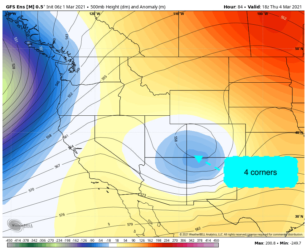
High pressure takes hold initially with the models showing a modest system moving into southern Colorado by Thursday morning. This system features a good chance of moderate snowfall for Durango, Purgatory, Silverton, and Telluride. While the winds from the SW don't favor Telluride, the models push the focus north of Durango so it's possible the western mountains of southern Colorado versus further east (Wolf Creek) score higher amounts. It's too early to speculate so look for an update by midweek. Lighter snow will be possible over central or even northern Utah during this period.
Below: Weak to moderate trough pushing into the 4 corners by Thursday morning.

In Alaska, over 40 inches have fallen over Alyeska in the past 2 weeks. Light snow is likely Monday/Tuesday with an increase once again late this week. Check out Alaska Backcountry Guides based in Valdez if you are looking for small group Heli terrain that offers high-end service. There are still some scattered dates available.
Looking further out in the models, a storm system likely impacts the northern Cascades of Washington by Friday morning spreading leftovers south through Oregon. Some light snow will likely overspread the northern Rockies (Idaho and Wyoming) by Saturday or Sunday. The Sierra may benefit with higher amounts (Modest storm) as this low digs south towards California..
In week #2 it's possible that a stronger system impacts the west taking aim at the Sierra as depicted below in the ensemble runs.

Enjoy the powder everyone, or take a break early this week in anticipation of additional chases later in the period.
Powderchaser Steve


