SUMMARY: incredible past 5 days with 3-4 feet for the PNW, and many areas of the Rockies reporting 1-2 feet or more. Colorado. The next 5 days show a break in the action with a teaser for the 4 corners midweek, and a return to possible storminess for the PNW by Friday or Saturday.
RECAP
Most of the forecasts were on target! Here are a few snow totals from the past 24 hours. Very impressive amounts across many areas of the west in the past 24 hours. 48 and 72-hour totals were much deeper. Quality was good at nearly every area with cold temps, except for the wind issues in the PNW Friday, and to some extent higher elevations of the Wasatch Saturday.
1) Snoqualmie Pass - 19 inches
2) Mount Hood 15 inches
3) Brighton 14 inches
4) Grand Targhee 13 inches
5) Beaver Mountain 12 inches
6) Steamboat 9 inches as of 1 PM Saturday
7) Snowbasin 20 inches as of 2 PM Saturday.
Snow continued to fall over Northern Colorado as forecasted Saturday with Steamboat, Beaver Creek, and the Aspen area mountains scoring moderate to heavy snowfall (We forecasted the western resorts as the primary chase spots). In Utah, the hats go off to Snowbasin who has picked up 20 inches with 10-12 Friday night and another 7-8 during Saturday. The PNW would have been epic on Saturday with generally 10-12 inches overnight, cold temps, and decreasing winds. The I-90 resorts scored big time with Snoqualmie reporting 19 inches Saturday morning (24 hours). Lookout Pass on the eastern side of the Idaho Panhandle scored 21 inches in the past few days. Colorado snuck out some decent numbers on the western side of I-70 including Steamboat to the north (Other areas saw light or moderate snow on Saturday). We had that in the forecast.
My chase took me to Snowbird where 10-12 inches fell overnight with strong winds. If you chose the right wind-protected lines, the mountain skied great. if not, you were feeling funk from below. Winds gusted to 60 MPH on Friday night. Lower elevation resorts like PCMR, Pow Mow, Beaver, Snowbasin, would have been more wind protected and deeper further north.
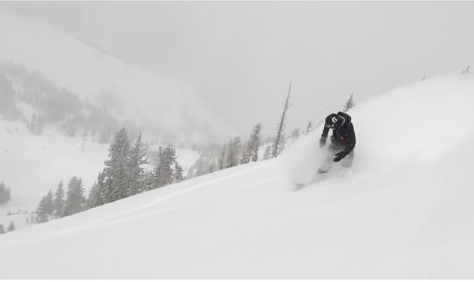
Below: @powderchasersteve via Instagram in the White Room at Snowbird Saturday.

Below: Snowbasin Stake is almost buried at 20 inches. WOO HOO

How did Snowbasin pick up this much snow? I forecasted Powder Mountain as favored with the West, Northwest Flow. Snowbasin usually reaps the deepest rewards under SW flow. I am not sure how that happened. The flow turned more westerly at times and set up just north of I-80 so it's possible that the location of the heaviest precip and west winds scored the deep goods at Snowbasin. Winds went NW on Saturday but Snowbasin continued to reap the rewards. Please comment if you were there!
Convective bands of snow showers are continuing Saturday evening for the Wasatch Range. Very cold temps, some lake enhanced showers are putting down additional snowfall that most likely won't amount to more than 1-4 inches by Sunday morning. Cold temps and lighter winds will keep the snow quality very good.
Short term:
Most of the powder will be in Canada favoring the central and northern areas of BC.
Extended:
Looking out into next week's chases. There is not anything major to talk about. High pressure settles into the west for most of next week. The models show a low-pressure trough bringing some snow to the 4 corners perhaps by Thursday (Southern Colorado, Utah, New Mexico). Another low-pressure system might take aim at the Pacific Northwest by late this week.
Below: High Pressure over the west on Monday with low pressure noted for northern New England.

Below: low-pressure system possibly impacting the 4 corners by Wednesday or Thursday. This will likely keep most snow in the southern Rockies.

Below: Low pressure might return to the PNW and perhaps the Rockies by late next week or the weekend.

There are many goods to still be had on Sunday with terrain openings. Get them now before high pressure settles in.


