Steady light to occasional moderate snowfall will continue for the Tetons over the next 4-7 days. Generally warm conditions at the bases near freezing will keep the highest amounts at the summits with less at the bases. Expect several days of light snow in the short term (Wednesday to Friday) with some peak warming noted Thursday afternoon and again late Friday (Snow levels may rise above the bases). Storm totals wll continue to build slowly at the higher elevations with a mixed bag lower on the mountain. Temperatures will drop enough in the overnight periods to bring all snow to the bases. There will be no single deep event in any 6 hour period, however the sum totals at the highest elevations of Targhee will most likley approach 5-10 inches by midday Saturday (Combined 3-5 day totals). Grand Targhee currently stands at 443 inches YTD with additional snowfall tipping those scales higher in the long range forecast.
Late Friday or early Saturday will feature a cool down with an increased probobility for moderate snow. The long term pattern continues to bring periodic waves of energy into the Tetons into next week. Warming is likely to occur Sunday or Monday before cooler air arrives mid next week. The models are too far out to forecast with accuracy, but i'ts likely colder temperatures late Tuesday or Wednesday will bring a more substancial round of snowfall to the Tetons. Conifidence is difficult this far out as the models are still having a difficult time pinpointing the exact path of the midweek storm.
Below: 10,000 feet temperatures dropping somewhat on Saturday/Sunday with light to moderate moisture.

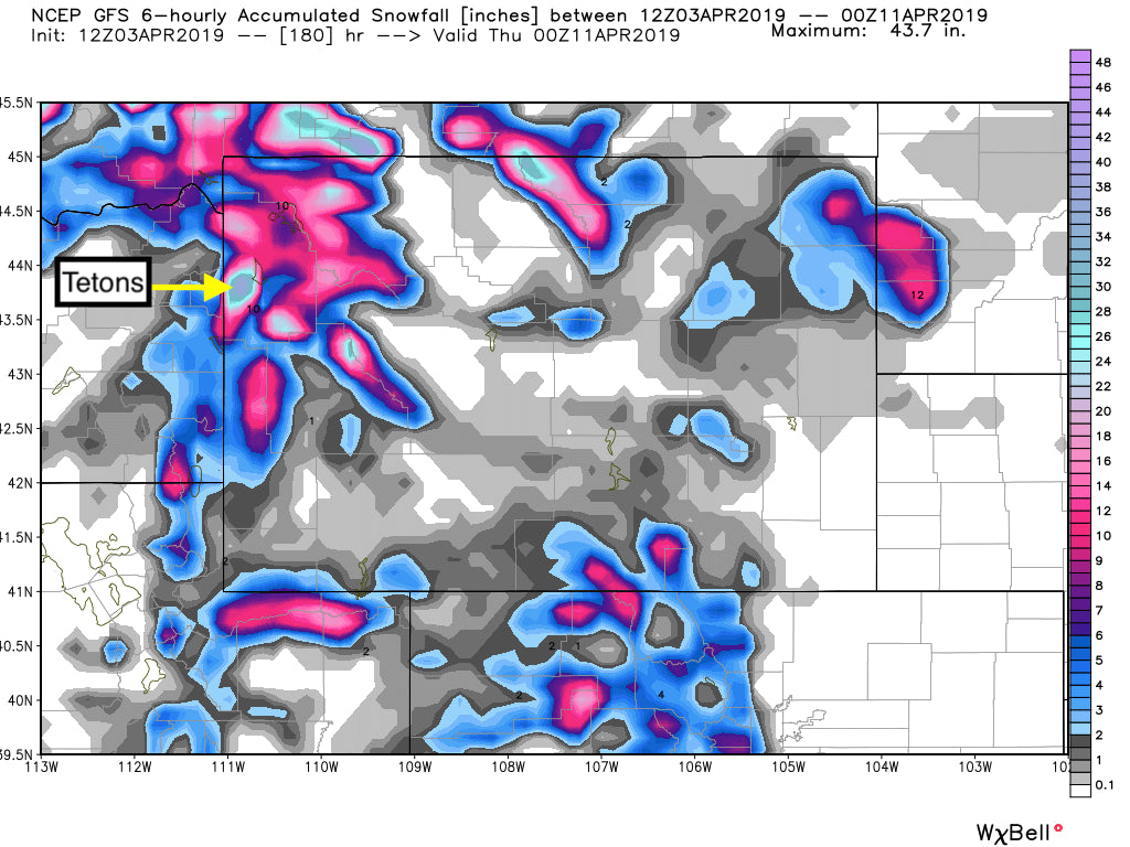
Below: Total snowfall for the Tetons at the higher elevations through next Wednesday (April 11th). It's gong to be long duration events of light snow with peak periods possible Saturday and again early or mid next week (Warm early next week cooling midweek).

Below: Temps warming early next week.

Below: Temps cooling mid next week with some additional snowfall likely.

Summary: Light periods of snowfall likely this week especially at upper elevations with a chance for higher amounts for Saturday and slighter cooler temps. Warming will occur late in the weekend and early next week with continued high elevation snow (Low elevation mixed). Colder mid next week with an increased chance of moderate snow by Wednesday.
Powderchaser Steve- Powderchasers.com. Please follow us on Instagram and Facebook or sign up for our Powder Alerts on the web.


